TS Milton May Make Landfall as a Major Hurricane on Wednesday on the West Coast of Florida
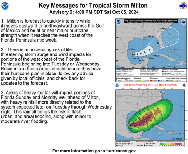
Tropical Storm Milton continues to strengthen in the Gulf of Mexico and poses a significant risk of life-threatening impacts to the west coast of Florida next week. Currently located around 245 miles north of Veracruz, Mexico, Milton has maximum sustained winds of 40 mph and is moving north-northeast at 3 mph. The minimum central pressure is at 1006 MB (29.71 inches).
There are no coastal watches or warnings in effect yet, but hurricane and storm surge watches are expected for parts of Florida soon. Residents in the Yucatán Peninsula, Florida Peninsula, Florida Keys, and northwestern Bahamas should monitor the storm’s progress closely.
Milton’s current structure suggests it is in a development stage, and while its initial motion is somewhat uncertain, it is anticipated to begin moving eastward on Sunday. The storm is expected to accelerate northeastward by Tuesday night as it approaches the west coast of Florida.
Given favorable atmospheric and oceanic conditions, Milton is forecast to become a hurricane within 36 hours and potentially a major hurricane within 72 hours. There is a high likelihood of multiple life-threatening hazards, including storm surge and strong winds, impacting Florida’s west coast starting late Tuesday or Wednesday.
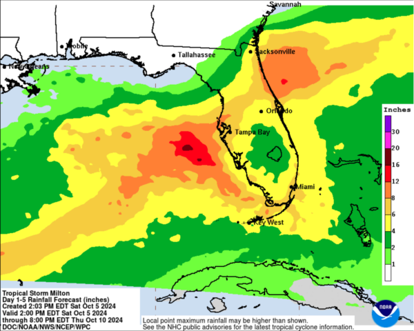
Heavy rainfall is also expected across portions of Florida starting Sunday and Monday, increasing the risk of flash flooding, urban flooding, and minor to moderate river flooding from Tuesday through Wednesday night.
Category: ALL POSTS, Severe Weather, Social Media, Tropical


