
A Busy Tropical Update with Three Named Storms… Including TS Milton Over the Gulf of Mexico
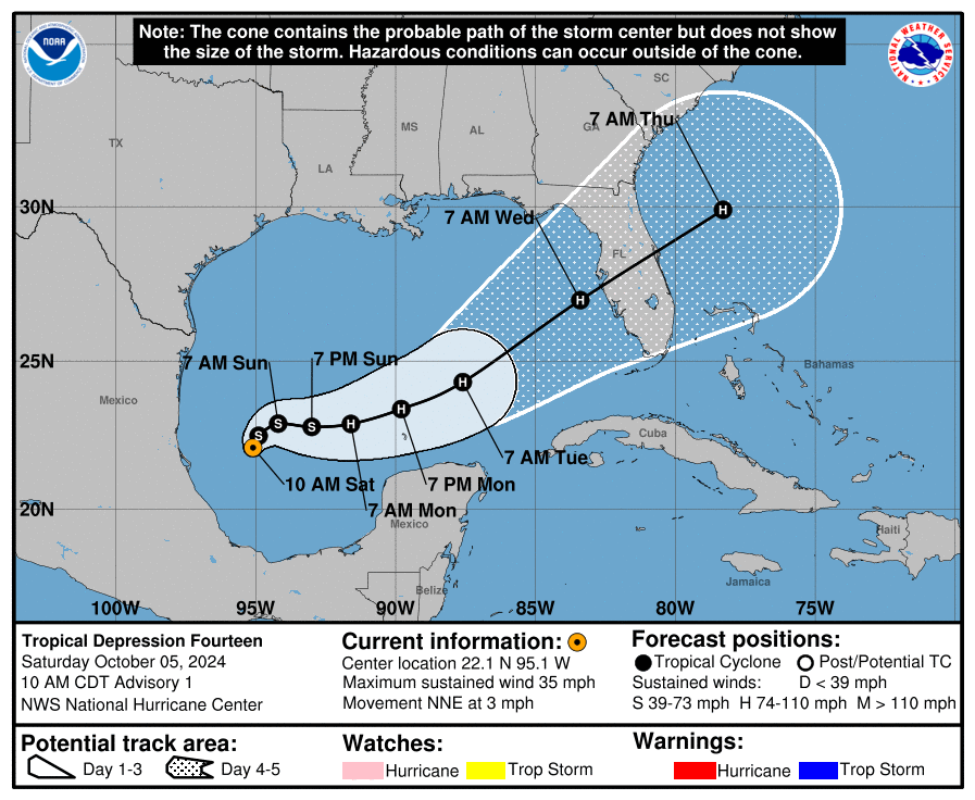 While this graphic still says Tropical Depression Fourteen, the forecast track hasn’t changed after strengthening into Tropical Storm Milton.
Tropical Storm Milton has formed in the Gulf of Mexico with winds now at 40 mph. Milton is expected to strengthen as it moves north-northeast at 3 mph. This storm could pose life-threatening risks, including dangerous storm surge and strong winds, to Florida’s west coast by midweek. Current stats place Milton 220 miles north-northeast of Veracruz, Mexico, with a minimum central pressure of 1006 MB. Residents in Florida are advised to stay alert and prepared as the storm develops.
Key Messages for Tropical Storm Milton:
Milton is expected to intensify rapidly as it moves across the Gulf of Mexico, likely reaching major hurricane strength by midweek as it approaches Florida’s west coast.
There is a growing threat of life-threatening storm surge and high winds for the west coast of Florida starting late Tuesday or Wednesday. Residents should have hurricane plans ready, listen to local officials, and stay updated on the forecast.
Heavy rainfall will impact parts of Florida starting Sunday and Monday, ahead of the storm, with more intense rain expected by Tuesday and Wednesday. This brings a risk of flash flooding, urban flooding, and possible moderate river flooding.
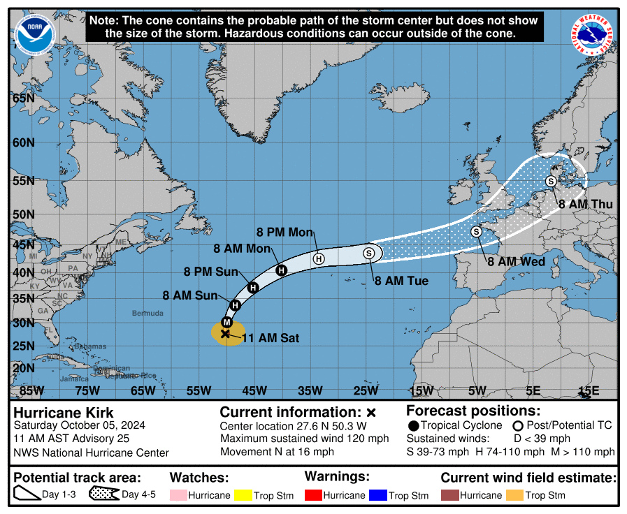
Hurricane Kirk, now a major Category 3 storm with 120 mph winds, is turning more northward and moving at 16 mph. It is located about 1,040 miles northeast of the Leeward Islands and 1,525 miles southwest of the Azores. Kirk is expected to move faster to the northeast starting Sunday. Although weakening is predicted early next week, it will remain a large hurricane for the next few days. Swells from Kirk will reach the U.S. East Coast by Sunday, creating dangerous surf and rip currents.
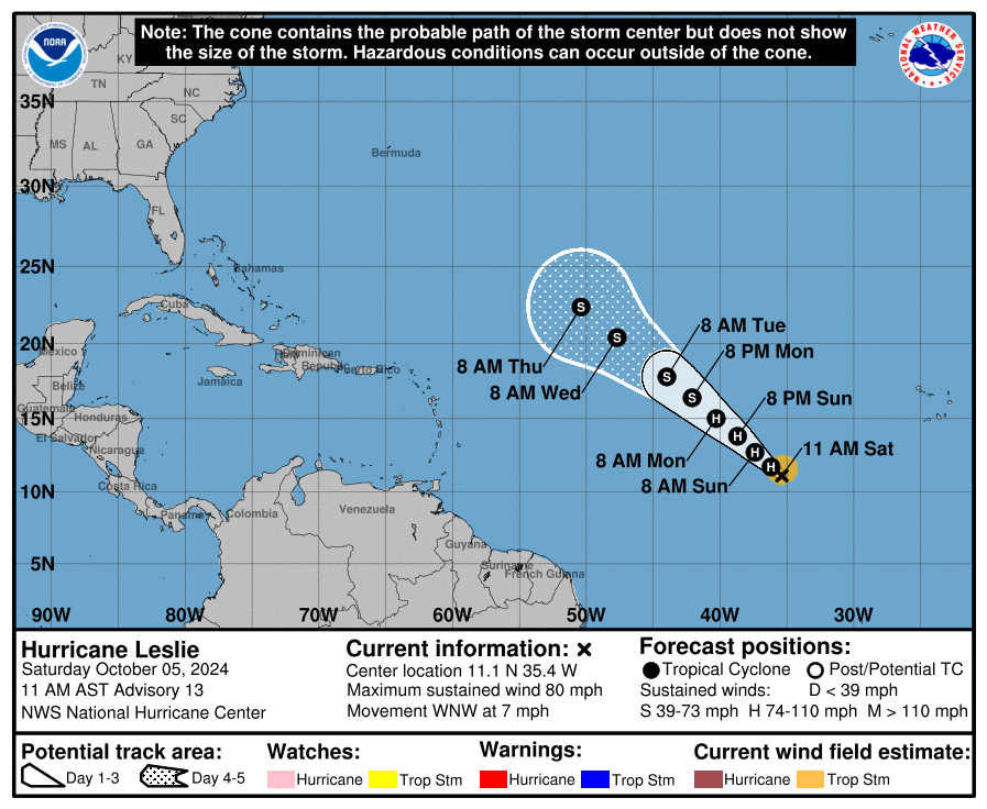
Hurricane Leslie is moving west-northwest at 7 mph with maximum sustained winds of 80 mph. As of 11 AM AST, it is located about 785 miles southwest of the southern Cabo Verde Islands. Leslie is expected to maintain this movement today, with a northwestward turn and an increase in speed by tonight, continuing through Tuesday. Some strengthening is possible today before a weakening trend starts on Sunday. Hurricane-force winds extend up to 15 miles from the center, and tropical-storm-force winds extend up to 105 miles. The minimum central pressure is 985 MB. There are no coastal watches or warnings in effect.
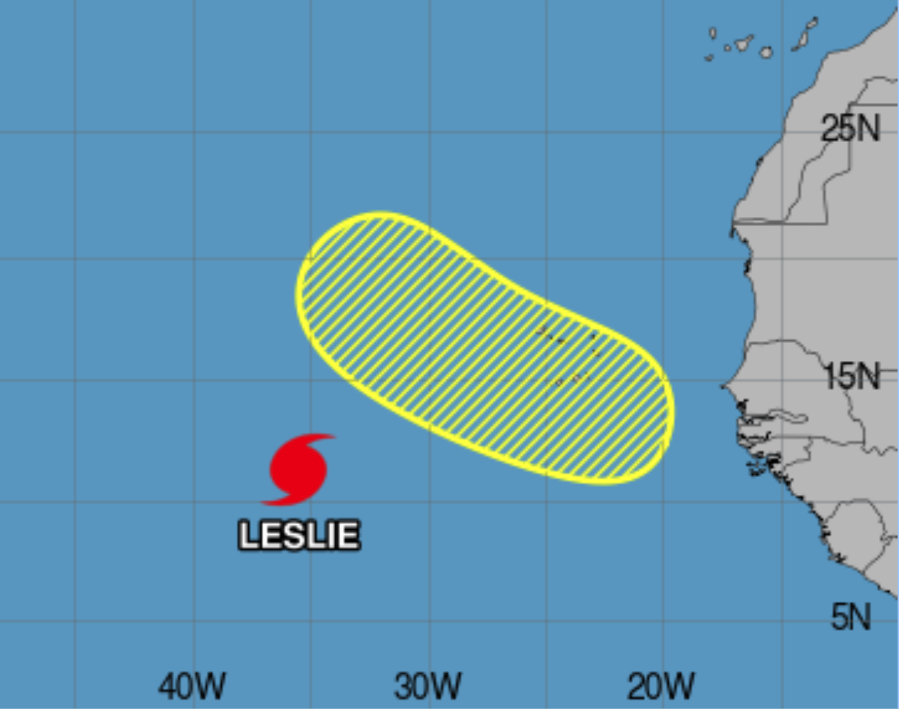
A tropical wave is expected to emerge off the west coast of Africa on Monday or Tuesday. Some development is possible as it moves westward or west-northwestward across the eastern Atlantic, potentially reaching the Cabo Verde Islands by Wednesday or Thursday. The chance of formation is near 0% within 48 hours, but it increases to 30% over the next seven days.
Category: ALL POSTS, Severe Weather, Social Media, Tropical
About the Author (Author Profile)
Scott Martin is an operational meteorologist, professional graphic artist, musician, husband, and father. Not only is Scott a member of the National Weather Association, but he is also the Central Alabama Chapter of the NWA president. Scott is also the co-founder of Racecast Weather, which provides forecasts for many racing series across the USA. He also supplies forecasts for the BassMaster Elite Series events including the BassMaster Classic.Subscribe
If you enjoyed this article, subscribe to receive more just like it.


