Advisories Will Be Starting at 10am for TD-14 Over the Southwestern Gulf of Mexico
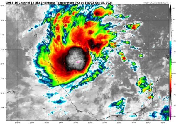
The National Hurricane Center has announced that they will start issuing advisories on Tropical Depression 14 which has organized enough to form a depression over the Southwestern Gulf of Mexico. TD-14 is forecast to move faster eastward or northeastward across the central and eastern Gulf of Mexico where additional strengthening is likely.
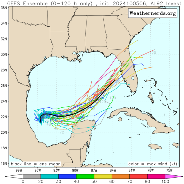
Forecast model ensembles from the GEFS is showing that the general track of this system will be eastward to begin with, before curving to the northeast and heading toward the Florida Peninsula. This system is likely to strengthen into a tropical storm and will be named Milton if no other system beats it to that name. It might make landfall along Florida’s west coast as a hurricane. This could bring some serious storm surge and coastal flooding to the southwest coast of South Florida, and could even see tropical storm conditions in the western and northern parts of the region.
There’s quite a bit of uncertainty right now because the models are showing a larger-than-usual spread in the storm’s potential intensity and track. That’s mainly because this system was still trying to find its center of circulation as those models performed their last run. As it develops, there will be adjustments to the forecast, and we’ll get a clearer picture of its path and impacts.
Category: ALL POSTS, Severe Weather, Social Media, Tropical


