Tropics Update: There’s Still a Chance Something May Form in the Gulf
Here is the latest update on the Tropics. We have a very impressive Kirk out in the Atlantic. Leslie is holding on too. The models still see potential in the Gulf.
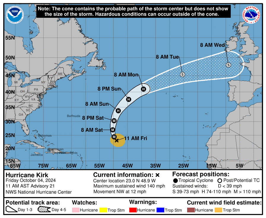
Hurricane Kirk: From the 11am AST update, Kirk is a Category 4 storm with max winds near the center at 140 mph! It is moving NW at 12 mph. Weakening is forecast late this weekend and into early next week. Some swells may reach the US Coast this weekend causing increased surf and rip currents.
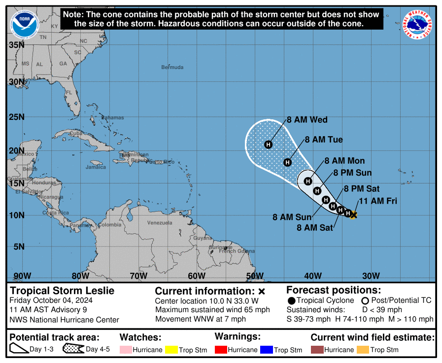
Tropical Storm Leslie is situated about 670 miles WSW of the Southernmost Cabo Verde Islands and moving WNW at 7 mph. Max winds are 65 mph and should become a hurricane tonight or tomorrow. Eventually Leslie will encounter colder water left by Kirk. That with drier air and shear will help the storm not to intensify much toward the end of the forecast cycle.
The Gulf: It continues to be a mystery at this point on whether or not we can get something a-going in the Gulf. The NHC has brought the chance of development back up to 40% over 7 days. The models are still hinting as well. Here is the European ensembles showing the models pulling something toward Florida, this would be mid next week.

A broad area of low pressure is expected to form this weekend over the southwestern/south-central Gulf area. It will move east/northeast and COULD develop as it does so. The fly in the ointment is a front. If the low can stay detached from the front, it would have a better chance of development. We will have to watch.
Regardless, huge surge of moisture will fly into the Sunshine State and quite a bit of rain is forecast. Here is the WPC QPF forecast through 7 days. You can see that high amount of tropical moisture over the Gulf and some areas of Florida picking up 3-5 inches of rain.
Category: ALL POSTS, Social Media, Tropical
About the Author (Author Profile)
Owner of Tornado Talk. Radio broadcast meteorologist with The Storm Report. WeatherBrains Panelist. B.S. Meteorology from Penn State University.Subscribe
If you enjoyed this article, subscribe to receive more just like it.


