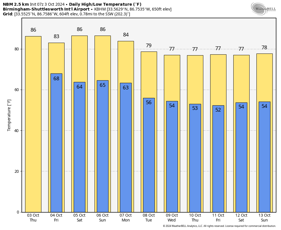
Highs In The 80s Through Monday; Mostly Dry
WARM OCTOBER AFTERNOON: The sky is mostly sunny across Alabama this afternoon with temperatures mostly in the mid 80s; tonight will be fair with a low in the 60s.
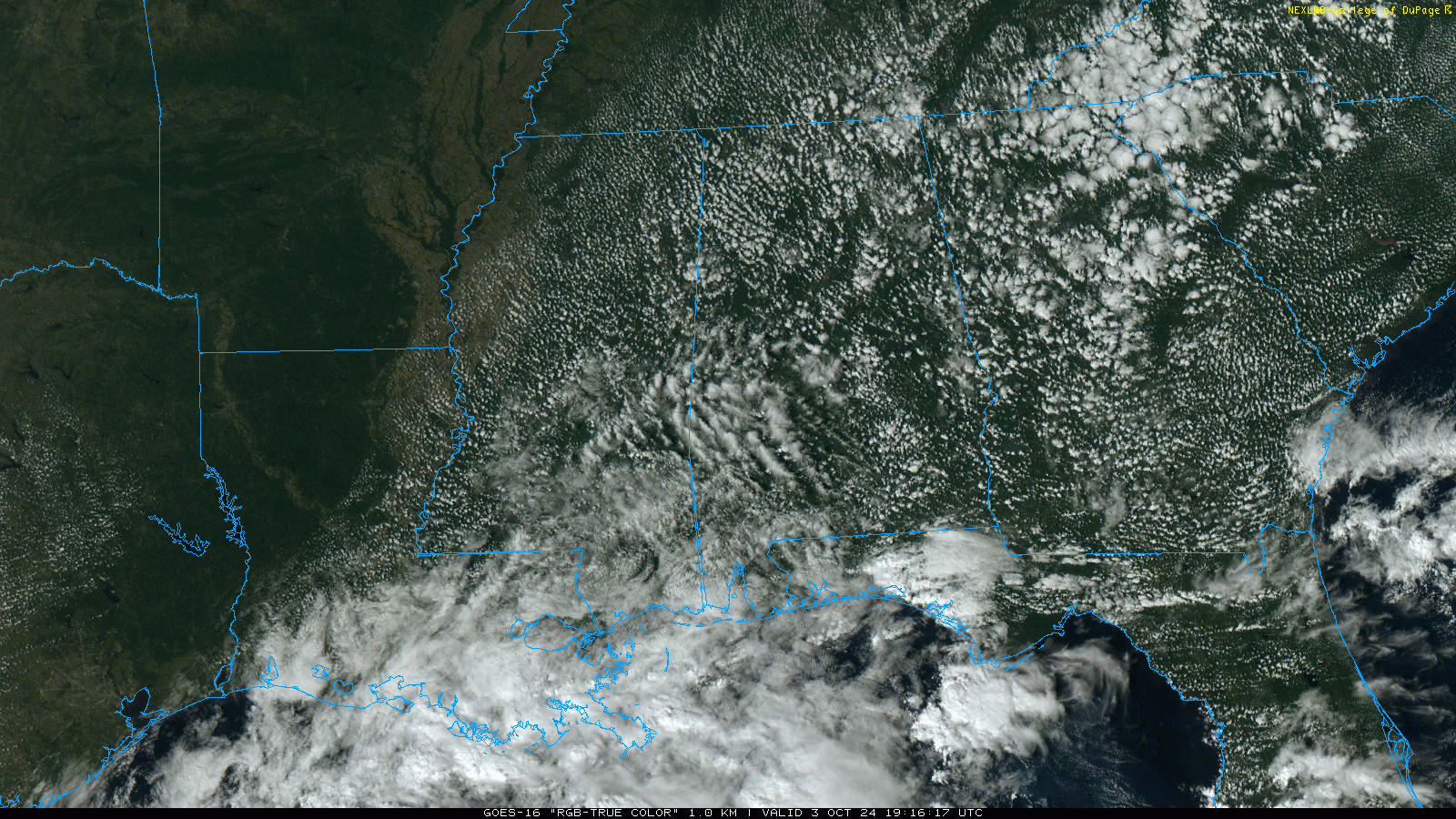
We will mention a chance of scattered showers tomorrow statewide… nothing heavy or widespread. Then, the weekend will be rain-free with mostly sunny days and fair nights. Highs will remain in the mid 80s for most places.
COOL CHANGE: Monday will be another warm, dry day with a high in the mid 80s, but a dry cold front passes through the state Monday night, and cooler air settles in for the west of the week with highs dropping into the 70s over the northern half of the state. Lows will be well down in the 50s; some of the cooler pockets could see upper 40s by mid-week. We see no risk of rain through the week… See the video briefing for maps, graphics, and more details.
TROPICS: Kirk is a major hurricane in the eastern Atlantic with winds of 125 mph; thankfully it will turn north, then northeast across the open Atlantic and is no threat to land. And, to the west of Kirk, we have newly formed Tropical Storm Leslie with winds of 45 mph. It will pretty much follow the same path as Kirk and will stay far from land.
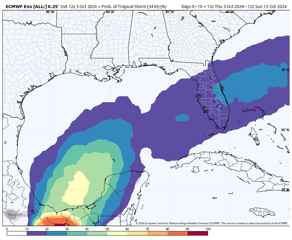
Closer to home, disorganized showers and thunderstorms over portions of the Gulf of Mexico are associated with a surface trough. A broad area of low pressure is likely to develop over the Gulf of Mexico this weekend or early next week, but subsequent tropical or subtropical development could be limited by the system’s potential interaction with a frontal boundary. Regardless of development, locally heavy rains could occur over portions of Mexico during the next few days and over portions of the Florida Peninsula from late this weekend into next week.
NHC gives it a 30 percent chance of developing. We see no tropical storms or hurricane threatening the Central Gulf Coast (Gulf Shores to Panama City Beach) at least for the next 7-10 days.
FOOTBALL WEATHER: Just a small risk of a shower during the first quarter, otherwise mostly fair and pleasant for the high school games tomorrow night; temperatures will fall through the 70s.
Saturday UAB will host Tulane at Protective Stadium in downtown Birmingham (12:00p CT kickoff)… the sky will be mostly sunny with temperatures in the low to mid 80s.
Auburn will be on the road at Georgia (2:30p CT kickoff)… the sky will be sunny with temperatures in the low 80s through most of the game.
Alabama travels to Nashville to take on Vanderbilt (3:15p CT kickoff)… expect a sunny sky with temperatures falling from near 85 degrees at kickoff, to near 80 by the final whistle.
RACE WEEKEND: Just an outside risk of a shower tomorrow at Talladega, otherwise warm and dry through the weekend with highs in the mid 80s. Lows will be in the 60s.
ON THIS DATE IN 1979: An F4 tornado struck the towns of Windsor, Windsor Locks, and Suffield in Connecticut, causing an estimated $400 million in property damage. The New England Air Museum, which housed more than 20 vintage aircraft, was destroyed. This tornado also caused a United Airlines flight to abort a landing at the Bradley International Airport because the pilot saw the tornado.
Look for the next video briefing here by 6:00 a.m. tomorrow…
Category: Alabama's Weather, ALL POSTS, Weather Xtreme Videos
About the Author (Author Profile)
James Spann is one of the most recognized and trusted television meteorologists in the industry. He holds the AMS CCM designation and television seals from the AMS and NWA. He is a past winner of the Broadcast Meteorologist of the Year from both professional organizations.Subscribe
If you enjoyed this article, subscribe to receive more just like it.


