A Look at the Tropics: Two Named Storms in the Atlantic, Gulf Development May Be Limited
Wanted to throw everyone’s way the latest on the tropics! We still have Kirk and Leslie in the Atlantic. Still watching the Gulf and as of now nothing major is brewing which is good news. That doesn’t mean there won’t be an increase in showers and storms for parts of the Gulf region and we will look at that in this update!
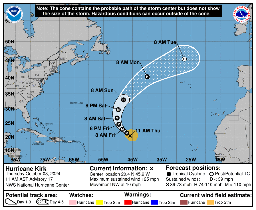
Hurricane Kirk is still strengthening across the central Atlantic with max winds of 125 mph at the center. It is moving NW at 10 mph. It still has the potential to get stronger and also is expected to grow larger. Kirk could send out swells across the Atlantic and will increase the risk of higher surf and rip currents for the Leeward Islands by Friday, Bermuda and the Greater Antilles by Saturday, and the U.S. East Coast and the Bahamas by Sunday. 6-7 days from now, a post-tropical Kirk could impact parts of the UK or Mainland Europe.
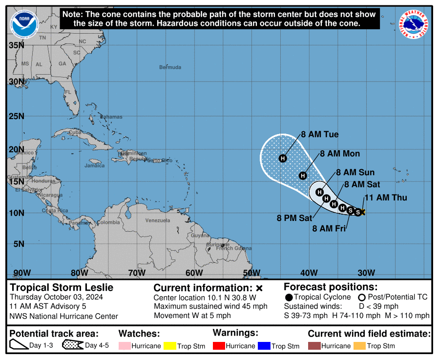
Leslie is a tropical storm and is projected to strengthen to a hurricane in a day or two. Right now, max winds are at 45 mph. Right now, this system is following in Kirk’s footsteps. No major land impacts at this time.
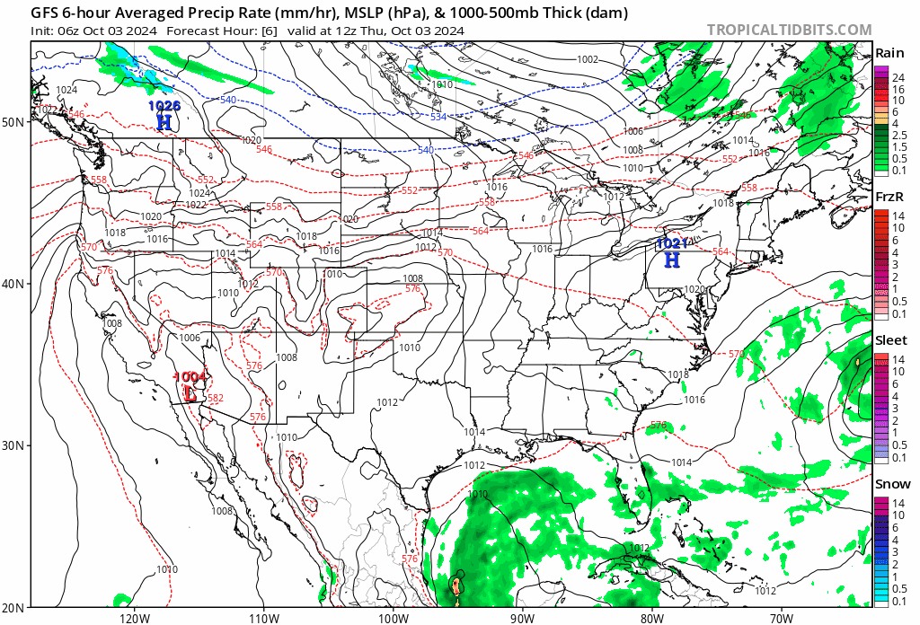
The NHC has brought the chance for development of a Gulf system down to 30% over the next seven days. A broad area of low pressure is still expected to form late in the weekend or early next week. Further development may be hindered due to a front settling in. If if there is no development there will be plenty of moisture moving into Mexico, along the Gulf coast and especially into Florida and heavy rains could occur. Here is the 6Z run of the GFS models showing all the moisture bottled up in the Gulf with slugs of heavier rain pulling into Florida at times.
Category: ALL POSTS, Social Media, Tropical
About the Author (Author Profile)
Owner of Tornado Talk. Radio broadcast meteorologist with The Storm Report. WeatherBrains Panelist. B.S. Meteorology from Penn State University.Subscribe
If you enjoyed this article, subscribe to receive more just like it.


