
Quiet Early Fall Weather Pattern To Continue Across Alabama
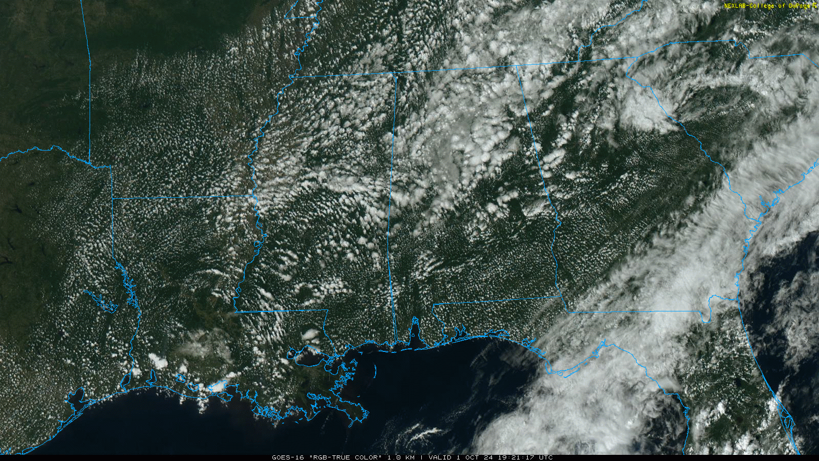
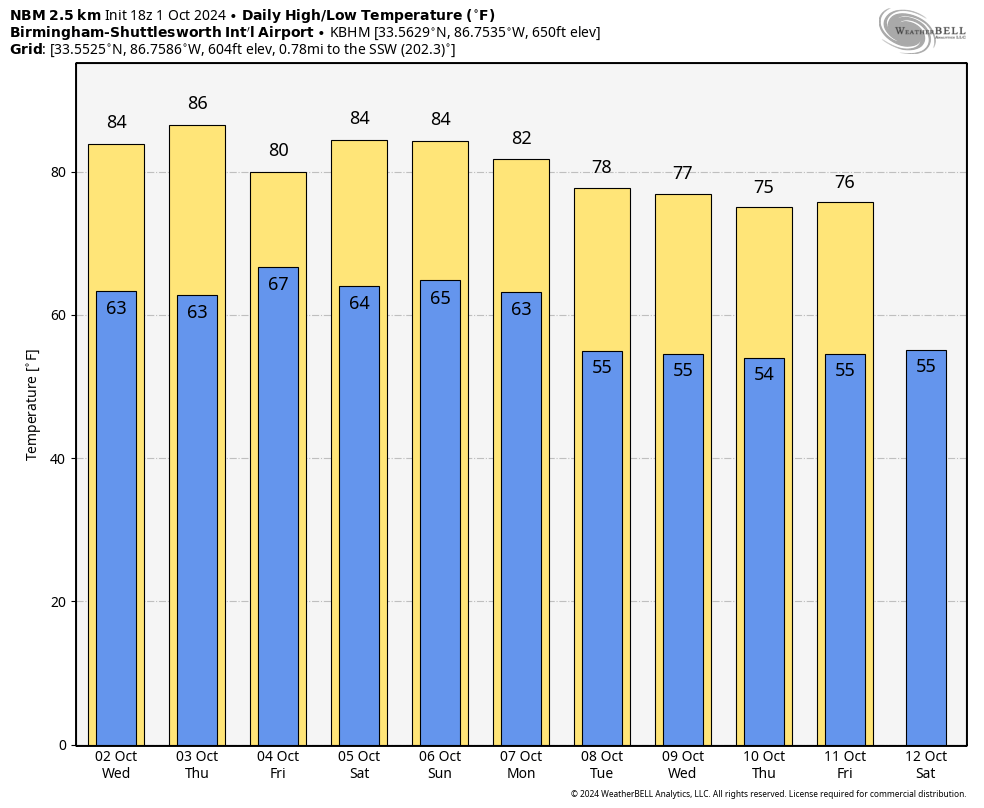
RADAR CHECK: No rain on radar at mid-afternoon; any showers that form over the next few hours will be few and far between. Otherwise we have a mix of sun and clouds across the state with temperatures mostly in the low to mid 80s. Tonight will be fair with a low in the 60s.
Tomorrow will be partly to mostly sunny day with a high in the 81-85 degree range.
We will bring in a chance of showers Thursday over the southern quarter of the state, and on Friday a few scattered showers are possible statewide. This won’t be an especially heavy or widespread rain event, and many communities over North Alabama won’t see a drop due to the scattered nature of the showers.
THE ALABAMA WEEKEND: Most of Alabama will be warm and dry over the weekend with highs in the 80s, but a few scattered showers are possible near the Gulf Coast. And, much of next week looks dry as well. Temperatures come down over the latter half of the week with highs in the upper 70s over North Alabama, with lows in the 50s. See the video briefing for maps, graphics, and more details.
TROPICS: Tropical Storm Kirk is expected to become a powerful hurricane in. the eastern Atlantic late this week, but it will turn north over the open Atlantic and is no threat to land. And, a new wave in the far eastern Atlantic (Invest 91L) is expected to become a tropical storm this week, but it will also turn north and will not impact any land areas.
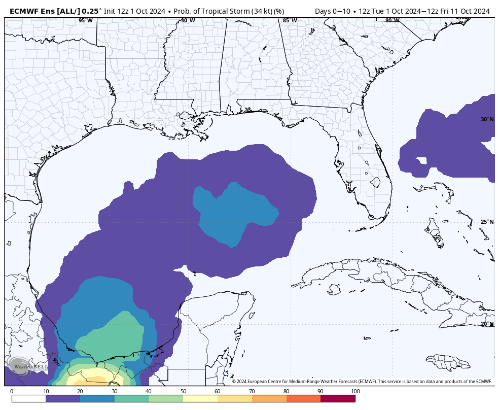
Closer to home, a broad trough of low pressure is producing a large area of disorganized showers and thunderstorms from the southwestern Caribbean Sea into the southern Gulf of Mexico. Environmental conditions could support some gradual development of this system, and a tropical depression could form towards the end of this week or this weekend as the broader disturbance moves fully into the Gulf of Mexico. Interests along the U.S. Gulf Coast should continue to monitor the progress of this system.
NHC gives it a 40 percent of development; global models continue to show a weak, disorganized system over the Gulf in the 5-8 day time frame with slow and erratic movement. The tropical low will drift toward the Florida Peninsula (not the panhandle), and will most likely be just a rainmaker. But, of course, this could change and we will keep a close eye on the situation.
RACE WEEKEND: We can’t rule out a few isolated showers Friday at Talladega, but Saturday and Sunday will be warm and dry with a good supply of sunshine both days. The high on Friday will be near 80, followed by mid 80s over the weekend. Lows will be in the 60s.
ON THIS DATE IN 1893: The village of Caminadaville, Louisiana, was destroyed by a massive hurricane. Caminadaville was a vibrant fishing community in the late 19th century, located on Cheniere Caminada, adjacent to Grand Isle in coastal Jefferson Parish in Louisiana. It took five days for the news of this devastating hurricane to reach New Orleans.
Look for the next video briefing here by 6:00 a.m. tomorrow…
Category: Alabama's Weather, ALL POSTS, Weather Xtreme Videos
About the Author (Author Profile)
James Spann is one of the most recognized and trusted television meteorologists in the industry. He holds the AMS CCM designation and television seals from the AMS and NWA. He is a past winner of the Broadcast Meteorologist of the Year from both professional organizations.Subscribe
If you enjoyed this article, subscribe to receive more just like it.


