
A Look at Current Model Data for The Gulf of Mexico
A few days ago, models were hinting at some sort of tropical system making its way into the Gulf this weekend. However, this no longer appears to be the case according to latest model runs. While the GFS does show a very disorganized low pressure system building into the Eastern Gulf Sunday, it does not show it to have any characteristics of a tropical storm.
Models are now pointing towards the possibility of something occurring mid-week next week. Models are by no means in agreeance on one particular scenario, but they are starting to pick up on a system moving through the Gulf.
The ICON model shows a very organized system with a pressure of 970 mb sitting in the middle of the Gulf next Tuesday. The ICON model does not go out further than this time, so additional information is not yet available from this model.
![]()
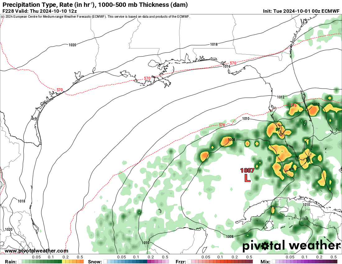
The EURO model suggests that an extremely disorganized system will move through the southern Gulf, and bring rain to southern Florida Wednesday and Thursday next week.
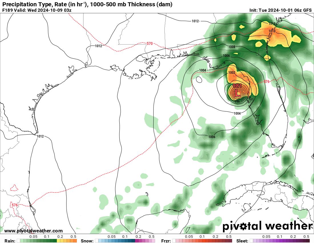
The GFS model is showing similar to outputs to the ICON model, with a tropical system of pressure 981 mb interacting with the middle of the Florida Coast next Wednesday.
As models continue to change, we will keep you updated. Stay tuned!
Category: ALL POSTS, Social Media, Tropical
About the Author (Author Profile)
Scott is a senior at Mississippi State University studying professional and broadcast meteorology.Subscribe
If you enjoyed this article, subscribe to receive more just like it.


