Models Still Conflicted About Area in the Western Atlantic
The 12Z model runs have processed, and we are not any closer to a definitive answer regarding what may happen in the Gulf later this week.
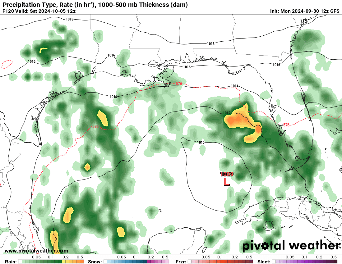
The GFS model, which did really well with Helene, is no longer showing an organized system in the Gulf in the next week. It only shows an area of lower pressure (but no lower than 1000 mb at any point) stalling over the middle of the Gulf this weekend. If this occurs, coastal areas could see some rain and windy conditions from this.
The Euro model tells a similar story, although it shows the system being slightly more organized. However, still nothing of tropical storm strength is shown in this model run.
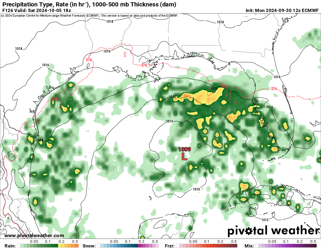
The NHC has marked this area with a 10% chance of formation within the next two days, and a 40% chance within the next seven days. We will continue to monitor this area, and update when necessary. Remember that models can change drastically from run-to-run, so this information could no longer be valid by the time the next set of model runs come out.
Category: ALL POSTS, Social Media, Tropical
About the Author (Author Profile)
Scott is a senior at Mississippi State University studying professional and broadcast meteorology.Subscribe
If you enjoyed this article, subscribe to receive more just like it.


