
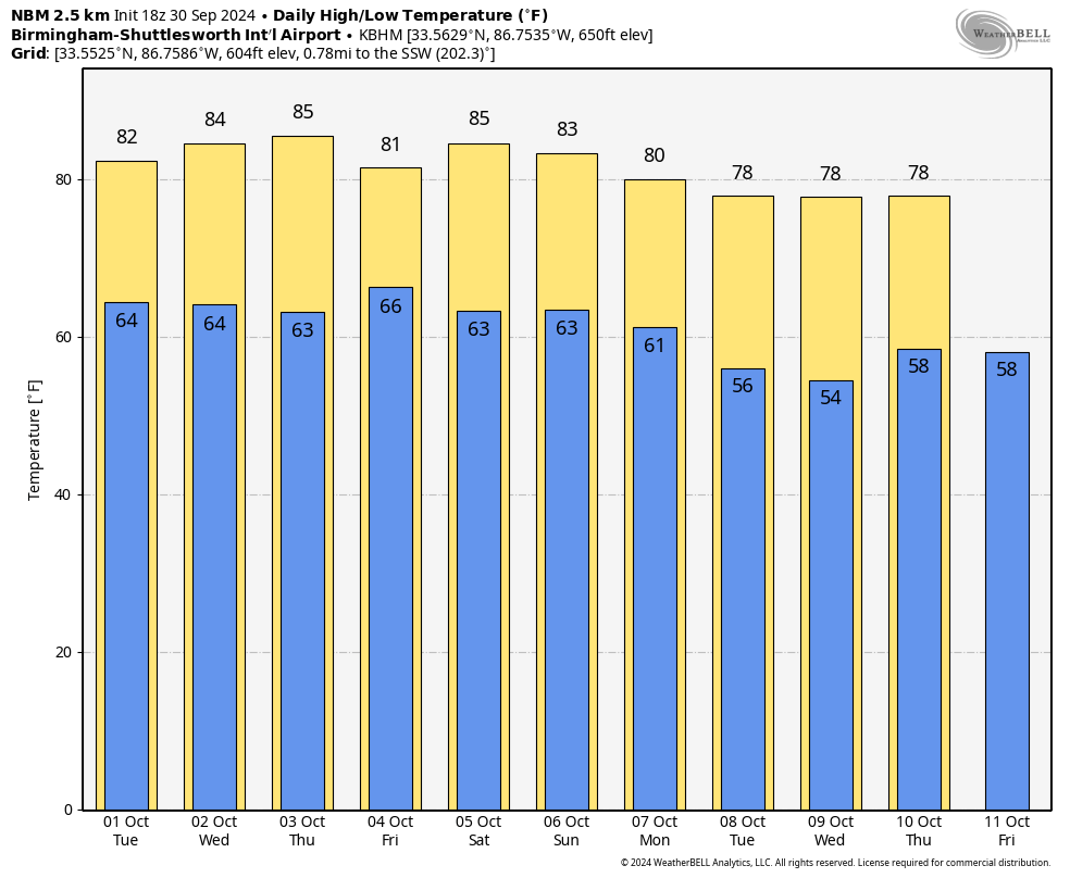
Warm Afternoons Through The Week; A Few Showers Thursday/Friday
RADAR CHECK: Showers are very hard to find across Alabama this afternoon… we have a mix of sun and clouds with temperatures in the 75-85 degree range. Any isolated showers will end this evening; the sky becomes fair tonight with a low in the 60s.
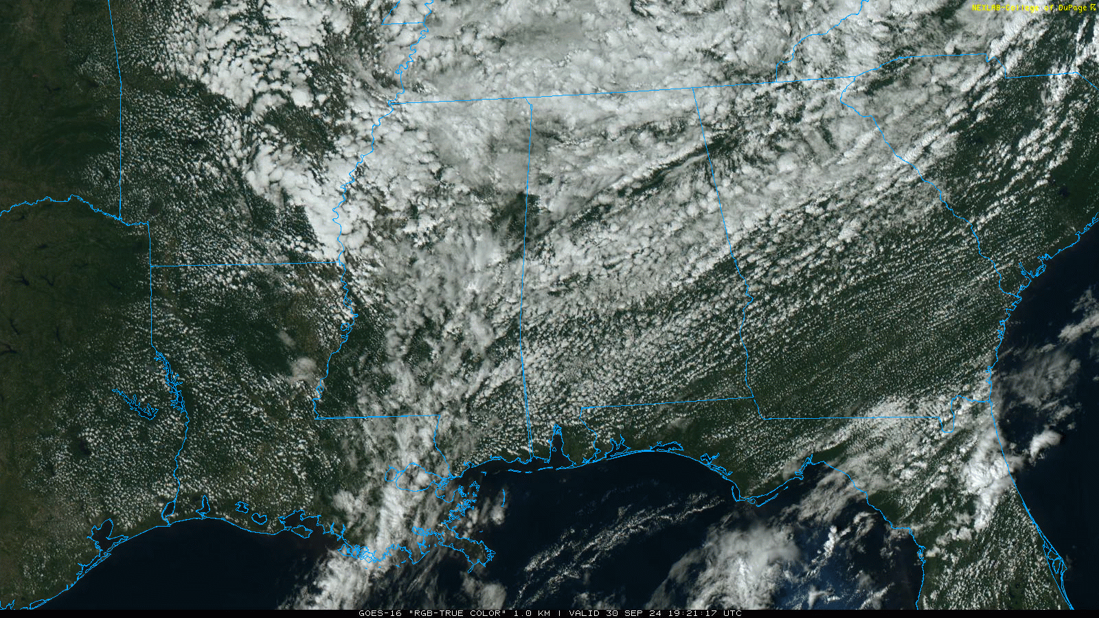
Most of Alabama will be warm and dry tomorrow and Wednesday; just a small risk of a shower over the northern third of the state tomorrow afternoon.
Moisture levels begin to rise Thursday, and we will mention a chance of showers over the southern counties. Then, a few showers are possible statewide on Friday. No wash-out; rain amounts are expected to be light and spotty.
THE ALABAMA WEEKEND: At this point the weekend looks warm and dry. Expect a partly to mostly sunny sky Saturday and Sunday with highs in the 81-84 degree range.
And, for now much of next week looks dry and cooler with highs dropping into the upper 70s along with lows in the 50s. See the video briefing for maps, graphics, and more details.
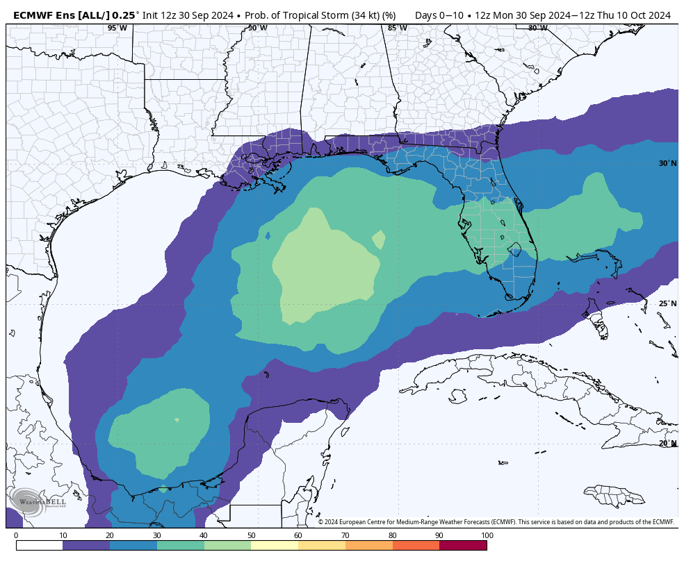
TROPICS: The Atlantic basin is active today. Here a breakdown on the action…
*Joyce is a weak tropical depression in the middle of the Atlantic far from land; it dissipates tonight.
*Isaac is now a post-tropical system in the North Atlantic… NHC has issued the last advisory.
*TropicaL Storm Kirk is in the eastern Atlantic, and is forecast to become a major hurricane by the end of the week. But, it will turn north into the open Atlantic and is no threat to land.
*A trough of low pressure located over the southwestern Caribbean Sea continues to produce some disorganized shower and thunderstorm activity. Environmental conditions could become conducive for gradual development, and a tropical depression could form in a few days while the system is over the southern Gulf of Mexico or northwestern Caribbean Sea. Interests along the U.S. Gulf Coast should continue to monitor the progress of this system.
NHC has dropped the chance of development to 40 percent, and it is still too early to know the final destination or intensity. The new global models (12z set) really show little development. But it remains something to watch.
RACE WEEKEND: A few showers are possible across East Alabama Saturday, but for now the weekend looks warm and dry for the races at the Talladega Superspeedway. Afternoon temperatures will be in the low to mid 80s, lows will be in the 60s.
ON THIS DATE IN 1896: A hurricane formed on September 22 and lasted until September 30. It formed directly over the Lesser Antilles and hit Cuba, Florida, Georgia, South and North Carolina, Virginia, Washington D.C., and Pennsylvania. Its maximum sustained winds were at 130 mph.
Look for the next video briefing here by 6:00 a.m. tomorrow…
Category: Alabama's Weather, ALL POSTS, Weather Xtreme Videos
About the Author (Author Profile)
James Spann is one of the most recognized and trusted television meteorologists in the industry. He holds the AMS CCM designation and television seals from the AMS and NWA. He is a past winner of the Broadcast Meteorologist of the Year from both professional organizations.Subscribe
If you enjoyed this article, subscribe to receive more just like it.


