
Tropics Update: Status on Isaac, Joyce, Kirk, and 2 Other Disturbances
We are getting closer to the end of the typical hurricane season, but the Atlantic is very busy this week with 3 named storms, and 2 other disturbances. That’s a lot to keep up with! Don’t worry, though, because we’ve got you covered. Here is a summary of what is going on with each of these systems.
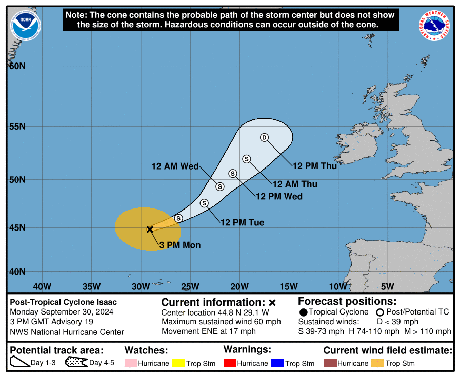
ISAAC:
Isaac, located in the Northeast Atlantic, is a post-tropical cyclone. The National Hurricane Center has issued its last advisory for the storm, as it is expected to continue weakening over the next day. Isaac has not caused too much trouble, as it stayed over the Atlantic for its entire lifespan. There is no threat to the United States with Isaac.
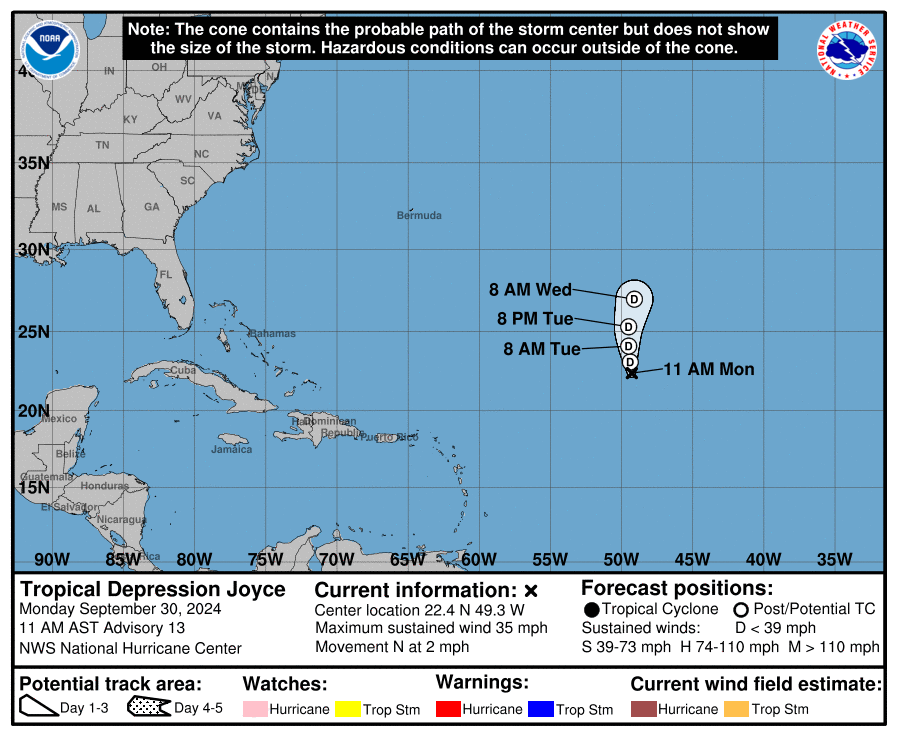
JOYCE:
Joyce has not been a very impressive storm; it has remained below hurricane status for its duration. It is located in the Central Atlantic, and is expected to remain a tropical depression for the next day or so, before becoming a remnant low over the ocean. There is no threat to the United States with Joyce.
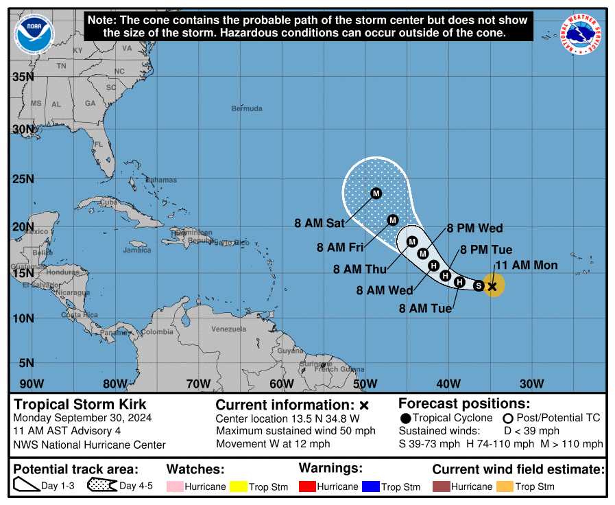
KIRK:
Kirk is currently a tropical storm in the Central Atlantic, and is following the track of Joyce. The NHC notes that Kirk is likely to reach hurricane status by tomorrow morning, and major hurricane status by Wednesday night. It is shaping up to be a pretty impressive storm. Currently, Kirk poses no threat to the United States.
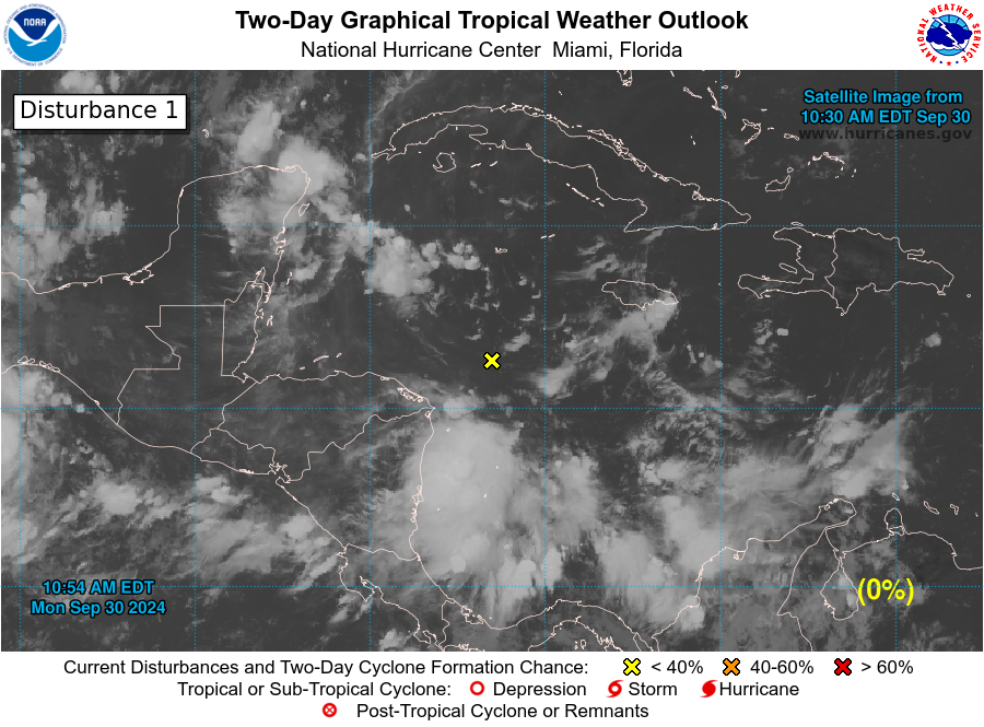
NHC Disturbance 1 (Western Atlantic):
Right now, there is no tropical system associated with this disturbance. But, model guidance suggests that a tropical depression could form within the next few days. We have been hinting at this for a couple days now, and we are continuing to closely monitor the system. The NHC places the formation chance within the next 7 days at 40%. This means that as of right now, we could see nothing come of this system. However, conditions do seem to be somewhat favorable to support a tropical depression forming. Formation will largely depend on whether the system can pull its self together and become more organized. Models are still all over the place with this system, and each run over the last 24 hours has told a different story. The latest GFS run shows a very weak system interacting with the southern Florida Gulf Coast. The latest Euro run shows a very weak system interacting with the Alabama and Florida Coast. With this being said, coastal areas along the Gulf of Mexico should continue to keep an eye on this system. We are hoping, though, that this system will fizzle out before it can become a strong storm.
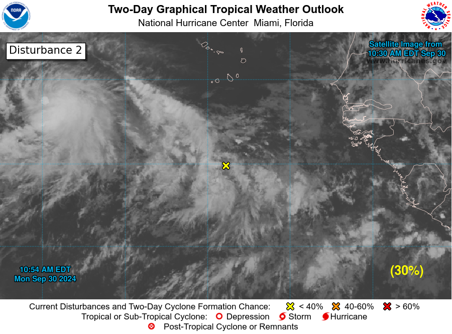
NHC Disturbance 2 (Eastern Atlantic):
This area of interest, located off the coast of Africa, has a very good chance of formation. The NHC places the formation chance through the next 7 days at 80%. Currently, this is an area of disorganized storms (also known as a tropical wave). This tropical wave is set to pass over warm waters, and the atmosphere will help the system to strengthen. This area is closely following Tropical Storm Kirk.
Category: ALL POSTS, Social Media, Tropical
About the Author (Author Profile)
Scott is a senior at Mississippi State University studying professional and broadcast meteorology.Subscribe
If you enjoyed this article, subscribe to receive more just like it.


