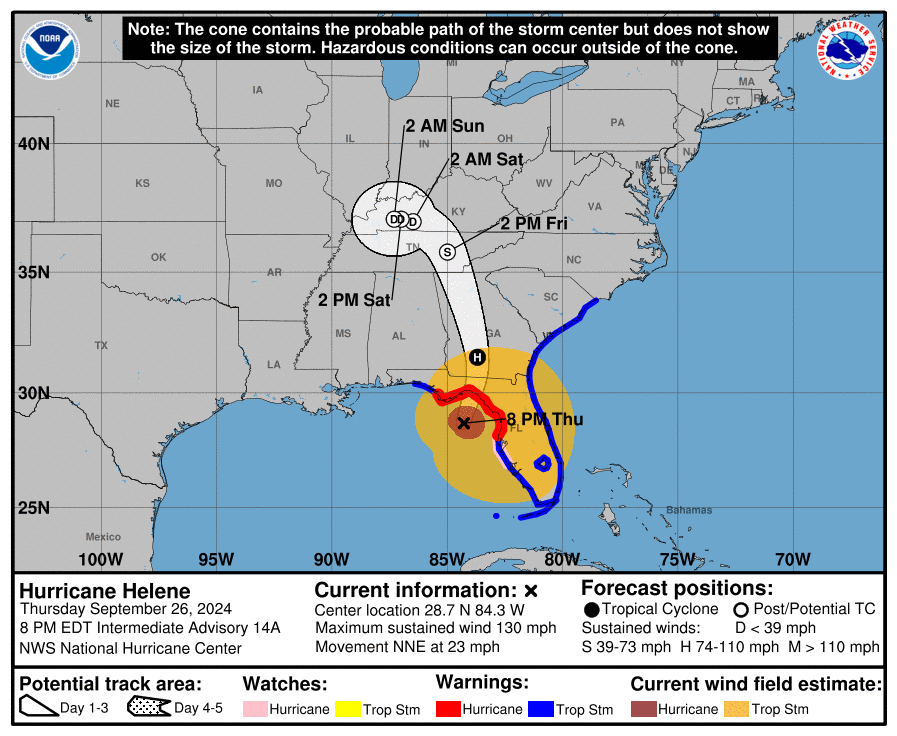
Hurricane Helene Nearing Gulf Coast – Extremely Dangerous Conditions Expected
• Location: 80 miles west-southwest of Cedar Key, Florida; 115 miles south of Tallahassee
• Winds: 130 mph (Category 4 hurricane)
• Movement: North-northeast at 23 mph
Warnings:
• Storm Surge Warning: Life-threatening flooding from rising waters near Mexico Beach to Flamingo, including Tampa Bay.
• Hurricane Warning: Hurricane conditions expected from Anclote River to Mexico Beach.
• Tropical Storm Warning: Tropical storm conditions expected in areas like the Florida Keys and Tampa Bay.
Key Hazards:
• Storm Surge: Flooding of up to 15-20 feet possible in parts of Florida’s Big Bend area.
• Winds: Strong, damaging winds will spread inland, even after the storm weakens.
• Rain: Up to 6-12 inches of rain, with isolated totals of 20 inches, could cause flash flooding and landslides.
• Tornadoes: Tornado risk for Florida, Georgia, and the Carolinas.
• Surf: Dangerous surf and rip currents along the coasts of Florida, Georgia, and the Carolinas.
Discussion & Outlook:
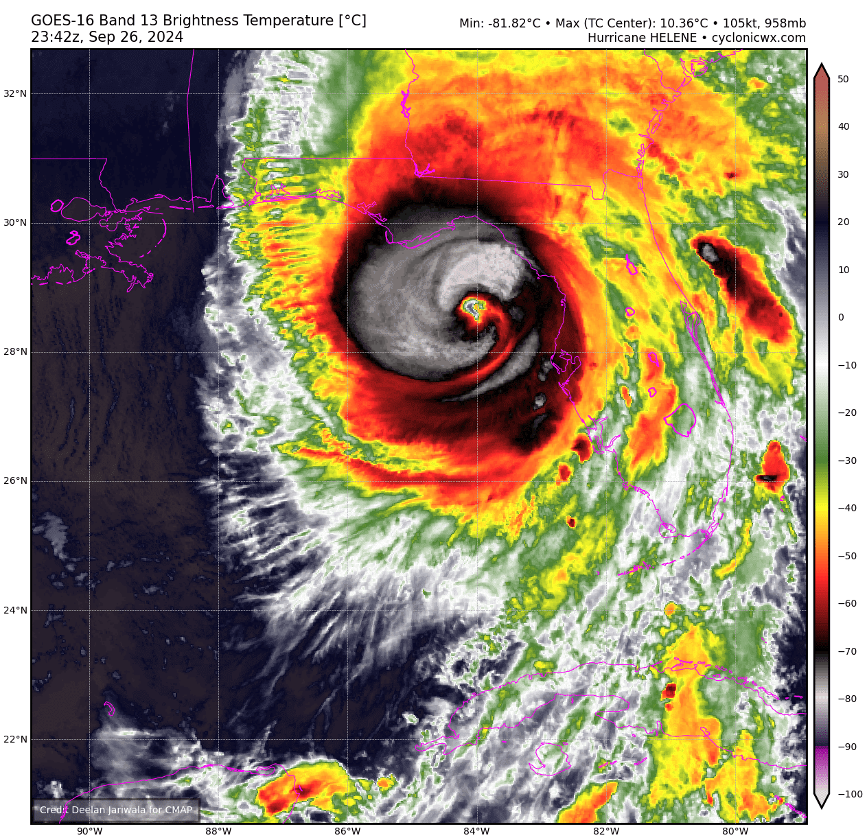
As of 7:00 PM CDT, the eye of Hurricane Helene is located at 28.7°N and 84.3°W. The storm is moving north-northeast at about 23 mph and is expected to make landfall in the Florida Big Bend area within a few hours. After that, Helene is forecast to turn northwest and slow down as it moves over the Tennessee Valley on Friday and Saturday.
Helene is currently a Category 4 hurricane with maximum sustained winds of 130 mph. Some strengthening is possible before it reaches the coast, but the storm will weaken once it moves inland. However, its fast-moving winds will still cause significant damage far inland, including in higher elevations of the southern Appalachians.
Hurricane-force winds extend up to 60 miles from the center, while tropical-storm-force winds reach as far as 310 miles. For example, the Albert Whitted airport in St. Petersburg, Florida, recorded sustained winds of 53 mph with gusts up to 76 mph.
Hurricane Hunter aircraft have measured the storm’s minimum central pressure at 942 mb (27.82 inches).
Category: Alabama's Weather, ALL POSTS, Severe Weather, Social Media, Tropical
About the Author (Author Profile)
Scott Martin is an operational meteorologist, professional graphic artist, musician, husband, and father. Not only is Scott a member of the National Weather Association, but he is also the Central Alabama Chapter of the NWA president. Scott is also the co-founder of Racecast Weather, which provides forecasts for many racing series across the USA. He also supplies forecasts for the BassMaster Elite Series events including the BassMaster Classic.Subscribe
If you enjoyed this article, subscribe to receive more just like it.


