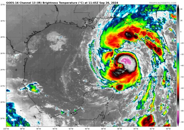
Helene Now Cat 2 Hurricane…Pressure Continues to Drop…Winds Now 100 mph
Good morning from the capital city of Florida, beautiful Tallahassee, which is expected to receive a major impact from Hurricane Helene.
The storm still looks a little disheveled on satellite imagery this morning and reconnaissance planes overnight have reported a double eyewall structure, which is fortunately less conducive to rapid intensification. But deep convection has been wrapping around the northern and northeastern part of the core over the past couple of hours, which could bode poorly for it staying a little weaker.
And Helene does continue to steadily intensify as shown by Air Force and NOAA Hurricane Hunters curretly in the storm. The NOAA plane recently found a central pressure of 961.6 mb and the Air Force plane found 963.4 mb. The concerning thing was that the NOAA plane found maximum flight level winds sustained at 97 knots, which translates to 100 mph at the surface,
Helene is a large hurricane with hurricane force winds extending out 50 miles in the eastern semicircle.
The center of the storm has turned a little more northeast in the past few hours, which raises the question about whether the track will side a little further east in the Florida Big Bend. The forecast error cone currently extends from Apalachicola to Perry.
Helene will bring strong winds and heavy rain to the eastern half of Alabama. We will have reports on impacts throughout the event.
We will be wreporting all day and night from here.
Category: Alabama's Weather, ALL POSTS, Social Media, Tropical


