4am CDT Update: Large Hurricane Helene Churning Toward the Northeast Gulf Coast, Max Winds at Center now 90 mph
Today is the day everyone. We are watching Helene make its approach toward the Northeastern Gulf Coast with a landfall of the center this evening/tonight along the Big Bend area of Florida. Widespread, multiple impacts for millions of people along the coast and inland.
Stats
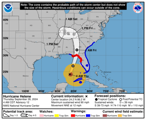
LOCATION…24.2N 86.2W
ABOUT 350 MI…560 KM SW OF TAMPA FLORIDA
ABOUT 385 MI…625 KM S OF APALACHICOLA FLORIDA
MAXIMUM SUSTAINED WINDS…90 MPH…150 KM/H
PRESENT MOVEMENT…NNE OR 15 DEGREES AT 12 MPH…19 KM/H
MINIMUM CENTRAL PRESSURE…966 MB…28.53 INCHES
Forecast Track with Advisories
Highlights from NHC Discussion
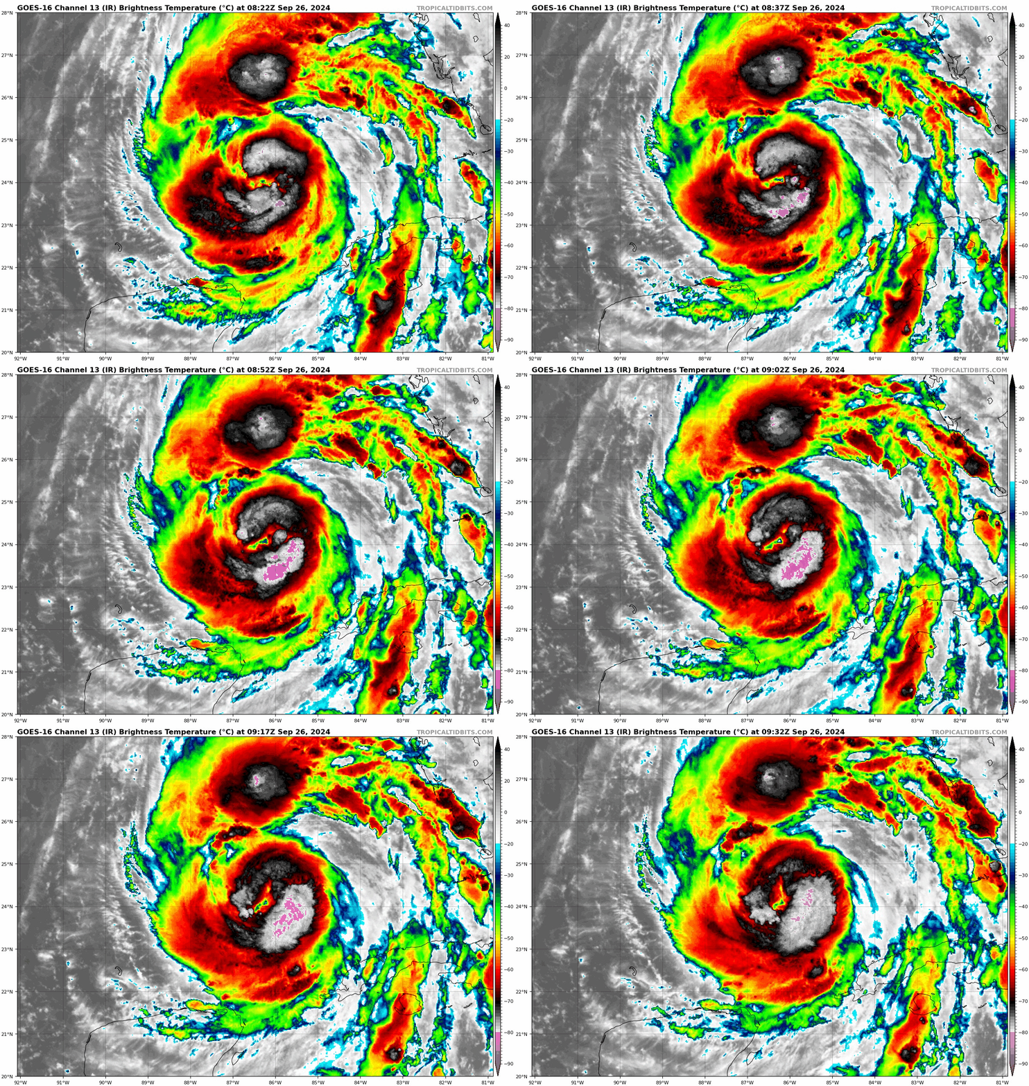
- Hurricane hunters find lower pressure at 966 mb. Max flight level winds at 700 mb occurring 50 n mi southeast of the center of 80 kts. They report concentric eyewalls.
- A faster pace is still forecast over the next 24 hours. Projected landfall this evening into tonight along the Florida Big Bend.
- Strengthening is still forecast. Helene is moving through very warm waters and low shear. “The main restraining
factor on intensification is the current concentric eyewall status.” Models still show strengthening and the NHC reflects that in the forecast.
Surge
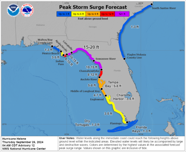
Catastrophic storm surge is still forecast for parts of the Big Bend. The highest projected surge of 15-20 feet. This is catastrophic, life-threatening storm surge.
Carrabelle, FL to Suwannee River, FL…15-20 ft
Apalachicola, FL to Carrabelle, FL…10-15 ft
Suwannee River, FL to Chassahowitzka, FL…10-15 ft
Wind
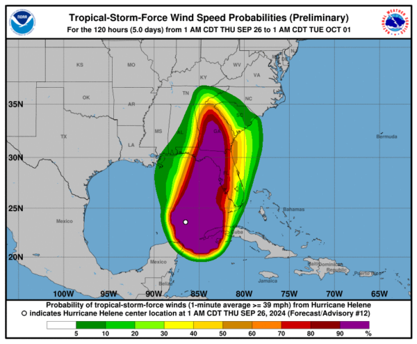
Helene is a very large storm with tropical storm force winds extending out 345 miles from the center. The hurricane winds out to 60 miles. With a faster forward speed, through landfall and beyond, damaging winds are expected to be well inland impacting a good part of the southeast and into the higher elevations of the southern Appalachians.
Rain
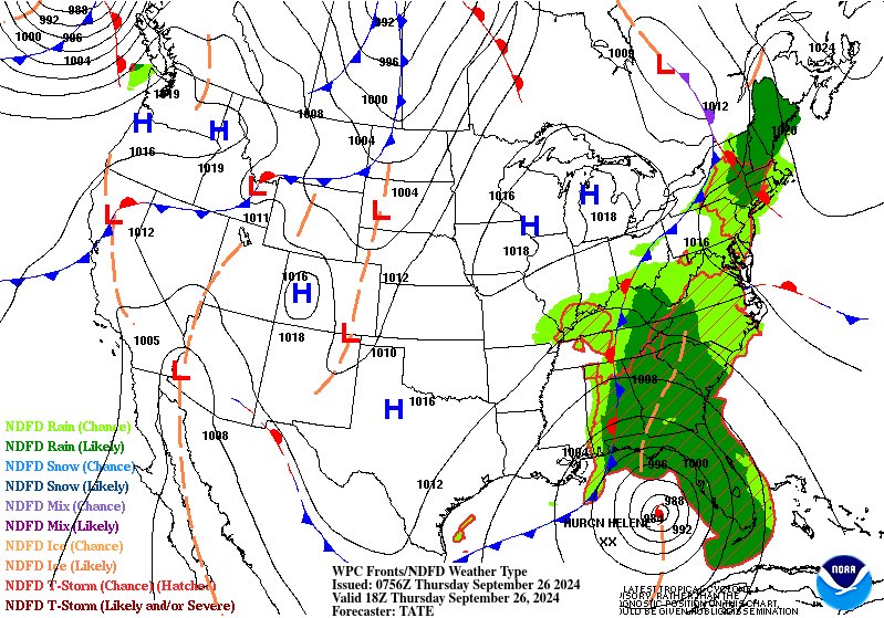
Here is the projected surface map at 18Z today:
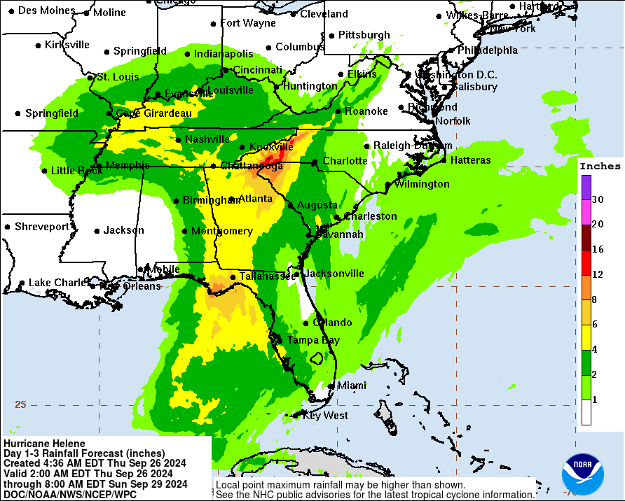
Notice we have a front laid out from the Ohio Valley through the Florida Panhandle. We had tremendous flooding yesterday for places like Asheville, NC. Moisture is riding along that front causing heavy rain and there are active flash flood warnings this morning from far East TN through parts of Western NC. I bring this up because this is flooding WELL ahead of Helene making landfall. Rain from Helene moving over this area could be in the 6-12 inch rain and locally more possible. This is on top of what folks have already seen. Catastrophic flooding expected. Not only flash flooding but river flooding could be significant. Landslides are possible for the steep terrain of the southern Appalachians.
Flash flooding at UNC Asheville @UNCAweather #ncwx #helene pic.twitter.com/eThAZ5zhhp
— Andrew Price (@andrewprice0311) September 25, 2024
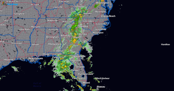
Radar snapshot at 428 am CDT.
Tornadoes
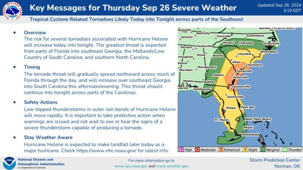
There is an increasing tornado threat today with the focus across Florida into southeast GA and into the Carolinas. There have already been a few tornado warning across parts of south Florida with rain bands pushing in.
Final Thoughts
Helene will bring widespread and potentially catastrophic conditions across the southeast. The NHC starts their discussion saying, “Helene is sending some mixed structural signals this morning.” Basically, we have lower pressure but the winds at the center are struggling. There is plenty of opportunity to see this storm wrap up. Regardless of that, Helene has a very large wind field. Tropical storm/hurricane winds will impact a lot of the southeast. Because of this wind field, the push of water coming into the Florida west coast will be tremendous. A wide area of 12 ft+ storm surge from Apalachicola to Chassahowitzka! That is a very large area. Surge is just the rise in water, waves on top of the surge could make values higher.
Data from the hurricane hunters will be crucial to help with a real-time look at Helene and its structure. Folks need to prepare for worsening conditions as the day goes on. Hurricane preparations should be rushed to completion.
Category: ALL POSTS, Social Media, Tropical


