A Look at Helene: Model Tracks and Timing; Storm Surge
We are close to 24 hours away from the estimated landfall of Hurricane Helene, so here is a look at some recent model data.

The GFS model has slowed the storm down by a small amount, placing landfall between 8-10PM Thursday night. It estimates a minimum pressure of 959 mb. This run of the GFS shows landfall occurring right in the middle of the Big Bend region of Florida.
In earlier runs, the GFS was showing an area of dry air being brought into the southern flow of the system. However, it not longer supports this. It now shows a precipitation band extending across the entire flow around the low pressure center. If this is the case, high levels of storm surge are likely to occur.

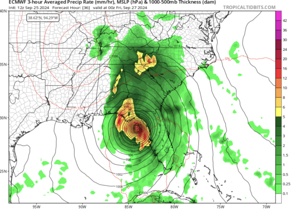
The Euro model is essentially in agreeance with the GFS. The only difference is that this model denotes a minimum pressure of 954 mb at landfall.

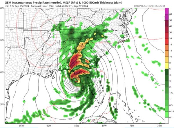
The Canadian model is telling a slightly different story than the above models. It is still showing an evening time landfall, but it takes the storm a little more northward than the others. It estimates a higher central pressure of 970 mb.
Additionally, this model still shows dry air being brought into the storm. This would be a better situation, as it would limit some of the storm surge and flooding risk. While it would by no means alleviate those risks, it would allow some breaks in rainfall to occur instead of the continuous downfall of rain shown by the GFS.
Category: ALL POSTS, Social Media, Tropical


