Strong Storms Expected Across Parts of Alabama Today

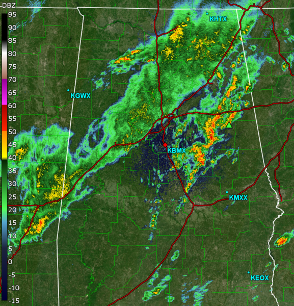
Current Radar image at 9:25AM CDT
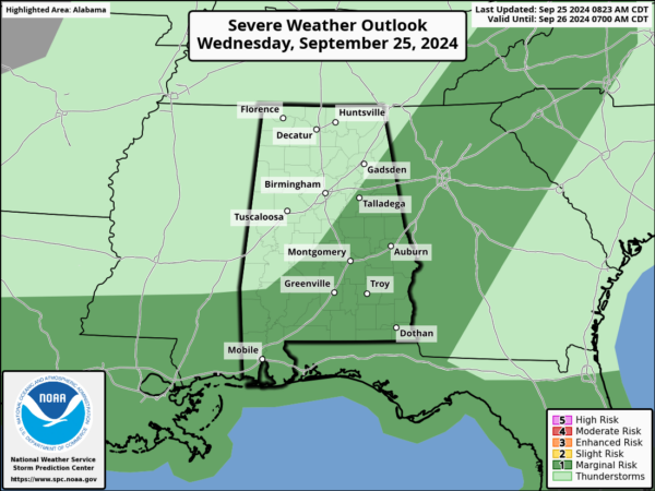
The latest SPC Outlook has much of South and East Alabama under a marginal risk for severe storms. Storms will likely begin to fire up around the lunch time hours, and will continue to move around the area through the evening hours. The main concern with these storms will be a damaging wind threat, with gusts up to 60 mph. A brief tornado cannot be ruled out, due to a high level of instability present in the atmosphere. Beyond the threat of strong storms, rain will be present in the entire state over the next couple of days as Helene makes its way towards the Gulf Coast.
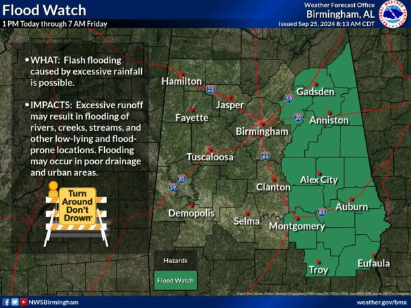
Additionally, a flood watch will be in effect from 1pm today until Friday morning for several counties. Be prepared for a lot of rain over the next two days, and make sure to stay vigilant when traveling! Flash floods can occur very quickly, and are especially dangerous when they affect roads. Do not drive down any road that appears to be flooded.
Stay tuned as we continue to monitor these storms throughout the day!
Category: Alabama's Weather, ALL POSTS, Social Media


