4am CDT Update on PTC 9: New Advisories for Parts of the Florida Gulf Coast
Good morning! It is time for another day in the tropics….and still no major answers in the latest NHC update. We have a disorganized system right now, but how long will that last? And when it does wrap up and begin to move over the Eastern Gulf, how strong will it become?
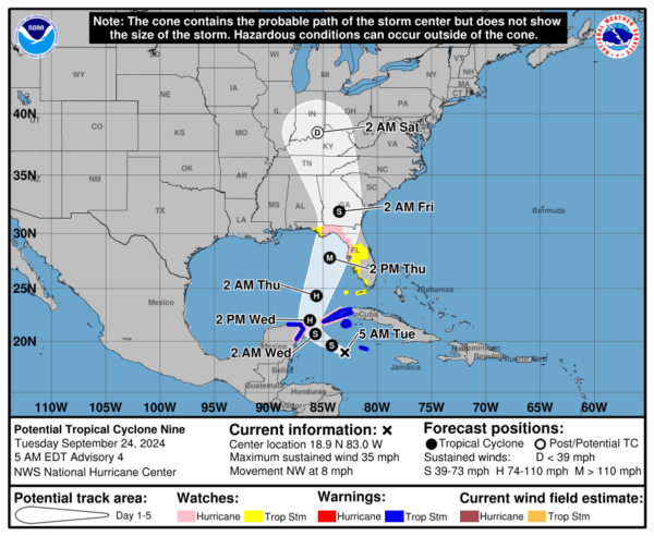
These are the questions that will plague all forecasters as the day goes on and make messaging extremely difficult. Our team will continue to give you insight and analysis on what is going on to the best of our ability. Let’s start this morning with a look at the 4am CDT advisory:
Stats:
LOCATION…18.9N 83.0W
ABOUT 120 MI…195 KM WSW OF GRAND CAYMAN
ABOUT 240 MI…390 KM SSE OF THE WESTERN TIP OF CUBA
MAXIMUM SUSTAINED WINDS…35 MPH…55 KM/H
PRESENT MOVEMENT…NW OR 315 DEGREES AT 8 MPH…13 KM/H
MINIMUM CENTRAL PRESSURE…1001 MB…29.56 INCHES
Watches and Warnings:
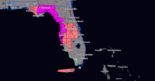
We have new ones this morning for parts of Florida.
A Storm Surge Watch has been issued from Indian Pass Florida southward to Bonita Beach Florida, including Tampa Bay and Charlotte Harbor.
A Hurricane Watch has been issued for the Gulf Coast of Florida from Englewood northward and westward to Indian Pass, including Tampa Bay.
A Tropical Storm Watch has been issued for the Gulf Coast of Florida from Indian Pass to the Walton/Bay County Line and from north of Bonita Beach to south of Englewood.
NHC Discussion:
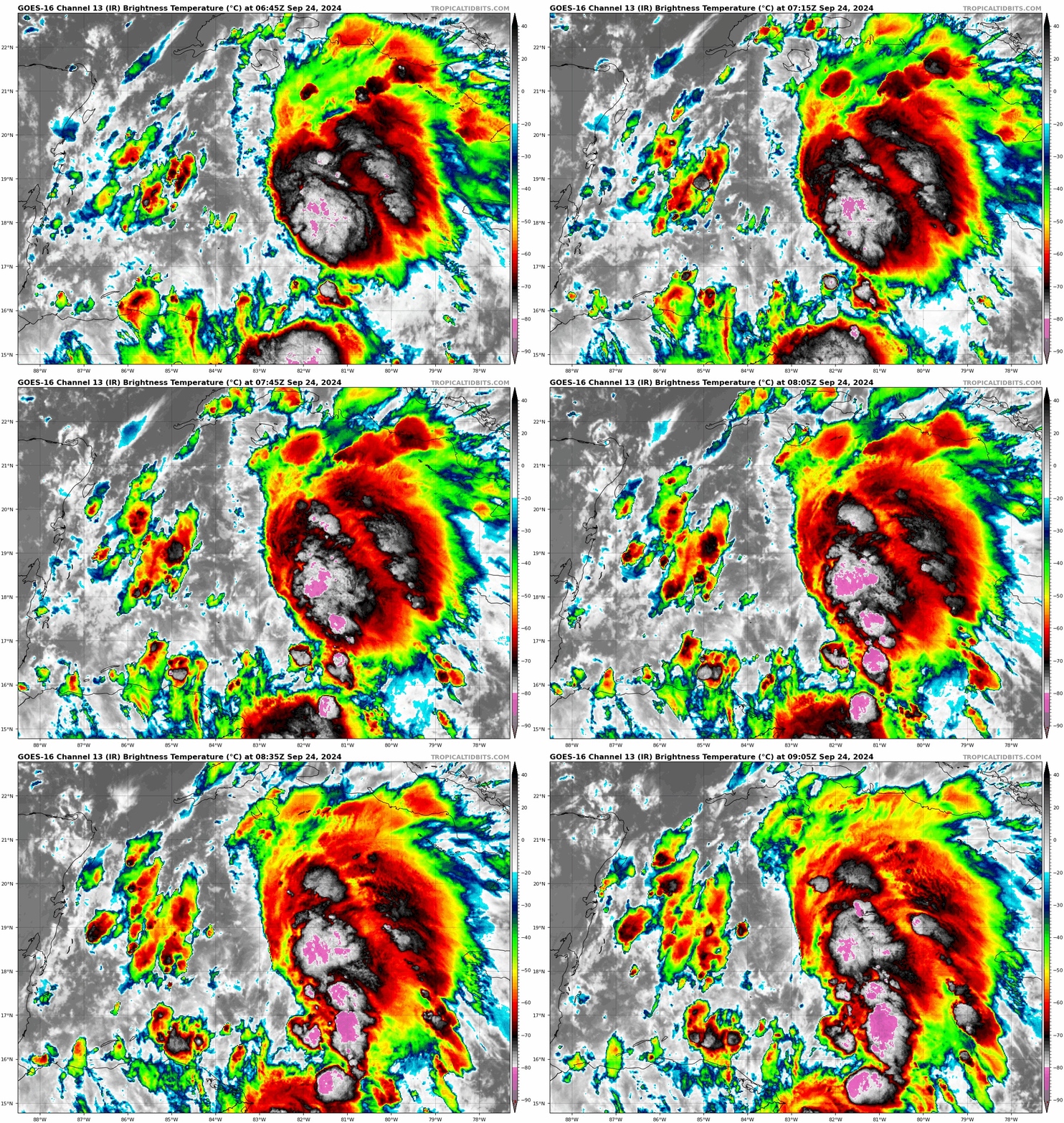
As you can see by the latest IR, we do have a blow up of a convection near the Caymans. This is on the eastern side of broad circulation, there is still no defined center. Hurricane Hunters also state the low-level circulation is not the greatest. Initial intensity forecast has remained the same.
Southwesterly shear has hindered the development of this disturbance. The various models show the shear easing over the next 12-24 hours and this system will get its chance to ramp up. And that rapid intensification is still forecast. The official NHC forecast projects at Category 3 at landfall, still near the Big Bend Area. Until we get a defined center though, their is going to continue to be some uncertainty on exactly where future-Helene will go. The model consensus is still near the Big Bend. But we know, a tropical system is not just one point. And this is forecast to become a large system that will have a wider impact. This is why the NHC has hoisted the hurricane and storm surge watches for areas well away from the center.
Most of the overnight models have slowed the system just a bit so that is something to monitor. Right now though, the official forecast hasn’t changed much in terms of timing, with a landfall Thursday evening as a steadily moving major hurricane. Because it will be moving faster inland, higher winds will be felt further inland.
I will end this early report with this: Please pay attention if you are a Florida resident or have interests there. Make sure you wrap up your hurricane preparations and be ready to act. Further inland, for Georgia and into the state of Alabama, be prepared for strong winds and very heavy rain. Today will be a crucial day for the Hurricane Hunters has they gather the information needed to help with guidance on the track.
Category: ALL POSTS, Social Media, Tropical


