720 am CDT Tropics Update: Monitoring the Gulf Closely; Should Have Advisories Issued Today For Parts of the NW Caribbean/Mexico/Western Cuba
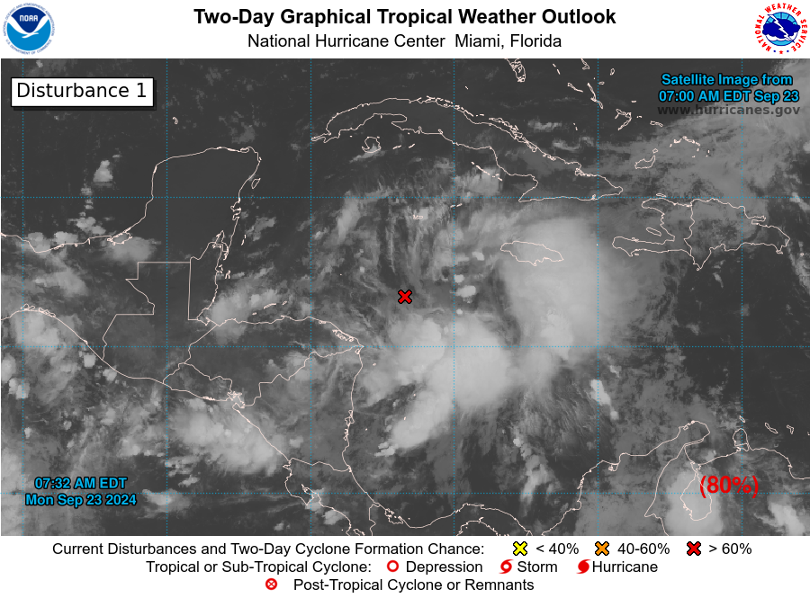
The National Hurricane has issued their tropical weather outlook as of 7am CDT. We have invest 97L in the NW Caribbean. Showers and thunderstorms are gradually becoming more organized. The NHC states, “Regardless of development, this system is expected to produce heavy rains over portions of Central America during the next several days. Interests in the northwestern Caribbean, the Yucatan Peninsula of
Mexico, and western Cuba should closely monitor the progress of this system, as watches or warnings will likely be required later this morning for portions of these areas.” We will be looking to see if more of a full advisory package will be produced by 10am CDT and pass that your way. This would give us as well the first forecast cone.
The latest guidance continues to show a track into the Gulf and then heading somewhere from the Florida Panhandle to the west coast of Florida. More models are focused on the Panhandle region, with a potential hurricane (Helene) landfall on Thursday.
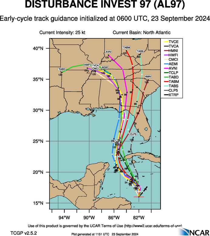
There is widespread solutions on the intensity of this system. Plenty of models though bring it to a hurricane and possibly a strong one. The waters are very warm for this to happen but it is too early to really pinpoint how strong eventual Helene could become. Folks need to plan now that a major hurricane could be coming their way by the latter half of the week.
Hurricane Hunters will be heading into this system today.
We will keep you update through the week on this situation. There will be impacts in Alabama. Uncertainty on how much of an impact of course depending on the track. But at least an increase in rain and wind, especially if the track is more toward the Florida Panhandle.
Category: ALL POSTS, Social Media, Tropical
About the Author (Author Profile)
Owner of Tornado Talk. Radio broadcast meteorologist with The Storm Report. WeatherBrains Panelist. B.S. Meteorology from Penn State University.Subscribe
If you enjoyed this article, subscribe to receive more just like it.


