Invest 97L Designated; Could Become Major Hurricane in the Gulf
The disturbance in the northwestern Caribbean has been designated Invest 97L by the Hurricane Center. It is forecast to become a named storm (Helene) over the next 48 hours and a hurricane by Tuesday afternoon. It will move into the Gulf of Mexico and quickly reach the northern Gulf Coast late Thursday, possible as a major hurricane. Interests from Louisiana to the west coast of Florida should be monitoring the latest information and reviewing their hurricane plans.
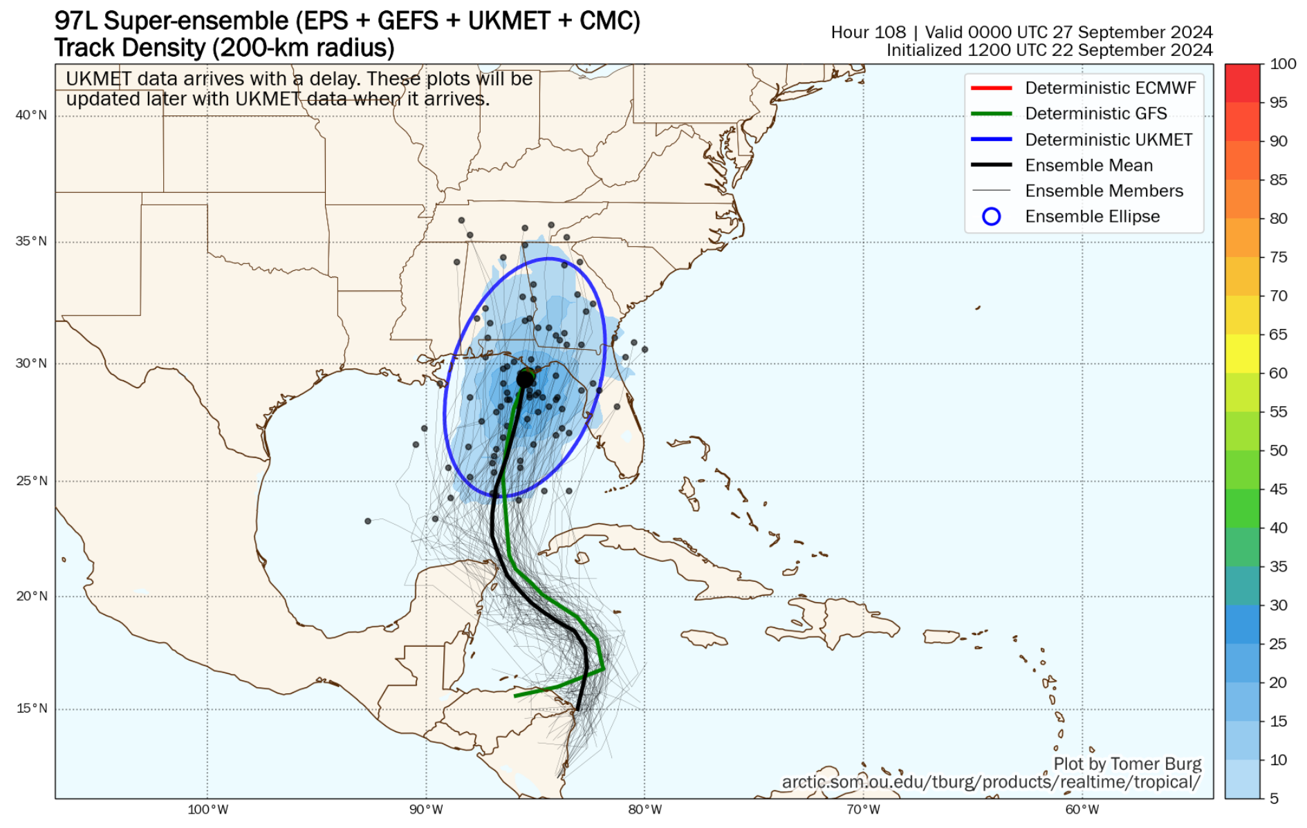
This is very good information from the Super Ensemble of the UKMET, GFS, and European ensemble members, showing where the various center could be at 7 p.m. Thursday evening.
Environmental conditions ahead of the storm are very favorable for intensification and early SHIPS guidance from the GFS shows it as a 100 knot hurricane at 96 hours (Thursday afternoon). It could even reach Category Three status.
It will pass over very warm water, including water with high oceanic heat content, especially starting Tuesday. Upper level divergence is forecast to be favorable as well. The other factor long time readers of the blog know is critical is the moistness of the surrounding air. That will not be a problem all the way across the Gulf.
Residents along the Gulf Coast from Louisiana to Florida should stay vigilant and closely follow updates on Invest 97L. A potential hurricane landfall is becoming increasingly likely on Thursday or Friday this week. If named, the storm will be called Helene.
We will have continuous coverage through the storm’s landfall.
Category: ALL POSTS, Social Media, Tropical
About the Author (Author Profile)
Bill Murray is the President of The Weather Factory. He is the site's official weather historian and a weekend forecaster. He also anchors the site's severe weather coverage. Bill Murray is the proud holder of National Weather Association Digital Seal #0001 @wxhistorianSubscribe
If you enjoyed this article, subscribe to receive more just like it.


