
Hurricane Center Ups Probabilities on Caribbean/Gulf Disturbance, Look at 12z Global Models
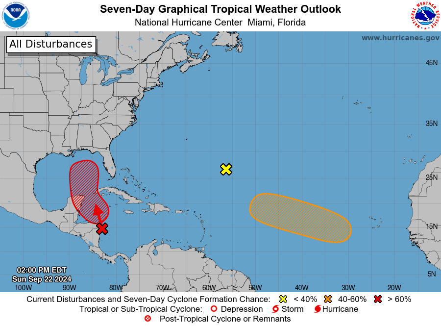
The NHC has issued their updated tropical weather outlook within the past hour, and they have updated the probabilities of development from what will eventually be 97L in the northwestern Caribbean to 40% over the next 48 hours and 80% over the next 7 days.
The activity over the western Caribbean certainly seems to be growing in size and intensity. And we are beginning to see a circulation in the surface wind pattern also.

The 12z run of the GFS depicts a stronger storm a little further west with a landfall in the eastern Panhandle near or east of Panama City, perhaps near Mexico Beach or Port St. Joe as a 107 mph hurricane.
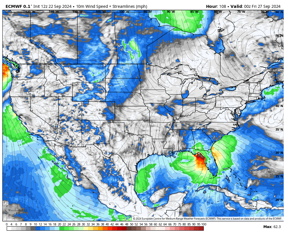
The Euro 12z run is much weaker with a 60 mph tropical storm in the same area. Both show landfall around 7 p.m. Thursday night.
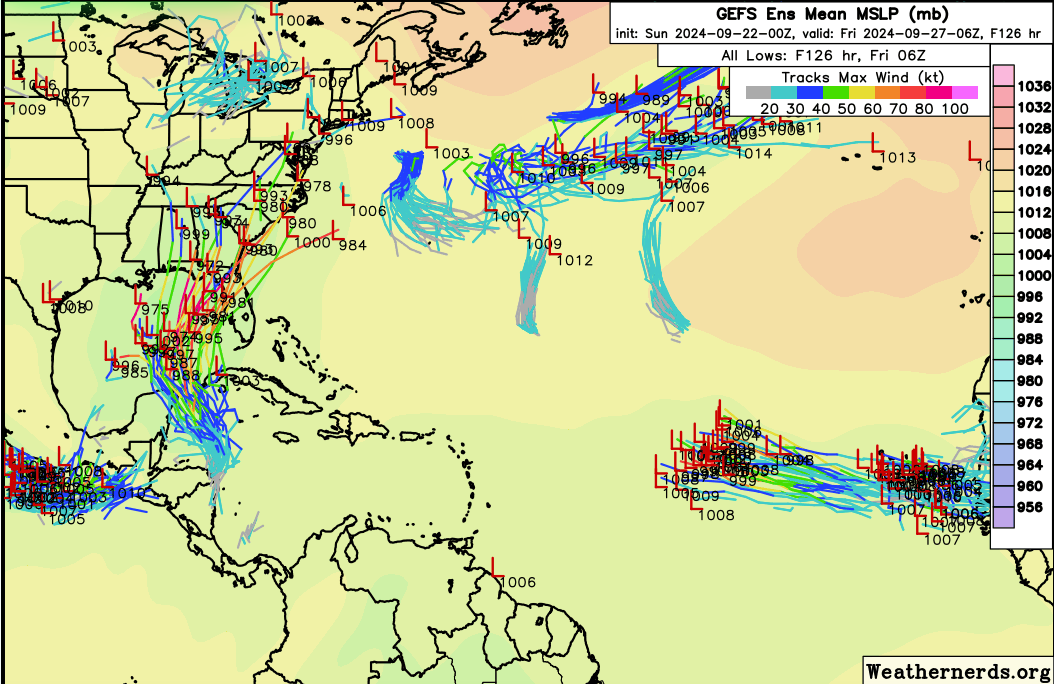
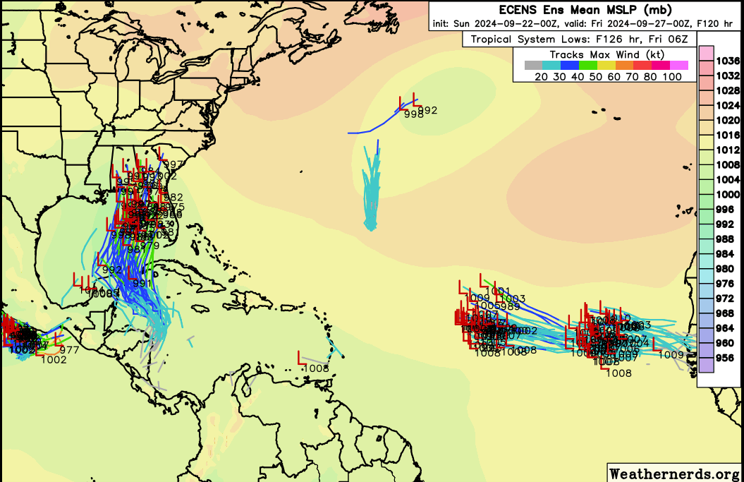
The ensembles from last evening show a much wider range of possibilities, although they are still clustered in the eastern Gulf.
Here are the GEFS ensembles…
Here are the Euro ensembles…
Category: Alabama's Weather, ALL POSTS, Social Media, Tropical
About the Author (Author Profile)
Bill Murray is the President of The Weather Factory. He is the site's official weather historian and a weekend forecaster. He also anchors the site's severe weather coverage. Bill Murray is the proud holder of National Weather Association Digital Seal #0001 @wxhistorianSubscribe
If you enjoyed this article, subscribe to receive more just like it.


