Very Bright and Hot on This Last Day of Summer
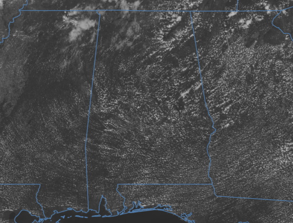
Other than a few fair-weather clouds floating overhead, today is very bright and hot, which is what you would expect to close out the last day of summer in 2024. No rain at all as dry air is in place thanks to a building ridge moving more into the area. Temperatures are currently in the upper 80s to the lower 90s at 1pm across Central Alabama, with Talladega as the hot spot at 93 degrees. Alexander City is the cool spot at 87, while Birmingham was sitting at 91 degrees. Afternoon highs are expected to reach the lower to mid 90s across the area. Skies will clear out tonight across the area and will eventually cool into the upper 60s for overnight lows. The first day of fall will look a lot like the last day of summer. Sunday’s weather will be similar to today’s as skies will be mainly sunny with hot high temperatures reaching the lower to mid 90s.
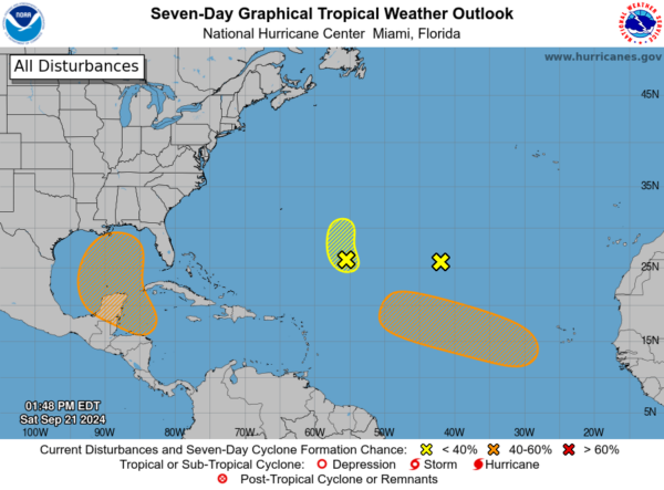
1. Central Subtropical Atlantic (Remnants of Gordon):
Strong upper-level winds continue to keep showers displaced well to the east of an area of low pressure (the remnants of Gordon) located over one thousand miles southwest of the Azores. Development of this system is not expected while it moves slowly northwestward over the central subtropical Atlantic during the next couple of days.
* Formation chance through 48 hours…low…near 0 percent.
* Formation chance through 7 days…low…near 0 percent.
2. Central Subtropical Atlantic (AL96):
An area of low pressure located about 700 miles southeast of Bermuda continues to produce a small cluster of showers and thunderstorms northeast of its center. However, the low is embedded in a very dry environment, and therefore significant development is not expected while it moves generally northward at 5 to 10 mph over the central subtropical Atlantic.
* Formation chance through 48 hours…low…10 percent.
* Formation chance through 7 days…low…10 percent.
3. Northwestern Caribbean Sea and Gulf of Mexico:
A broad area of low pressure is likely to form by the early to middle part of next week over the northwestern Caribbean Sea and the adjacent portions of Central America. Thereafter, gradual development of this system is possible, and a tropical depression could form as the system moves slowly northward across the northwestern Caribbean Sea and Gulf of Mexico through the end of next week. Regardless of development, this system is expected to produce heavy rains over portions of Central America during the next several days.
* Formation chance through 48 hours…low…near 0 percent.
* Formation chance through 7 days…medium…60 percent.
4. Eastern and Central Tropical Atlantic:
A tropical wave is expected to move westward from the coast of Africa on Sunday or Monday. Gradual development of this system is possible thereafter, and a tropical depression could form next week while the wave moves westward across the eastern and central tropical Atlantic.
* Formation chance through 48 hours…low…near 0 percent.
* Formation chance through 7 days…medium…40 percent.
Category: Alabama's Weather, ALL POSTS, Social Media, Tropical


