
Tropics Update: The Models Still Show Something Brewing in the NW Caribbean/Gulf Of Mexico Early Next Week
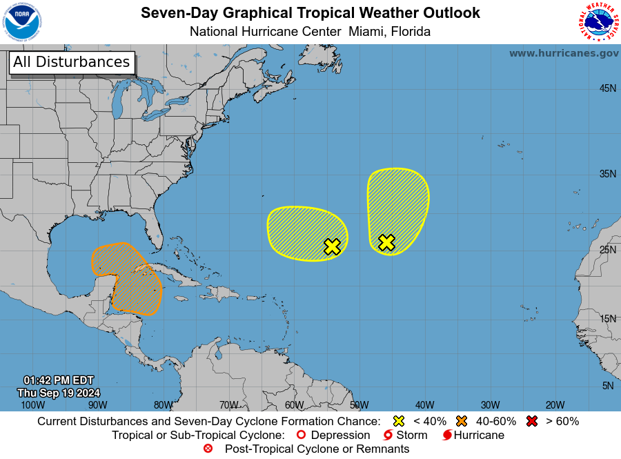
Happy Thursday Afternoon! Doing a check of the tropics as the models have been consistent in showing some development of low pressure early next week over the NW Caribbean. Conditions would be favorable for development as it moves north or northwest through this region and possibly into the Gulf of Mexico. The NHC in their 1pm CDT tropical discussion have a medium chance for development through 7 days.
They are watching two other areas over the Subtropical Atlantic and give only low chances right now of development. One area is still the remnants of Gordon. These will be mainly fish storms and do not pose problems to land masses at this time.
Back to the area we are most interested in and a look at some of the model runs. (Not a forecast)
12z GFS valid Tuesday evening September 24. Shows something forming in the NW Caribbean.
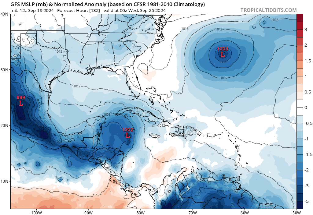
This is this model’s projection late Thursday, Sept. 26.
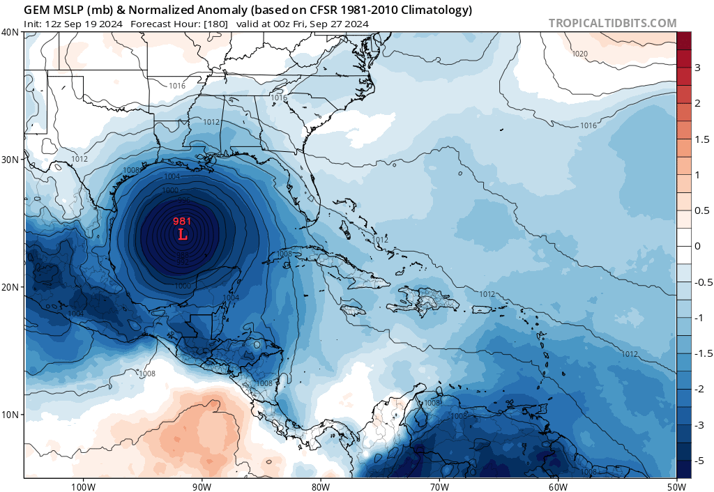
The 12z GEM at 180 hours also shows possible hurricane in the Gulf
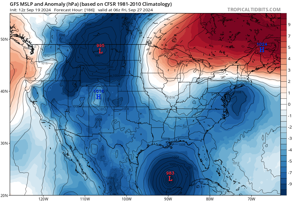
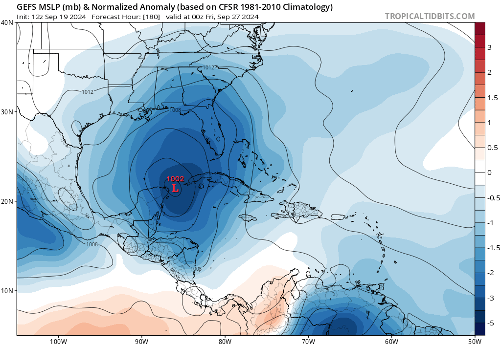
The 12Z GFS Ensemble has a low near the Bay of Campeche at this same time frame, slightly weaker.
Here is the GFS Ensemble at the same time showing possible movement of the low.

What does all of this tell us? We are seeing consistent signs of a low pressure system emerging out of the NW Caribbean heading into the Gulf of Mexico by early to mid next week. The models different on strength and location. Most right now are not showing a fast movement. We just need to stay vigilant in watching the trends with the models through the rest of this week and into the weekend and then as we head into next week, hopefully we will have a better handle on where this low will go. This is the area during the hurricane season where development is more likely so we need to monitor this all very closely.
Category: ALL POSTS, Social Media, Tropical
About the Author (Author Profile)
Owner of Tornado Talk. Radio broadcast meteorologist with The Storm Report. WeatherBrains Panelist. B.S. Meteorology from Penn State University.Subscribe
If you enjoyed this article, subscribe to receive more just like it.


