Midday Nowcast: Sun for Most, Clouds for Others; Gordon is No More
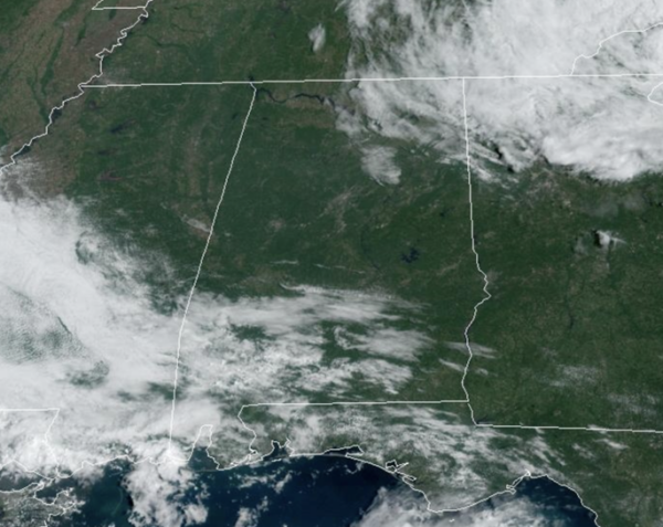
MAINLY DRY PATTERN: Some showers remain possible today and tomorrow, but these are confined to the southern half of the state. For the rest of the state, we are seeing more sunshine than clouds, with highs in the mid 80s this afternoon. Lows tonight will again fall into the lower 60s. Tomorrow through Friday, little change with plenty of sunshine and very warm temperatures as highs will be in the upper 80s. A few spots will flirt with the 90° mark by Friday.
BIRMINGHAM ALMANAC: For September 16th, the average high for Birmingham is 86° and the average low is 65°. The record high is 101° set in 1927, while the record low is 49° set in 1999. We average 0.13” of precipitation on this date, and the record value is 2.93” set in 1913.
ACROSS THE USA: There is a Slight Risk for Excessive Rainfall (level 2 of 4) Tuesday across central and southeastern Virginia as the remnants of Potential Tropical Cyclone Eight moves northward. Flash and urban flooding also is possible. Strong to severe thunderstorms are expected across the High Plains and portions of the central Plains Tuesday. The primary threats will be severe wind gusts and large hail.
WEEKEND WEATHER AND BEYOND: At this point we see a totally dry weekend for Alabama with mostly sunny warm days and fair pleasant nights. Highs will be in the upper 80s with some low 90s, while lows will be in the 60s. The quiet weather looks to continue into next week, with rain-free conditions as well with highs in the 80s.
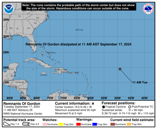
IN THE TROPICS: We had one storm in the Atlantic and it was Tropical Depression Gordon, however, as of the latest update from the NHC, Gordon has dissipated and it no more. For now, the rest of the Atlantic remains quiet, but again, we are in the heart of the season, and we are not done with named storms yet. Hurricane season ends on November 30th and the next couple of names are Helene and Isaac.
WORLD TEMPERATURE EXTREMES: Over the last 24 hours, the highest observation outside the U.S. was 111.7F at Al Ahsa, Saudi Arabia. The lowest observation was -108.0F at Vostok, Antarctica.
CONTIGUOUS TEMPERATURE EXTREMES: Over the last 24 hours, the highest observation was 102F at Phoenix, AZ. The lowest observation was 21F at Mammoth Lakes, CA.
Category: Alabama's Weather, ALL POSTS, Social Media


