Midday Nowcast: Partly Sunny Today; Drier Week of Weather Ahead
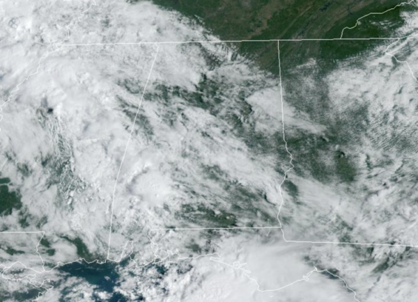
DRIER WEEK OF WEATHER: We are seeing a partly sunny sky today, with some showers mainly confined to the southern half of the state. Highs are in the low to mid 80s this afternoon. Most of Alabama will be dry tomorrow through Friday, although we will continue to mention a chance of showers for the southern counties tomorrow and Wednesday. Highs will be in the 80s, lows mostly in the 60s.
BIRMINGHAM ALMANAC: For September 16th, the average high for Birmingham is 86° and the average low is 65°. The record high is 101° set in 1927, while the record low is 48° set in 1961. We average 0.14” of precipitation on this date, and the record value is 9.75” set in 2004 (Hurricane Ivan related).
WEEKEND WEATHER AND BEYOND: At this point we see a totally dry weekend for Alabama with mostly sunny warm days and fair pleasant nights. Highs hold in the 80s, with lows in the 60s. The quiet weather looks to continue into next week, with rain-free conditions as well with highs in the 80s. Late September and October are typically the driest time of year for Alabama and it looks like this year is no different. The exceptions are usually when a tropical system impacts the state.
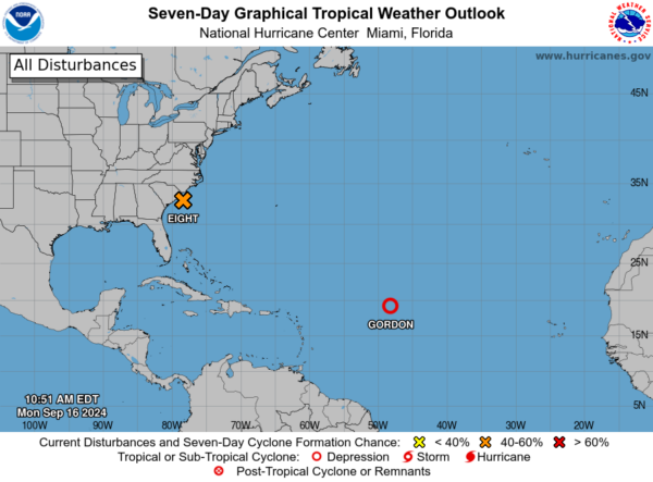
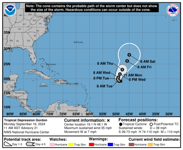
IN THE TROPICS: Gordon is back down to a tropical depression, and will continue to be a “fish storm” in the eastern Atlantic.
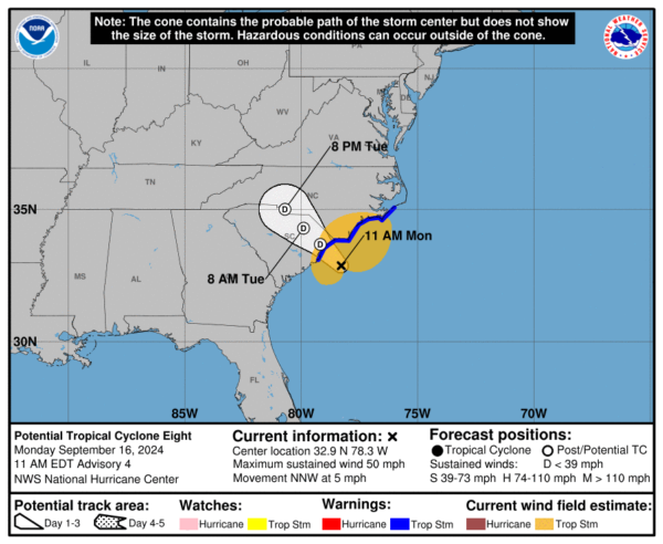
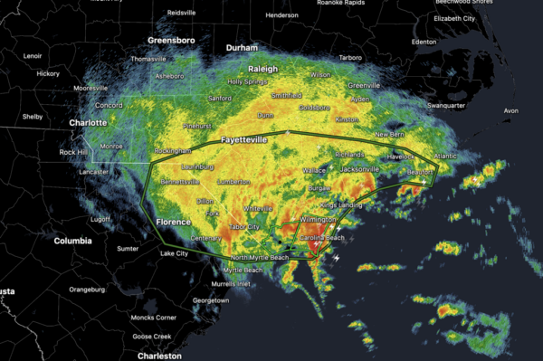
SOON TO BE HELEN?: Probably not, but we shall see as it is likely to move onshore before it can be named. The latest update on Potential Tropical Cyclone Eight, the feature was centered near latitude 32.9 North, longitude 78.3 West. The system is moving toward the north-northwest near 5 mph. A northwestward motion is expected during the next day or two. On the forecast track, the low will reach the coast of South Carolina this afternoon and then move inland across the Carolinas tonight through early Wednesday.
Surface observations indicate that maximum sustained winds are near 50 mph with higher gusts. Little change in strength is expected before the system reaches the coast, but steady weakening is anticipated after the system moves inland. The low is forecast to dissipate over the Carolinas by early Wednesday. Formation chance through 48 hours…medium…40 percent.
Tropical-storm-force winds extend outward up to 175 miles from the center. A National Ocean Service station at Wrightsville Beach, North Carolina, recently reported a sustained wind of 51 mph and a gust of 67 mph. The estimated minimum central pressure is 1005 mb (29.68 inches).
WORLD TEMPERATURE EXTREMES: Over the last 24 hours, the highest observation outside the U.S. was 111.0F at King Fahad International Airport, Dammam, Saudi Arabia. The lowest observation was -107.7F at Vostok, Antarctica.
CONTIGUOUS TEMPERATURE EXTREMES: Over the last 24 hours, the highest observation was 106F at Phoenix, AZ as well as Death Valley and Stovepipe Wells, CA. The lowest observation was 22F at Peter Sinks, UT.
Category: Alabama's Weather, ALL POSTS, Social Media, Tropical


