
Monday Morning Tropics Update: Low Off South Carolina Coast Less Organized, We Still Have Gordon
Been reviewing the 4am and 7am CDT updates from the National Hurricane Center on the low off the South Carolina Coast and Gordon. This low pressure is not looking very organized. Most of the deep convection has been shunted to the north and east of the center due to strong upper-level winds. The hurricane hunters have been flying into the disturbance and denoted a peak wind of 54 knots at 6000 feet. From the discussion: “An Air Force Reserve Hurricane Hunter aircraft still measured a 2-3 degree Celsius temperature difference at 850 mb from north to south, indicating that the frontal boundary is diffuse but not totally gone. Therefore, the low is still not a tropical or subtropical cyclone.”
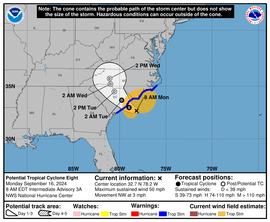
SUMMARY OF 800 AM EDT…1200 UTC…INFORMATION
———————————————-
LOCATION…32.7N 78.2W
ABOUT 85 MI…140 KM S OF CAPE FEAR NORTH CAROLINA
ABOUT 100 MI…160 KM E OF CHARLESTON SOUTH CAROLINA
MAXIMUM SUSTAINED WINDS…50 MPH…85 KM/H
PRESENT MOVEMENT…NW OR 325 DEGREES AT 3 MPH…6 KM/H
MINIMUM CENTRAL PRESSURE…1005 MB…29.68 INCHES
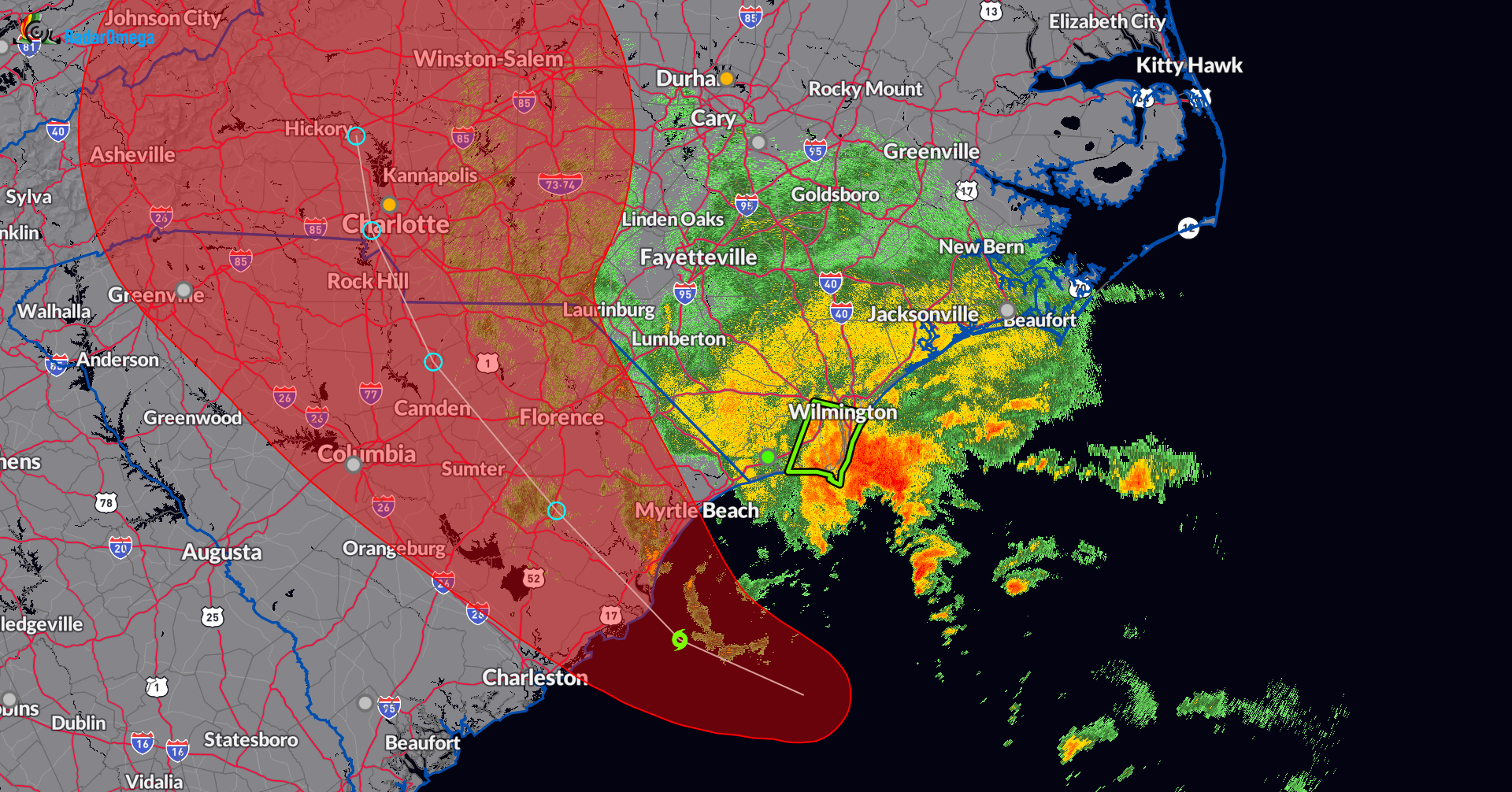
Strong storms are pulling into the North Carolina Coast with one Flash Flood Warning. This warning runs until 130pm EDT for Eastern Brunswick and Southern New Hanover Counties. This includes Wilmington. An estimated 2-3 inches of rain has fallen and another 2-3 inches possible.
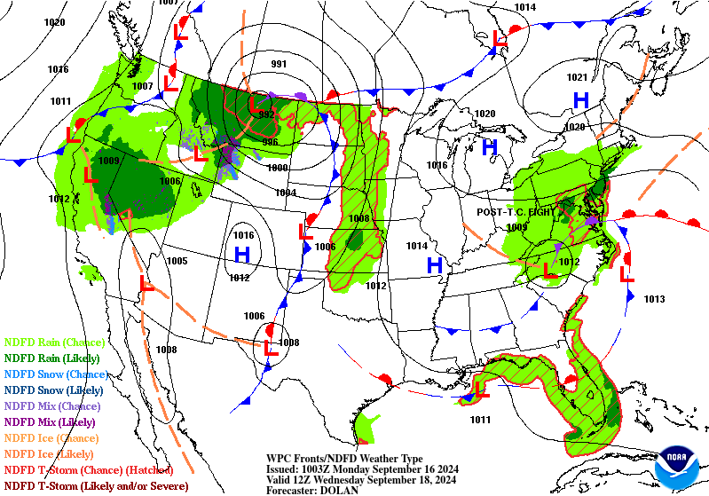
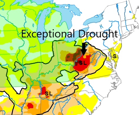
Here is a look at where some of the tropical moisture may be located Wednesday AM. I highlight this because there may finally be some rain hitting the drought stricken areas of Ohio and into West Virginia. Not a drought-buster but they will take what they can get.
Gordon is still a tropical depression located just over 1000 miles east of the Northern Leeward Islands. Not expecting much from this system. The NHC hinted it could become a post-tropical remnant low at any point. Max winds right now at 30 mph.
Category: ALL POSTS, Social Media, Tropical
About the Author (Author Profile)
Subscribe
If you enjoyed this article, subscribe to receive more just like it.


