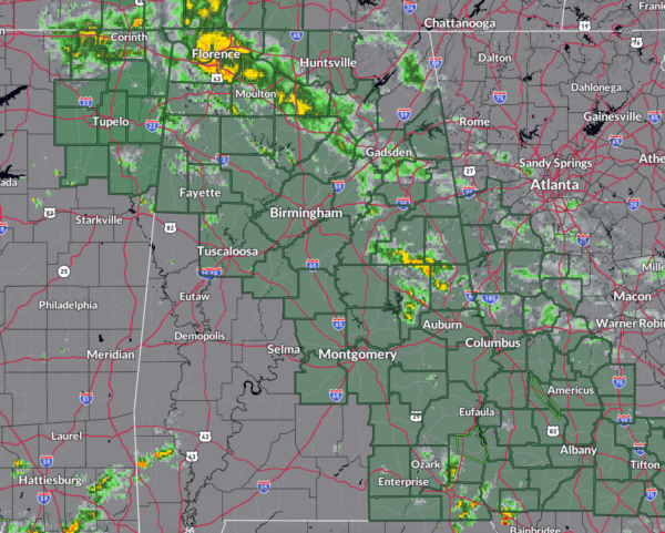
Flooding Threat Continues for Parts of Alabama Overnight
Things are much quieter this evening across Alabama.
A band of light to moderate rain extends from the Quad Cities of Northwest Alabama into Morgan County to south of Gadsden then southward into Tallapoosa and Chambers County.
The activity is moving northwest around the remnant low from Hurricane Francine, which is located southeast of Greenwood, MS.
Flash flood watches remain in effect for much of Alabama. The Tennessee Valley counties are effective until this evening, the Central Alabama counties until tomorrow morning, and same for Southeast Alabama. I would imagine Huntsville might extend for their counties…will be watching the teletype room for that.
There is a flood warning for Big Nance Creek near Courtland in Lawrence County. There is also a flood warning til 7 p.m. for Henry County.
The HRRR, one of our convection allowing models, is predicting that heavy rain will erupt during the evening again over Central Alabama. We will be carefully watching the radar. It just won’t be the Birmingham radar, since it became inoperable this afternoon. But surrounding radars will suffice for heavy rain.
Many areas have picked up up 3-8 inches of rain and the ground is saturated in most areas, and additional rainfall could cause more flash flooding, especially in areas where training of cells sets up.
Pay attention to weather information through the night and tomorrow morning in case more warnings are necessary.
Category: Alabama's Weather, ALL POSTS, Social Media


