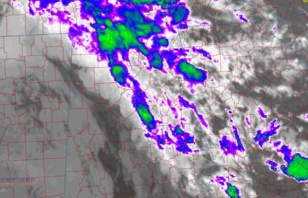
Cloud Tops Cooling in the Heavy Rain Band, Rainfall Increasing
Not a good sign early this morning, but the cloud tops are cooling on the convection over eastern Shelby County, northern Walker, eastern Lauderdale, Lawrence, and Limestone counties.
This indicates rainfall rates may be increasing.
Cloud tops are generally now above 20,000 feet in the stronger cells and approaching 30,000 feet in the strongest ones.
In addition, reflectivity returns on the BMX radar are definitely increasing.
We could be in for a long morning across Central Alabama in areas where this firehose of heavy rain meanders.
Please be aware if you have to go out, and lets friends, family, and neighbors in the heavy rain area know there will be water on roadways.
Category: Alabama's Weather, ALL POSTS, Severe Weather, Social Media


