More Heavy Rain & Some Storms Likely Over Already Rain-Soaked Areas for the Rest of Tonight
For the rest of the night, there’s a good chance of flash flooding due to heavy rain continuing in some areas. Recently, certain spots have already received 1 to 3 inches of rain over the past six hours, and more rain is expected.
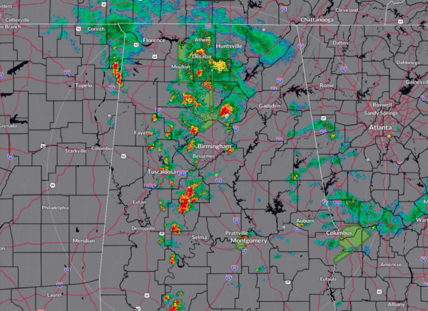
Here’s what’s going on: The radar shows a couple of areas with intense storm activity. One is in the northeastern part of Mississippi near Booneville and Corinth, and another larger area stretches from Selma to Decatur. In these regions, the rain has been falling steadily, causing flooding. These stormy bands are sticking around because of the way low-level winds are interacting with the weather system. Also, the heat leftover from earlier in the day and moisture in the air are helping the storms stay strong.
This situation isn’t likely to change much. We can expect more rain, with rates of about 1 inch per hour, in the same areas that have already seen heavy rainfall. There might be some weakening of the storms in a few places as the air cools slightly. However, models suggest that the storms will keep going through the night, especially in Alabama. So, the risk of flash flooding will remain high, with an additional 1 to 3 inches of rain possible before early morning.
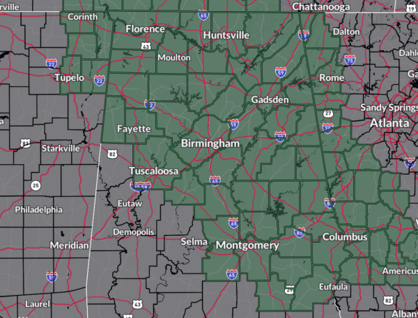
All the North Alabama counties and much of the Central Alabama counties remain in a Flood Watch through Saturday evening with the amount of rain that is forecast to fall between now and then. Excessive runoff may result in flooding of rivers, creeks, streams, and other low-lying and flood-prone locations. Creeks and streams may rise out of their banks. Flooding may occur in poor drainage and urban areas.
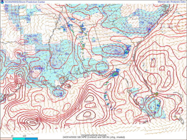
While we still have a good bit of surface-based instability in place over the area, helicity values have dropped or are dropping below what you want to see for severe thunderstorm development with rotating updrafts. While I simply cannot rule out one or two, the threat for the brief spin-up tornadoes have greatly diminished. However, the remaining instability will allow for thunder and lightning in some of these rain bands, so you will probably hear some rumbles of thunder as these pass over your location.
So, for the rest of tonight, nearly all the activity will be along and west of the I-65 corridor in North and Central Alabama, with models showing rain moving over to the east side by around midnight to 2am on Saturday morning.
Category: Alabama's Weather, ALL POSTS, Partner News Stories, Tropical


