615pm: Radar Check and Review of Active Advisories
We are finishing off our week here in Alabama on a very active note. Have several flash flood warnings and flood advisories that continues across parts of the northern and central parts of the state. Some of these storms are producing rainfall rates of 1-3″+ per hour and this is on top of a few inches already bring the risk of flooding. In addition, some of the storms are packing a punch with strong winds to 40-50 mph and small hail.
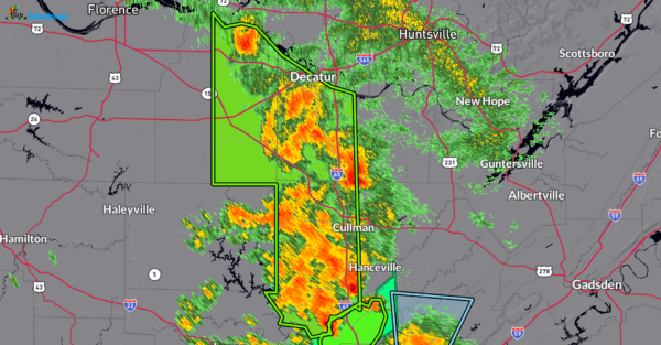
Let’s review northern Alabama first. Flooding has been reported by emergency management in Moulton and Cullman. A Flash Flood Warning remains in effect until 7 PM CDT for Cullman, Western Morgan and Eastern Lawrence Counties.
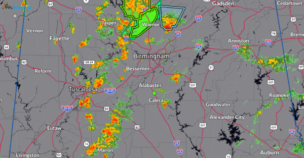
Across Central Alabama, we have numerous storms. The strongest have been north of Birmingham. These have brought in big time rain and the risk of flooding near Smoke Rise. Notice the storm east of Warrior. That has a blue polygon indicating a stronger storm has formed. This is west of Springville and could produce small hail and strong winds 40-50 mph. I zoomed out a bit to show you the other storms still getting their act together west of Birmingham, down to Tuscaloosa and points south. If these move into the areas that have already been dealing with flooding, that could aggravate the situation.
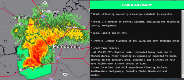
Looking at one more area and that is Montgomery. Very strong storm here that is not moving much. Flood advisory has been posted for this storm. An estimated 1-3 inches of rain has fallen.
Category: Alabama's Weather, ALL POSTS, Severe Weather, Social Media


