
Flood Warning for parts of Colbert, Franklin and Lawrence Counties until 530pm CDT (replaces Flash Flood Warning)
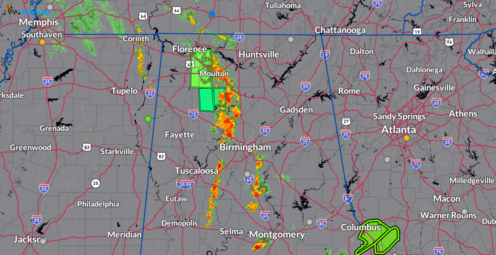
The NWS Huntsville replaced the flash flood warning with a flood warning. The heavier storms are moving more into Morgan and Cullman Counties but still some residual flooding in place for parts of Colbert, Franklin and Lawrence Counties.
The storm heading through Morgan and Cullman will move into the I-65 and 565 corridors during peak rush hour. Ponding on the roads expected and we can’t rule out localized flooding. Heads up Cullman and Decatur.
Other storms are building south of Birmingham that need to be monitored for heavy rain rolling in through this Friday evening.
BULLETIN - IMMEDIATE BROADCAST REQUESTED
Flood Warning
National Weather Service Huntsville AL
333 PM CDT Fri Sep 13 2024

ALC033-059-079-132230-
/O.NEW.KHUN.FA.W.0005.240913T2033Z-240913T2230Z/
/00000.0.ER.000000T0000Z.000000T0000Z.000000T0000Z.OO/
Colbert AL-Franklin AL AL-Lawrence AL-
333 PM CDT Fri Sep 13 2024

...FLOOD WARNING IN EFFECT UNTIL 530 PM CDT THIS AFTERNOON...
...REPLACES FLASH FLOOD WARNING...

* WHAT...Flooding caused by excessive rainfall is expected.

* WHERE...A portion of northwest Alabama, including the following
  counties, Colbert, Franklin AL and Lawrence.

* WHEN...Until 530 PM CDT.

* IMPACTS...Flooding of rivers, creeks, streams, and other low-lying
  and flood-prone locations is imminent or occurring.

* ADDITIONAL DETAILS...
  - At 331 PM CDT, Doppler radar indicated heavy rain due to
    thunderstorms over the past couple of hours. Minor flooding
    is expected to linger in Eastern Colbert, Eastern Franklin,
    and Western Lawrence Counties in Northwest Alabama through
    530 PM CDT.
  - Some locations that will experience flooding include...
    Muscle Shoals, Town Creek, Littleville, Leighton, Courtland,
    La Grange, Ne Smith, Hatton, Mt Hope, Whiteoak, Newburg,
    Landersville, Tharptown, Northwest Alabama Regional Airport,
    Ford City, western Bankhead National Forest and Red Bank.
  - http://www.weather.gov/safety/flood

PRECAUTIONARY/PREPAREDNESS ACTIONS...

Turn around, don't drown when encountering flooded roads. Most flood
deaths occur in vehicles.
Category: Alabama's Weather, ALL POSTS, Severe Weather, Social Media
About the Author (Author Profile)
Owner of Tornado Talk. Radio broadcast meteorologist with The Storm Report. WeatherBrains Panelist. B.S. Meteorology from Penn State University.Subscribe
If you enjoyed this article, subscribe to receive more just like it.


