
Flood Advisories for Tuscaloosa, Autauga Counties; Potential Training Situation Setting Up For I-65 Corridor
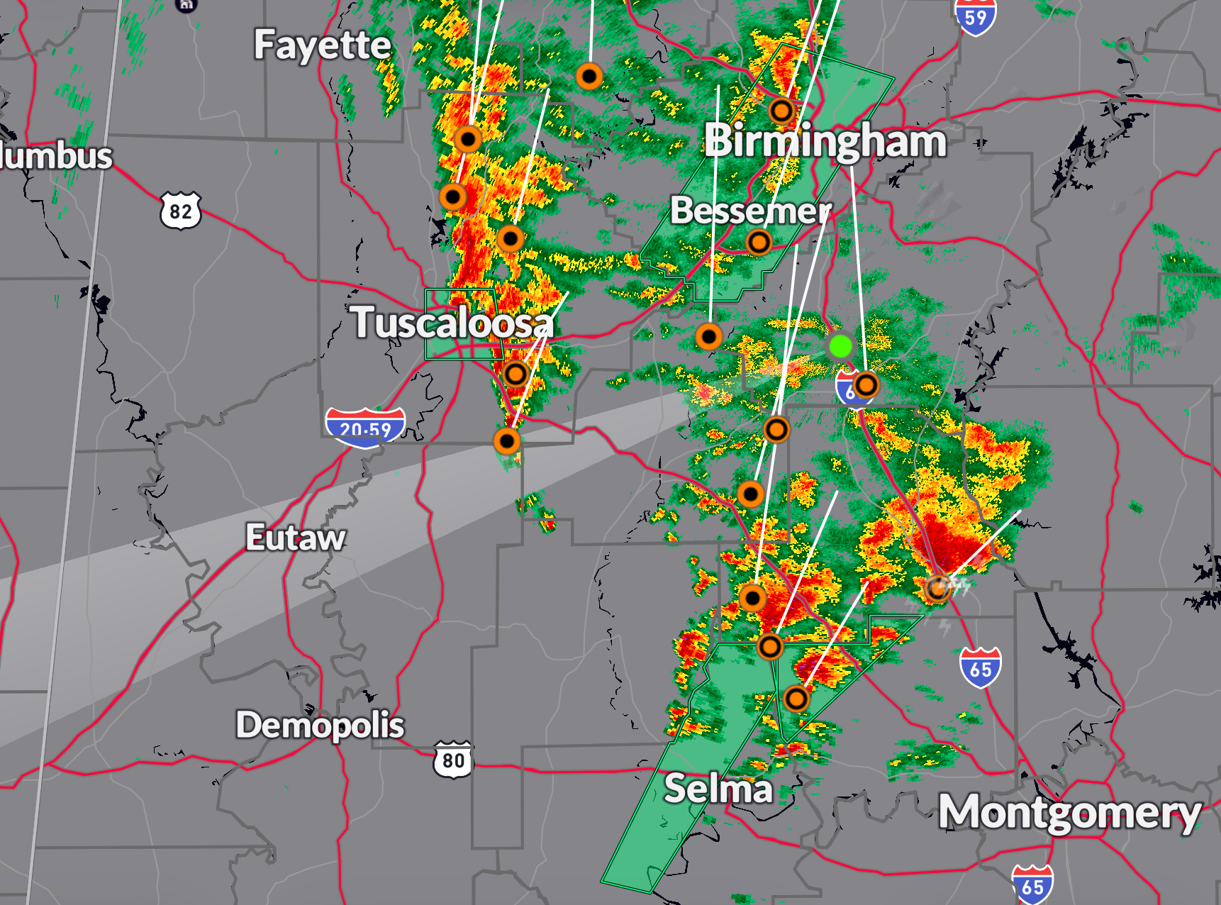
More heavy rain just moved through the Tuscaloosa area and has triggered a flood advisory.
0.85″ fell in the first round at the Tuscaloosa Airport. This round has been east of the Airport, but close to two inches of rain may have fallen on top of the 1.15″ earlier.
A flood advisory was issued for Autauga County including Valley Grande, Selma, and Cahaba.
The first round of rain moving into the Birmingham area has weakened considerably.
Of more concern for the Birmingham area is that the axis of heavy rain seems to have slowed its eastward progress and heavier rain to the south over Chilton and Autauga Counties may train northward and combine with the second band of heavy rain coming in from Tuscaloosa County to present a very heavy rain threat.
Please remain alert through the evening and overnight for the threat of heavy rain and flash flooding. CHeck the blog, the radar, and your warning sources frequently.
Category: Alabama's Weather, ALL POSTS, Severe Weather
About the Author (Author Profile)
Bill Murray is the President of The Weather Factory. He is the site's official weather historian and a weekend forecaster. He also anchors the site's severe weather coverage. Bill Murray is the proud holder of National Weather Association Digital Seal #0001 @wxhistorianSubscribe
If you enjoyed this article, subscribe to receive more just like it.


