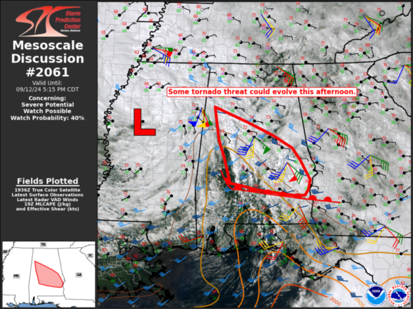
Still Monitoring a Tornado Threat
The Storm Prediction Center (SPC) has issued a mesoscale discussion talking about the severe weather/tornado threat for parts of Central and South Alabama. A good deal of cloud cover has created more of a stable atmosphere north of the warm front we have talked about in several posts. The front is slowly slide northward and there is some destabilization that could occur. There are bands that have formed and that persistent area of storm near Montgomery as well. All of this will need to be monitored to see if low-topped supercells could form. Be weather ready just in case things begin to get active.
Category: Alabama's Weather, ALL POSTS, Severe Weather


