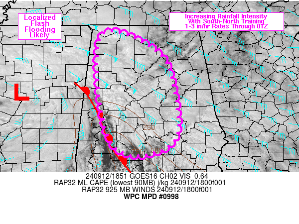
Increased Threat For Flash Flooding Across Portions of Northern and Central Alabama
The Weather Prediction Center has just posted a discussion about the risk of heavy rain and flooding across parts of the state. In our last update, we did a radar check and noted some of the heavy rain that has been forming. A warm front is extending from parts of of western AL to the FL Panhandle. This boundary will lift slowly as the afternoon goes on. With daytime heating, increased CAPE, low level convergence and ample moisture, higher rainfall rate are possible with some of the rain bands setting up. The WPC states 1-2 inches of rain in an hour is a possibility. With some training of the storms there could be someone with 3 inches of rain in an hour. Please be careful this afternoon. Do not drive across flooded roadways. Turn Around Don’t Drown.
Category: Alabama's Weather, ALL POSTS, Severe Weather


