Francine Impacts on Alabama: Tornado Threat along with Heavy Rain and Gusty Winds
Here is a detailed analysis of the weather situation across the state of Alabama.
Current Conditions
The center of Tropical Depression Francine is located not far from Jackson, MS. It has been weakening tremendously and will transition into a post-tropical system later today.
There is a large area of heavier rain to the north and northwest of the center. It is coming down at a pretty good clip over from Clarksdale to Greenville, Grenada and Greenwood. Flash Flood Warning for parts of Central MS due to 1-3 inches of rain that has fallen across that area an another 1-2 inches possible in an hour. The rain shield extends north from central Arkansas through southern TN.
Rain is more sporadic right now across northern and central Alabama with some pockets from near Alexander City to Anniston and the east into a good part of Georgia.
Feeder bands coming in off the Gulf are producing very heavy rain and we have had several tornado warnings across the Florida Panhandle. Reports of a funnel cloud near Carrabelle in Franklin County, FL.
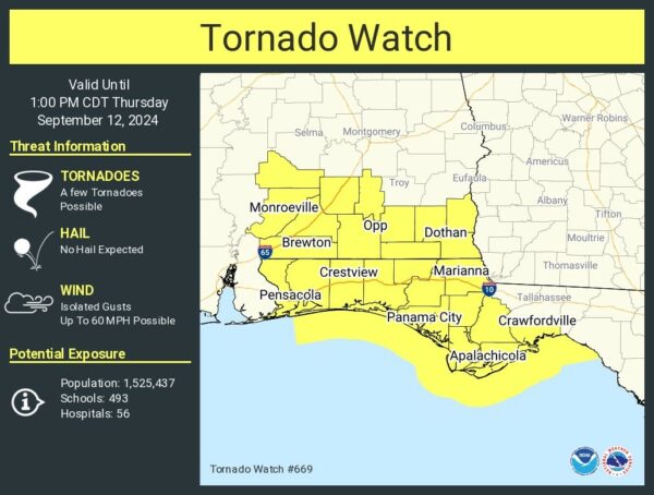
We continue a tornado watch through 1pm CDT for portions of south Alabama and into the Florida Panhandle.
Severe Weather Analysis
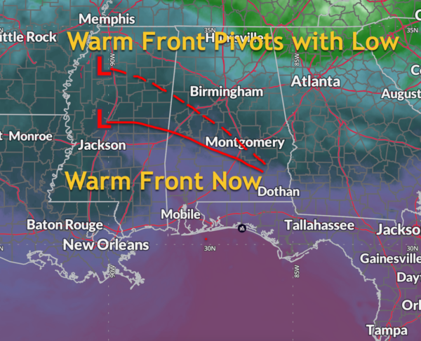
The center of soon to be tropical or post-tropical depression Francine is centered seomwhere between Jackson and Greenwood in Mississippi at mid-morning. A warm front extends east southeasward from the low. Pardon the lack of half circles on my hand drawn warm front. My graphics program will not let me be a meteorological Matissee this morning.
The low will continue moving slowly north, and gradually slowing and stalling near Memphis on Friday, dragging the front and all its high moisture to the south with it.
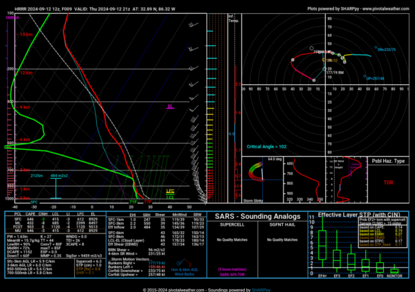
This will set up a zone of high moisture and low level convergence near and south of the warm front. Bands of showers and storms will form due to the convergence. Meanwhile, dry air mixing around the cyclone will help clear out the skies between feeder bands and allow for heating, increasing instability. In fact, sunshine is coming out in many spots across Central Alabama. Long time readers will know that is not good. CAPE values will approach 500-1,500 joules/km2 this afternoon, and locally higher in spots especially over South Central Alabama.
Meanwhile, strong winds in the atmosphere are providing a great deal of shear. Strom relative helicity values will be around 250 m2/s2 in the convergence zone, which is plenty sufficient for those tropical spin up tornadoes to occur. They are usually quick hitting, of short suration, and generally weaker on the scale, but some of them can be strong. We have seen that in our recent hurricane history in Alabama and the South.
Almost certainly, we will see more tornado watches as we go into the afternoon, likely for parts of Central Alabama. Review your tornado plan, and make sure that you have multiple reliable ways to receive warnings this afternoon.
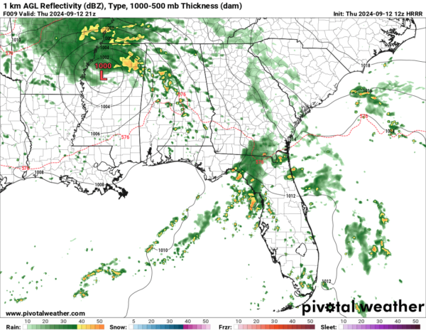
A strong feeder band is rotating northeastward through southwestern and West Central Alabama that could become the main problem later this afternoon. Here is what the radar could look like this afternoon.
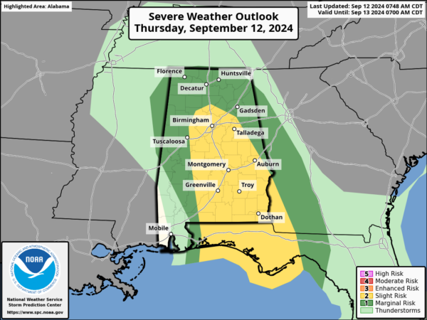
Here is the current SPC Day One:
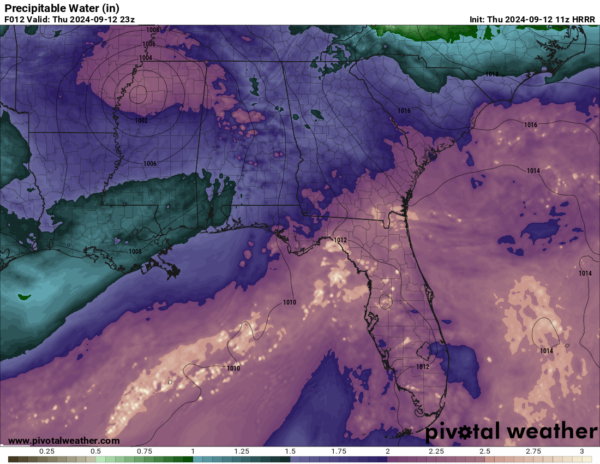
The high moisture air has precipitable values that are extreme for this time of year (2.00-2.25 inches).
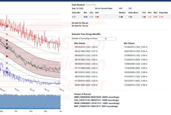
These precipitable water values are near records for this time of year for West Central Alabama:
Areas that see convective bands set up for extended periods of time could see very heavy rainfall amounts. Here is the WPC 24 hour QPF through 7 a.m. CDT tomorrow:
This has prompted the Weather Prediction Center to issue a Moderate Risk for Excessive Rainfall for much of North Central Alabama:
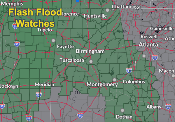
Flash flood watches are in effect for all of North, Central, and Southeast Alabama.
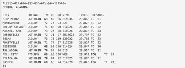
In the mean time, strong gradient winds continue to roar across Central Alabama. This will only continue as heating increases instability in between feeder bands. Winds are gusting to 36 mph this hour at the Shuttlesworth Birmingham International Airport. Here are current observations across Central Alabama:
The severe weather threat won’t go away tomorrow, with the low lurking near Memphis and all this moisture stranded over the area. More sunshine means more heating, and more instability. The shear will certainly be less, but likely sufficient again to power the threat of more spin up tornadoes once again.
Category: Alabama's Weather, ALL POSTS, Severe Weather


