4am Tropics Update: Heavy Rain and Tornado Threat Continues Due to Francine; Monitoring the Atlantic
Good Thursday Morning! Taking a look at Tropical Storm Francine and the continued impacts today especially for Alabama. Brief look at what is happening in the Atlantic.
Here are the 4am Stats and Advisories:
LOCATION…30.9N 90.1W
ABOUT 60 MI…100 KM N OF NEW ORLEANS LOUISIANA
MAXIMUM SUSTAINED WINDS…45 MPH…75 KM/H
PRESENT MOVEMENT…NE OR 40 DEGREES AT 12 MPH…19 KM/H
MINIMUM CENTRAL PRESSURE…992 MB…29.30 INCHES
A Storm Surge Warning is in effect for…
* Grand Isle, Louisiana to the Mississippi/Alabama Border
* Lake Maurepas
* Lake Pontchartrain
A Tropical Storm Warning is in effect for…
* Grand Isle, Louisiana to the Alabama/Florida border
* Lake Maurepas and Lake Pontchartrain, including metropolitan New
Orleans
A weakening Francine continues to move steadily northeast. A turn to the NNE and then N is anticipated over the next day and the system is expected to slow down. The center should be in the northern parts of Mississippi Friday. Francine will weaken today and become post-tropical.
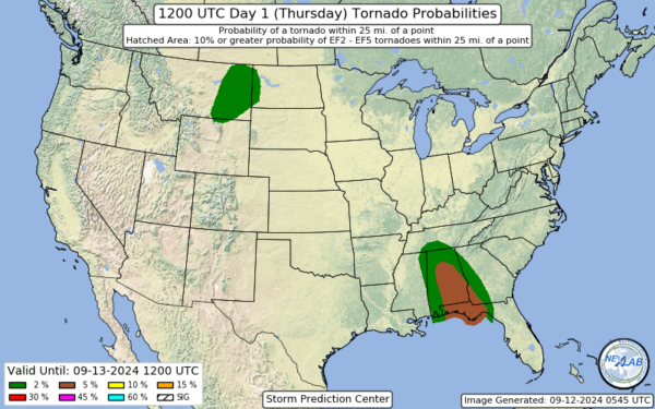
There continues to be the threat for some tropical storm wind gusts in the warning area at least for a few hours this morning. Heavy rain and the risk of isolated flooding across portion of the south today and there is a continued chance for tornadoes.
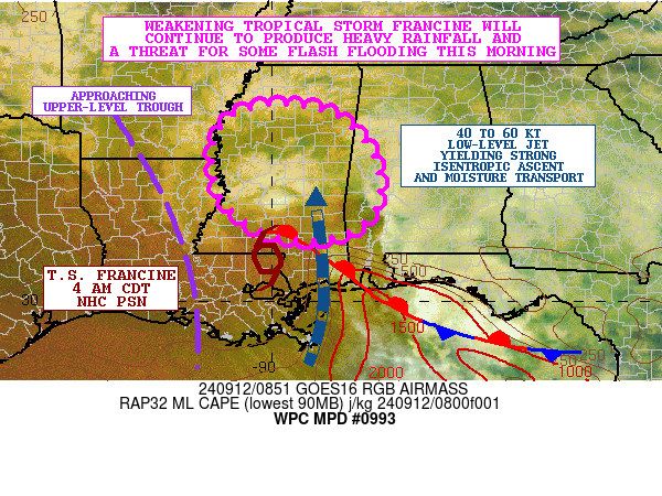
The Weather Prediction Center has posted a discussion highlighting the risk of flash flooding through the morning and the focus is on Mississippi and Western Alabama. Francine is interacting with a frontal zone and upper level trough and near that interaction is where some of the heaviest rain has formed this early morning. The 00Z HREF guidance suggests additional rainfall amounts going
through 15Z (10AM CDT) of 2 to 4 inches, with isolated heavier amounts. Flood watches are up for most of Alabama today.
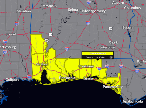
A tornado watch continues for portions of SW Alabama and the Florida Panhandle until 6am CT. This is a threat we will be monitoring throughout the day. Please be weather aware and heed any warnings that are issued.
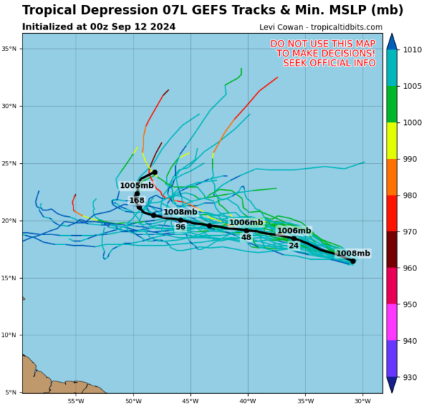
Tropical Depression #7 is expected to become a tropical storm today and the name would be Gordon.
LOCATION…17.3N 33.0W
ABOUT 600 MI…970 KM W OF THE CABO VERDE ISLANDS
MAXIMUM SUSTAINED WINDS…35 MPH…55 KM/H
PRESENT MOVEMENT…WNW OR 290 DEGREES AT 17 MPH…28 KM/H
MINIMUM CENTRAL PRESSURE…1007 MB…29.74 INCHES
The models at this point pretty much show this storm slowly moving west and then eventually curving. Just something to watch at this point.


