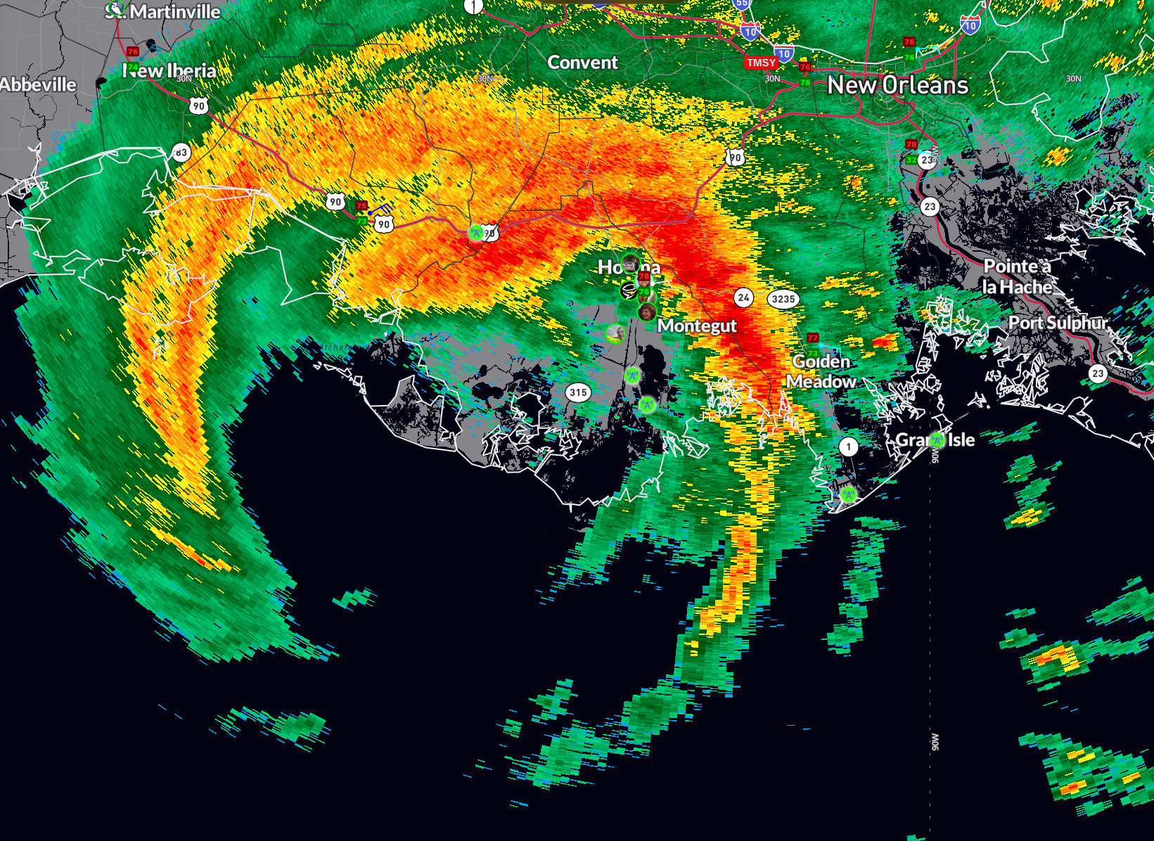
Francine Makes Landfall in Southern Terrebonne Parish as 100 mph Hurricane
WTNT61 KNHC 112157
TCUAT1
Hurricane Francine Tropical Cyclone Update
NWS National Hurricane Center Miami FL AL062024
500 PM CDT Wed Sep 11 2024
…FRANCINE MAKES LANDFALL IN SOUTHERN LOUISIANA…
…500 PM CDT POSITION UPDATE…
Francine has made landfall in southern Louisiana in the Parish of
Terrebonne, about 30 miles south-southwest of Morgan City, as a
Category 2 hurricane. Maximum sustained winds are estimated to be
near 100 mph (155 km/h).
A NOS station located on Eugene Island recently reported a peak gust
of 105 mph (169 km/h). The minimum pressure measured at that
location was 976 mb (28.82 inches).
Heavy rains and hurricane-force winds are spreading inland across
southern Louisiana. Now is the time to stay inside and away from
windows. Have multiple ways to receive warnings and updates.
Another position update will be provided at 600 PM CDT (2300 UTC).
SUMMARY OF 500 PM CDT…2200 UTC…INFORMATION
———————————————–
LOCATION…29.3N 91.3W
ABOUT 30 MI…45 KM SSW OF MORGAN CITY LOUISIANA
ABOUT 85 MI…140 KM WSW OF NEW ORLEANS LOUISIANA
MAXIMUM SUSTAINED WINDS…100 MPH…155 KM/H
PRESENT MOVEMENT…NE OR 45 DEGREES AT 17 MPH…28 KM/H
MINIMUM CENTRAL PRESSURE…972 MB…28.71 INCHES
$$
Forecaster Cangialosi/Bucci
About the Author (Author Profile)
Bill Murray is the President of The Weather Factory. He is the site's official weather historian and a weekend forecaster. He also anchors the site's severe weather coverage. Bill Murray is the proud holder of National Weather Association Digital Seal #0001 @wxhistorianSubscribe
If you enjoyed this article, subscribe to receive more just like it.


