
2pm Update: Worsening Conditions Reported; Eye of Francine Visible on Satellite
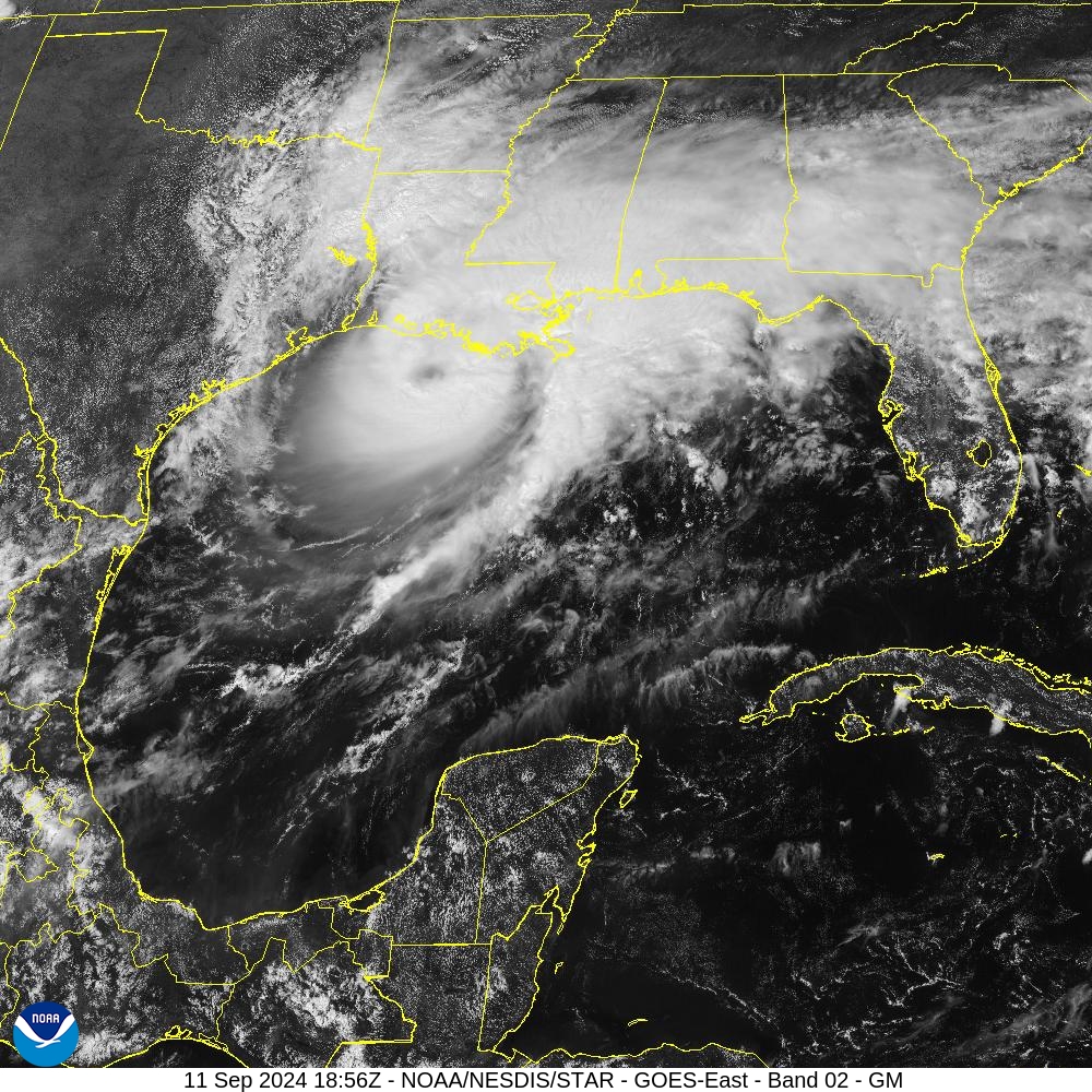
Hurricane Francine is starting to speed up as it heads toward the Louisiana coast, now centered about 80 miles SSW of Morgan City, LA. And you can see that center on the satellite imagery above!
Tropical storm force winds and very heavy rain is increasing big time across southern Louisiana and Mississippi. Hurricane force winds are just off shore. Folks need to be hunkered down as conditions will continue to worsen over the next 12 hours.
An oil platform southeast of the center recently reported sustained winds of 92 mph and a peak gust of 112 mph at an elevation of 102 ft. A NOS station located on Eugene Island recently reported reported sustained winds of 48 mph and a peak gust of 53 mph.
A couple of reports from X:
Gusts over 60mph have been observed (by measurement) southwest of Theriot, LA and weather continues to deteriorate further. #lawx #francine #HurricaneFrancine #hurricane pic.twitter.com/ijx7s17xIZ
— Brian Emfinger (@brianemfinger) September 11, 2024
Storm surge coming in, in Dulac, LA @accuweather #LAwx pic.twitter.com/4jsgfvTsIm
— Aaron Rigsby (@AaronRigsbyOSC) September 11, 2024
About the Author (Author Profile)
Owner of Tornado Talk. Radio broadcast meteorologist with The Storm Report. WeatherBrains Panelist. B.S. Meteorology from Penn State University.Subscribe
If you enjoyed this article, subscribe to receive more just like it.


