
1pm Update: Latest Stats and Radar Update
The NHC has produced their 1pm CDT update. Tropical storm conditions are now being seen along the Louisiana Coast.
LOCATION…28.6N 92.1W
ABOUT 95 MI…155 KM SW OF MORGAN CITY LOUISIANA
ABOUT 155 MI…250 KM SW OF NEW ORLEANS LOUISIANA
MAXIMUM SUSTAINED WINDS…90 MPH…150 KM/H
PRESENT MOVEMENT…NE OR 40 DEGREES AT 16 MPH…26 KM/H
MINIMUM CENTRAL PRESSURE…976 MB…28.82 INCHES
One of the biggest changes is the forward speed. Francine is now zipping to the northeast at 16 mph. Wind and pressure have not changed.
One advisory change: The Tropical Storm Warning has been discontinued for the southwestern coast of Louisiana west of Cameron.
Still looking at the center pushing into the LA coastline by evening time.
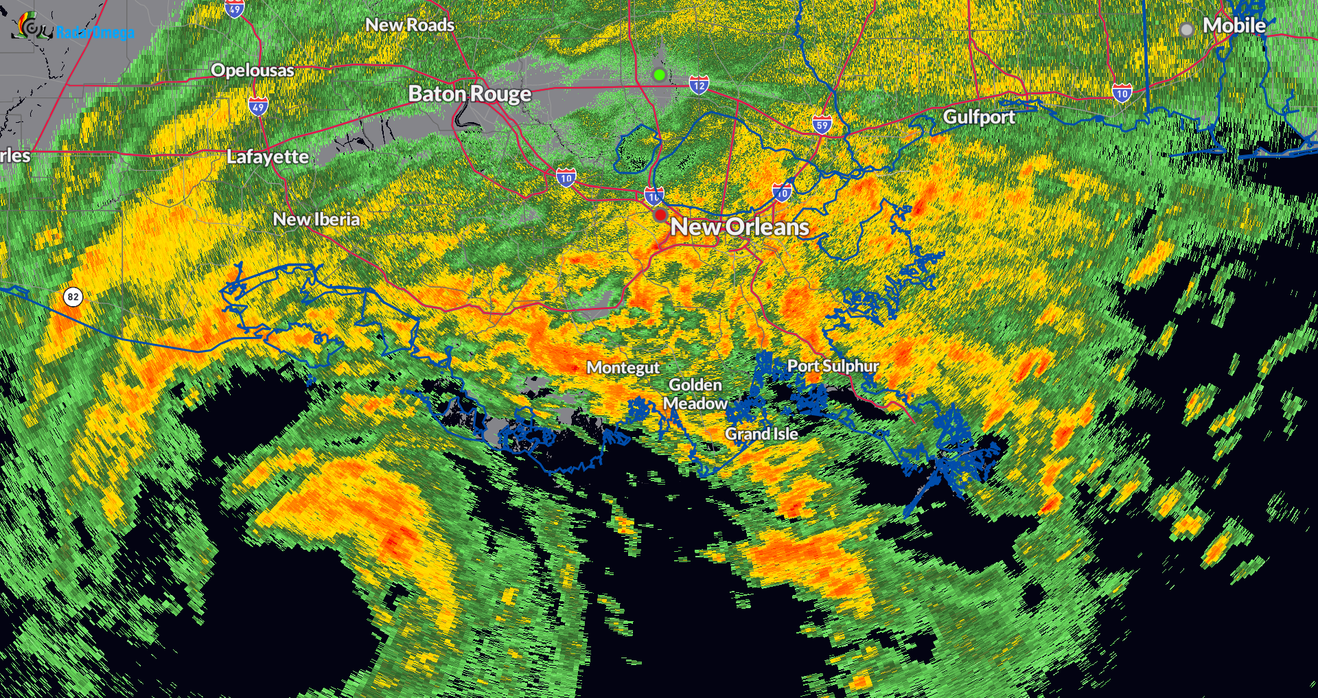
Here is a snapshot of the radar of the hefty rain bands pushing into southern Louisiana. Some of the rainfall rates this afternoon and evening could be anywhere from 1-3″ per hour. A tornado watch is in effect until 11pm CDT.
About the Author (Author Profile)
Owner of Tornado Talk. Radio broadcast meteorologist with The Storm Report. WeatherBrains Panelist. B.S. Meteorology from Penn State University.Subscribe
If you enjoyed this article, subscribe to receive more just like it.


