First Hourly Tropical Cyclone Update of the Day from NHC
The Hurricane Center is now issuing hourly updates on Hurricane Francine since it is solidly in the view of coastal radars. Here is the Lake Charles radar.
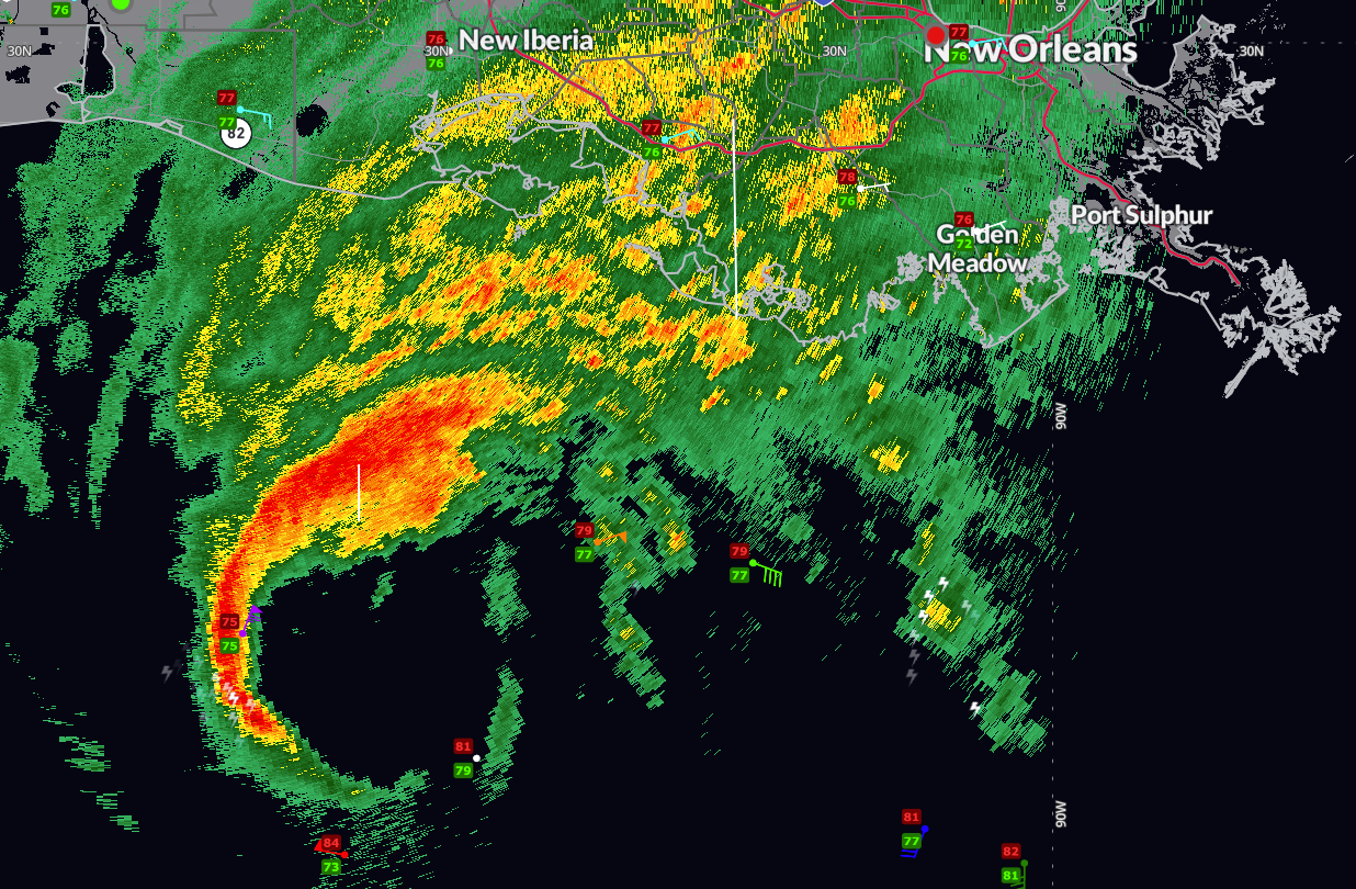
The center of the large eye is now 125 miles south southwest of Patterson, LA.
Hurricane Francine Tropical Cyclone Update
NWS National Hurricane Center Miami FL AL062024
1100 AM CDT Wed Sep 11 2024
…LIFE-THREATENING STORM SURGE AND HURRICANE-FORCE WINDS EXPECTED
TO BEGIN IN LOUISIANA THIS AFTERNOON…
…1100 AM CDT POSITION UPDATE…
Outer rainbands are starting to move onshore of the coast of
southern Louisiana. These conditions will continue to deteriorate
over the next couple of hours. Ensure you are in a safe location
before the onset of strong winds or possible flooding.
An oil platform north of the center recently reported sustained
winds of 85 mph (137 km/h) and a gust of 101 mph (163 km/h)
at an elevation of 98 ft (30 m).
Another position update will be provided at 1200 PM CDT (1700 UTC).
SUMMARY OF 1100 AM CDT…1600 UTC…INFORMATION
———————————————–
LOCATION…28.1N 92.6W
ABOUT 140 MI…225 KM SW OF MORGAN CITY LOUISIANA
ABOUT 205 MI…330 KM SW OF NEW ORLEANS LOUISIANA
MAXIMUM SUSTAINED WINDS…90 MPH…150 KM/H
PRESENT MOVEMENT…NE OR 40 DEGREES AT 13 MPH…20 KM/H
MINIMUM CENTRAL PRESSURE…976 MB…28.82 INCHES
$$
Forecaster Kelly
Category: Alabama's Weather, ALL POSTS, Severe Weather
About the Author (Author Profile)
Bill Murray is the President of The Weather Factory. He is the site's official weather historian and a weekend forecaster. He also anchors the site's severe weather coverage. Bill Murray is the proud holder of National Weather Association Digital Seal #0001 @wxhistorianSubscribe
If you enjoyed this article, subscribe to receive more just like it.


