A Late Night Look at a Strengthening Francine
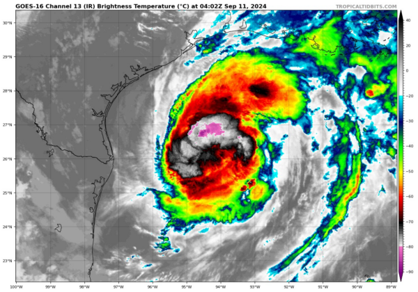
The satellite presentation of Hurricane Francine has improved dramatically late this evening. Strong convection has wrapped nearly halfway around the larger circulation.
The Air Force Hurricane Hunters are about 120 miles north of the center now heading south toward a center penetration.
This crew and the NOAA crew that was in the hurricane earlier have done a wonderful service by proving that the hurricane has intensified and that its wind field has become much larger and more organized.
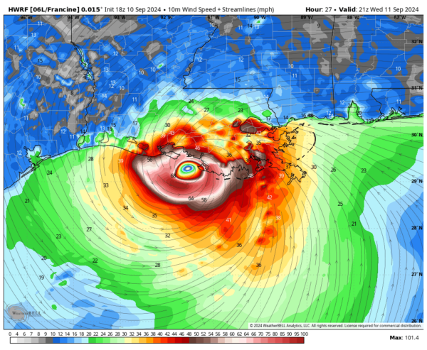
There is a good chance that Francine could become a category two hurricane with top winds of 100 mph or higher before landfall late tomorrow afternoon. The official forecast is for 90-92 mph at landfall. A new forecast package will be issued just before 4 p.m. CDT.
That is the HWRF model showing a 100 mph hurricane just before landfall tomorrow.
Jen Narramore will have that package for you then. Good night.


