4pm Tropical Update: Hurricane Watch for New Orleans, Tropical Storm Warning Now for the Alabama Coast
Some changes with the latest advisory from the NHC.
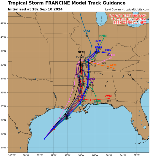
The latest computer models have continued to show a bit more of an easterly push with the track. Here is the latest 18Z track guidance.
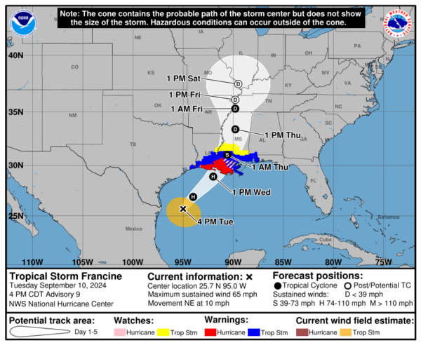
The NHC discusses this in their latest update and they have moved the forecast track a touch further east but still left of the various consensus models. The center Francine is still forecast at this point to cross the Louisiana Coast late Wednesday in St. Mary’s Parish but these little nudges will continue to be monitored as the have a big impact on who could see the worst surge.
Here is the update on the advisories:
A Hurricane Watch is now in effect for Lake Maurepas, Lake Pontchartrain, and metropolitan New Orleans.
A Tropical Storm Warning is now in effect for the Alabama coast from the Mississippi/Alabama border to the Alabama/Florida border.
The Hurricane Warning for the southwestern coast of Louisiana from Sabine Pass to Cameron has been changed to a Tropical Storm Warning.
The Storm Surge Warning has been discontinued for the Texas coast west of Sabine Pass.
All warnings and watches have been discontinued for the Texas coast from High Island southward.
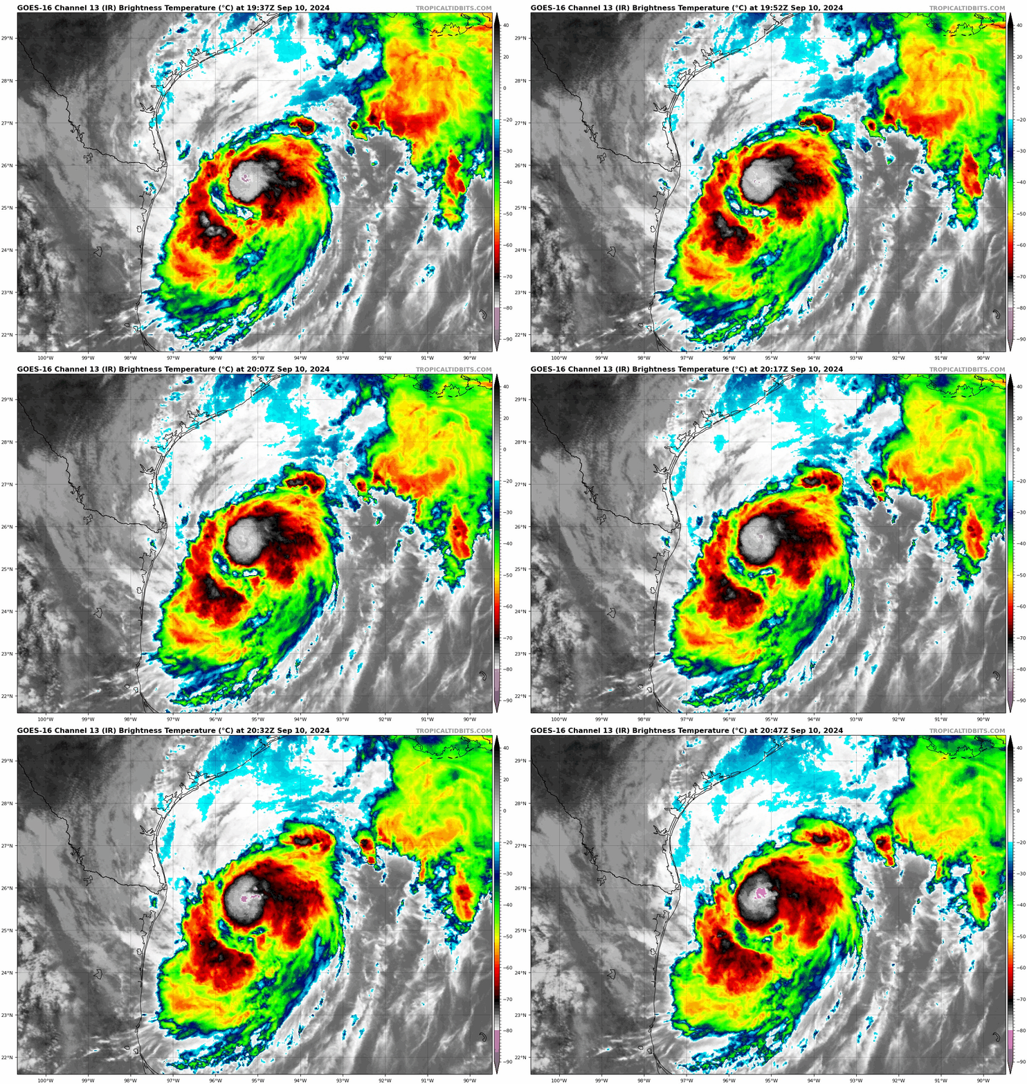
Francine will be running out of room to strengthen. It will remain over the warm Gulf waters for another 24 hours. There continues to be strong shear forecast to interact with the storm as it nears the LA Coast. Before the shear, Francine is forecast to strengthen to a hurricane. That could happen really at any point. At times, Francine has really looked like it was coming around with heavier bursts of convection. Those bands are not persistent but they are trying. The hurricane hunters did find a pressure down to 987 mb but flight level winds were 63 knots (700 mb). Intensity was level alone for now.
#Francine is trying to intensify as forecast this evening, with a big area of convective bursts wrapping around the center. The new eye it’s trying to form is quite small (10 miles or less) and the dry tongue is still present, so we’ll see how long this core can avoid disruption. pic.twitter.com/xb9DiEeJj5
— Andy Hazelton (@AndyHazelton) September 10, 2024
Main impacts:
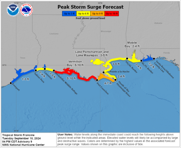
Storm Surge: Highest surge still projected for the LA coast. 2-4 foot surge for the Alabama Coast.
Flooding: A front is laid out across the Gulf coast and has been interacting with tons of moisture. Already seeing heavy rain for places like New Orleans. With Francine approaching, more and more rain will encroach upon the Gulf Coast. 4-8 inches of rain, locally over a foot in a short amount of time will be a dangerous scenario with a heightened risk of flash flooding.
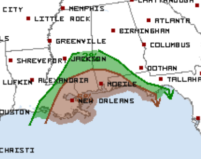
Tornado: As with most landfalling systems, there is a risk of isolated tornadoes. Here is the Day 2 tornado threat:


