10am Francine Update: Pressure Has Dropped Again; New Watches for the Alabama Coast
The NHC has produced their more comprehensive 10am tropical update. We will be monitoring closely all of these updates through landfall and beyond for impacts for our friends along the Gulf Coast and then of course for what may happen for the state of Alabama. Thank you for following our updates!
First of all, I love watching the hurricane hunters and their posts on X. Appreciate all they do to get the much updated information on Francine!
Lightning over the gulf last night on the way home from Francine pic.twitter.com/MU7ffBsQJa
— Tropical Cowboy of Danger (@FlynonymousWX) September 10, 2024
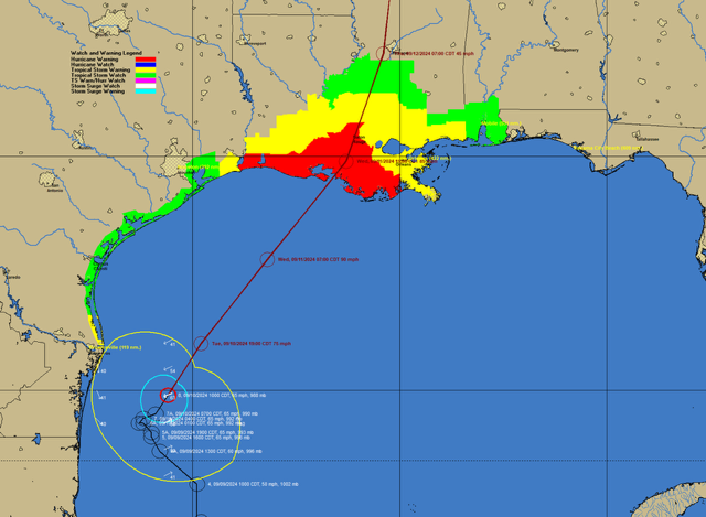
10am Stats
LOCATION…24.9N 95.6W
ABOUT 120 MI…195 KM SE OF MOUTH OF THE RIO GRANDE
ABOUT 425 MI…690 KM SW OF MORGAN CITY LOUISIANA
MAXIMUM SUSTAINED WINDS…65 MPH…100 KM/H
PRESENT MOVEMENT…NNE OR 20 DEGREES AT 8 MPH…13 KM/H
MINIMUM CENTRAL PRESSURE…988 MB…29.18 INCHES
NEW WATCHES/WARNINGS: Alabama Coast Included
We now have a storm surge watch and tropical storm watch along the Alabama coast!
In addition, a storm surge warning and tropical storm warning is now in effect from the Mouth of the Mississippi River, Louisiana, eastward to the Mississippi/Alabama Border, including Lake Maurepas and Lake Pontchartrain. A Tropical Storm Warning has been issued for the Mississippi coast east of the mouth of the Pearl River to the Mississippi/Alabama border.
From the NHC Discussion:
The hurricane hunters have found a pressure down to 988 mb but no increase in wind speed. There has been a blow up of convection around the center of Francine seen over the past few hours.
As Bill alluded to in his notes, there has been an eastward trend with the model guidance and the NHC has reflected that in their new forecast track. Because of that eastern shift, the new watches were produced further east to include the Alabama coast.
Strengthening is still forecast as Francine churns through the warm Gulf waters but is running out of time to strengthen too much. Still, a hurricane is forecast. Strong shear is expected to bring any strengthening to an abrupt halt near the Louisiana coast. The forecast is now for a Cat 1 hurricane at landfall.
Regardless of wind intensity at landfall, the impacts will be the same: Dangerous storm surge, tremendous flooding (coastal and flash flooding), isolated tornado threat and tropical storm to hurricane wind gusts.
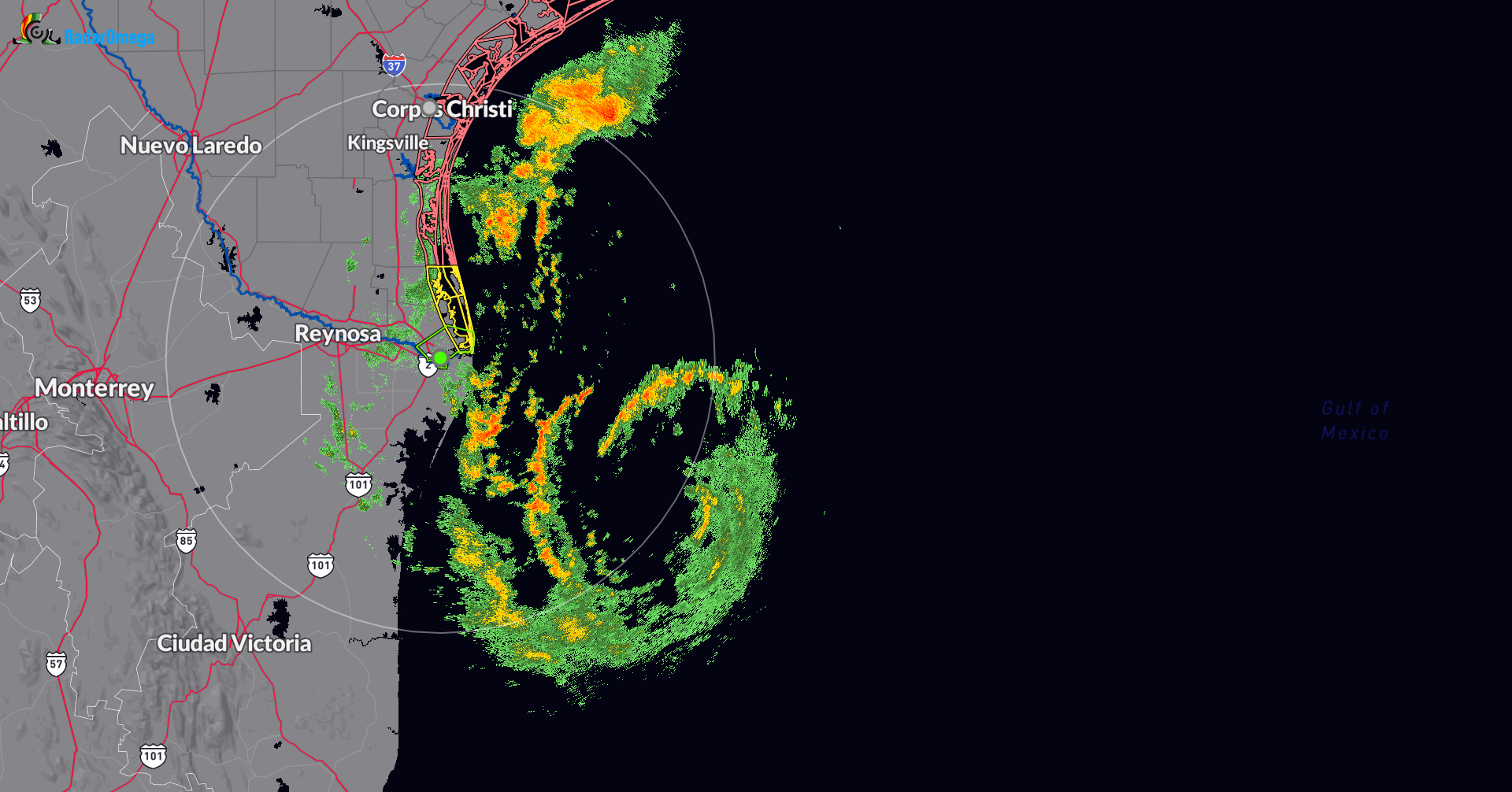
Latest radar snapshot out of Brownsville showing the rainbands associated with Francine.
Category: ALL POSTS
About the Author (Author Profile)
Owner of Tornado Talk. Radio broadcast meteorologist with The Storm Report. WeatherBrains Panelist. B.S. Meteorology from Penn State University.Subscribe
If you enjoyed this article, subscribe to receive more just like it.


