Midday Nowcast: We Now Have Francine, Impacts for Alabama Later this Week
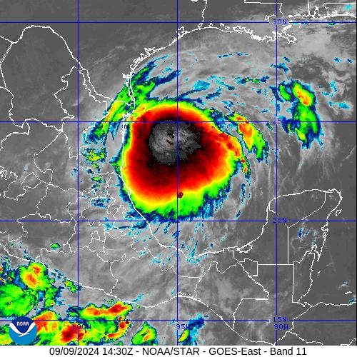
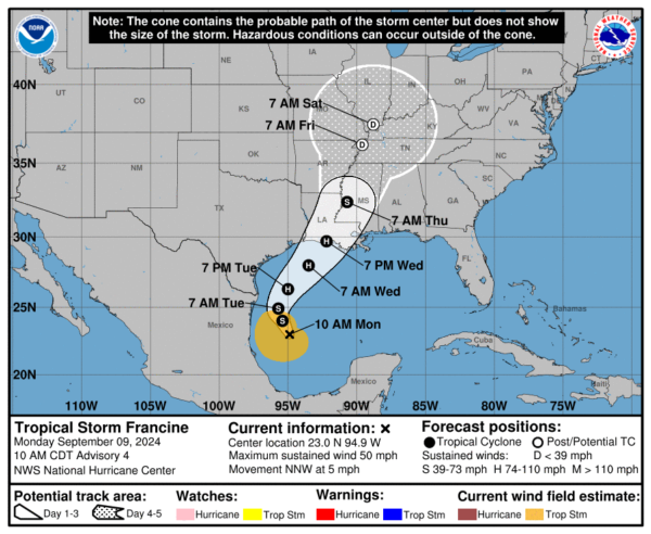
ALL EYES ON THE GULF: We now have Tropical Storm Francine in the southwestern Gulf, and it will bring some impacts to Alabama later this week. Latest update from the NHC: the center of Tropical Storm Francine was located near latitude 23.0 North, longitude 94.9 West. Francine is moving toward the north-northwest near 5 mph and a slow north-northwestward motion is expected for the remainder of the day, followed by a faster motion to the northeast beginning on Tuesday.
On the forecast track, Francine is expected to be just offshore of the northern Gulf Coast of Mexico through Tuesday, and approach the Louisiana and Upper Texas coastline on Wednesday. Maximum sustained winds remain near 50 mph with higher gusts. Gradual intensification is expected over the next day with more significant intensification on Tuesday Night and Wednesday. Francine is expected to become a hurricane before it reaches the northwestern U.S. Gulf Coast on Wednesday. Tropical-storm-force winds extend outward up to 160 miles from the center. The estimated minimum central pressure is 1002 mb (29.59 inches).
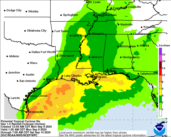
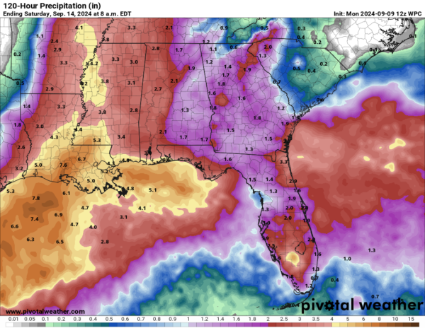
RAINFALL: Francine is expected to bring storm total rainfall of 4 to 8 inches, with local amounts to 12 inches, from the coast of far northeast Mexico northward along portions of the southern Texas coast, the far upper Texas coast and across southern Louisiana and southern Mississippi into Thursday morning. This rainfall could lead to the risk of considerable flash and urban flooding. ??Along the central Texas coast, rainfall totals of 1 to 3 inches are expected from Tuesday into early Wednesday. Across the Mid-South, rainfall totals of 2 to 4 inches, with local amounts of 6 inches, are expected from Wednesday into Friday morning. This rainfall could lead to the risk of flash and urban flooding.
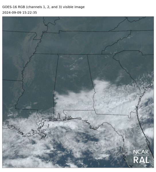
THROUGH TOMORROW: It is wam day across Alabama with a mainly sunny sky for the northern half of the state, with clouds to the south. No change tomorrow; a generally sunny day for most of Alabama with a high around 90 degrees; showers remain confined to the far southern counties of the state.
BIRMINGHAM ALMANAC: For September 9th, the average high for Birmingham is 88° and the average low is 67°. The record high is 103° set in 1925, while the record low is 55° set in 1981. We average 0.14” of precipitation on this date, and the record value is 1.85” set in 1959.
FRANCINE APPROACHES: Clouds begin to increase ahead of Francine approaching form the south, and widespread, soaking rain is likely Wednesday night and Thursday. Rain amounts of 2-4 inches are possible over the western half of the state, with 1-2 inches for the eastern counties.
A low end risk of a few isolated, brief tornadoes could develop on Thursday as the tropical low moves northward up the Mississippi River, but the air will be fairly stable. The lack of instability could mitigate any tornado threat, but we will still be watching radar very carefully. A slot of dry air will begin to work into the state Friday, and the main risk of showers will be over the eastern half of the state.
THE ALABAMA WEEKEND: The remnant tropical low will meander around the region, and we will need to mention a chance of showers or storms both Saturday and Sunday. This won’t be a wash-out, but some rain is certainly possible at times. Highs will be in the low to mid 80s.
NEXT WEEK: The risk of showers will persist for at least the first half of the week with highs holding in the 80s.
ELSEWHERE IN THE TROPICS: 1. Central Tropical Atlantic (AL92): An area of low pressure is producing disorganized showers and thunderstorms over the central tropical Atlantic. Environmental conditions are marginally conducive for development during the next few days, and a tropical depression could form while the system meanders over the central tropical Atlantic. By the middle part of the week, the system is forecast to move westward-northwestward at around 10 mph. Formation chance through 7 days…medium…60 percent.
2. Eastern and Central Tropical Atlantic, a trough of low pressure located several hundred miles west-southwest of the Cabo Verde Islands is producing a broad area of disorganized showers and thunderstorms. In a couple of days, this trough is expected to interact with an approaching tropical wave. Afterward, Environmental conditions appear favorable for gradual development of this system, and a tropical depression could form during the middle to latter part of this week while the system moves west-northwestward at 10 to 15 mph. Formation chance through 7 days…medium…60 percent.
Next names up are Gordon and Helen.
WORLD TEMPERATURE EXTREMES: Over the last 24 hours, the highest observation outside the U.S. was 118.8F at Nasiriya, Iraq. The lowest observation was -104.8F at Concordia, Antarctica.
CONTIGUOUS TEMPERATURE EXTREMES: Over the last 24 hours, the highest observation was 117F at Tecopa, CA. The lowest observation was 20F at Davis, WV.
Category: Alabama's Weather, ALL POSTS, Tropical

