Potential Tropical Cyclone 6 Designated…Expected to Become a Hurricane
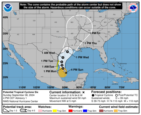
The NHC has initiated advisories on Potential Tropical Cyclone Six in the southwestern Gulf of Mexico.
SUMMARY OF 400 PM CDT…2100 UTC…INFORMATION
———————————————-
LOCATION…21.6N 94.6W
ABOUT 340 MI…545 KM SSE OF MOUTH OF THE RIO GRANDE
ABOUT 575 MI…925 KM S OF PORT ARTHUR TEXAS
MAXIMUM SUSTAINED WINDS…50 MPH…85 KM/H
PRESENT MOVEMENT…NW OR 320 DEGREES AT 5 MPH…7 KM/H
MINIMUM CENTRAL PRESSURE…1003 MB…29.62 INCHES
The system remains disorganized, but the Hurricane Hunters did find winds of 35-45 knots on the western side of the elongated trough.
It should become organized by tomorrow afternoon and it will become a tropical storm at that time. It will be named Francine.
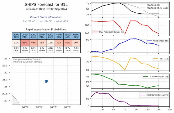
The intensification models are predicting pretty high probabilities of it becoming a hurricane. The NHC says on Wednesday. It could be sooner.
The 41% chance of a 55 knots increase in 48 hours is concerning. That is nearly 10x climatology and would make it a 115 mph hurricane by Tuesday afternoon.
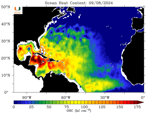
Oceanic heat content will be very high over the forecast track…
The limiting factor will be shear, which is low now, but will increase to about 15 knots on Tuesday, and then increase substantial Wednesday over the northern Gulf as it approaches landfall.
Landfall should occur Wednesday evening along the Southwest or Central Louisiana coast.
The GFS and Euro are the easternmost outliers right now. The GFS is stronger, calling for around 110 knots or 115 mph at landfall. The Euro is closer to 80 mph. Their timing is similar.
No watches or warnings for the US coastline yet, but the NHC warns that hurricane and storm surge watches will be required on Monday for portions of the Texas and Louisiana coasts.


