
Some Clouds Hanging Around; Can’t Beat The Temperatures Heading to Midday
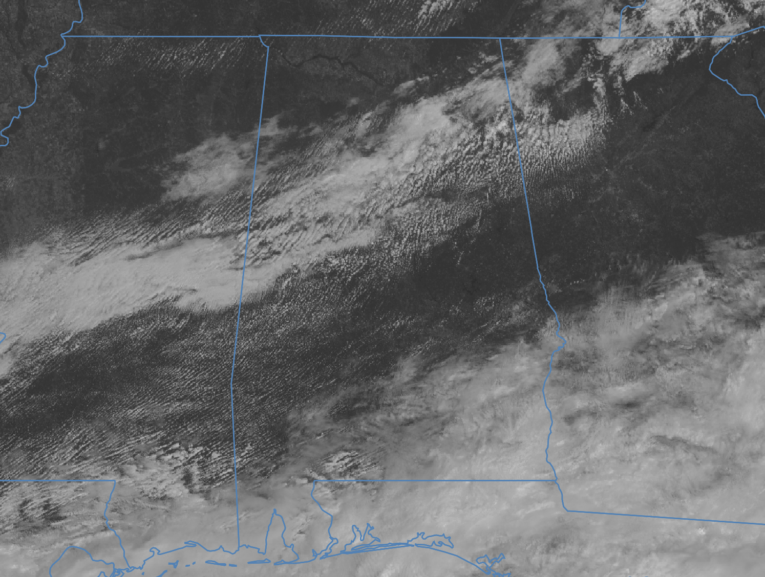
We have a band of broken clouds covering pretty much the I-59 corridor from northeast to southwest across the central parts of the state, with a lot more sun visible north and south of that, until you reach the southern 3rd of Alabama. Temperatures across the area were in the 70s across Central Alabama, ranging from as warm as 79 at the Shelby County Airport, to as cool as 71 in Haleyville. For now, there are no visible showers on the radar; however, we can’t rule out a few stray showers across the area, with a few scattered showers and storms possible down over the extreme southern portions of the area. Afternoon highs will be in the upper 70s to the mid 80s. Definitely a great day to watch race cars at Barber Motorsports Park (where I’m at), or at the stadiums pulling for your favorite college football team.
We’ll be dry with diminishing clouds tonight, and any lingering showers will be done just after sunset. Get ready to sleep without the AC tonight, and maybe have a few windows open, as lows will make it down into the lower 50s to the mid 60s from north to south.
Sunday looks to be a magnificent day with highs in the 80s. Most locations will be dry with mostly sunny skies. A few isolated to scattered showers and storms will be possible over the extreme southeastern parts of the area, but chances will be small.
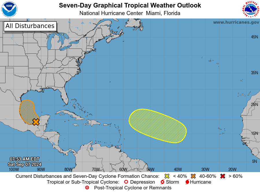
1. Southwestern Gulf of Mexico:
A tropical wave over the Bay of Campeche is producing disorganized showers and thunderstorms. An area of low pressure is forecast to develop while the wave interacts with a frontal boundary during the next couple of days. Environmental conditions are forecast to be conducive for development, and a tropical depression could form during the early or middle part of next week while the system moves slowly northwestward to northward over the southwestern Gulf of Mexico.
* Formation chance through 48 hours…medium…40 percent.
* Formation chance through 7 days…medium…60 percent.
2. Eastern and Central Tropical Atlantic:
An elongated trough of low pressure over the eastern and central tropical Atlantic is producing a broad area of shower and thunderstorm activity. A more well-defined area of low pressure may form within this region during the next few days. Some slow development of this system is possible while the disturbance meanders through the early part of next week, then begins to move west-northwestward across the central tropical Atlantic during the middle to latter part of next week.
* Formation chance through 48 hours…low…near 0 percent.
* Formation chance through 7 days…low…30 percent.
Category: Alabama's Weather, ALL POSTS, Tropical
About the Author (Author Profile)
Scott Martin is an operational meteorologist, professional graphic artist, musician, husband, and father. Not only is Scott a member of the National Weather Association, but he is also the Central Alabama Chapter of the NWA president. Scott is also the co-founder of Racecast Weather, which provides forecasts for many racing series across the USA. He also supplies forecasts for the BassMaster Elite Series events including the BassMaster Classic.Subscribe
If you enjoyed this article, subscribe to receive more just like it.


