
Increasing Rain/Isolated Flood Threat For the Alabama Coast
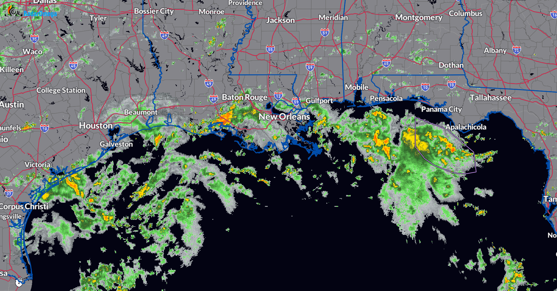
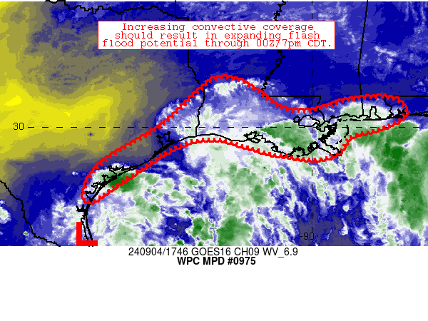
The Weather Prediction Center has posted a Mesoscale Precipitation Discussion about the increase in convection heading toward the Gulf Coast. Slow-moving storms are light up from near Port Lavaca, TX to New Orleans and just offshore the Alabama and Western Florida Panhandle coastlines. Some portions of southern LA have received 2-3 inches of rain in just an hour. Through the rest of today and into this evening, these convective bands will slowly drift northward and the risk of those heavy rainfall rates will continue to be in place. Heads up to the Alabama coast. Currently, there is not a flood watch in effect for the coast but this is definitely something to monitor through the rest of the day. In addition, a high rip current risk up through Thursday morning for the AL Coast. Surf height is from 3-5 feet.
Below is a radar snapshot as of 111pm CDT.
Category: Alabama's Weather, ALL POSTS, Severe Weather
About the Author (Author Profile)
Owner of Tornado Talk. Radio broadcast meteorologist with The Storm Report. WeatherBrains Panelist. B.S. Meteorology from Penn State University.Subscribe
If you enjoyed this article, subscribe to receive more just like it.


