Midday Nowcast: Temperatures Trending Cooler
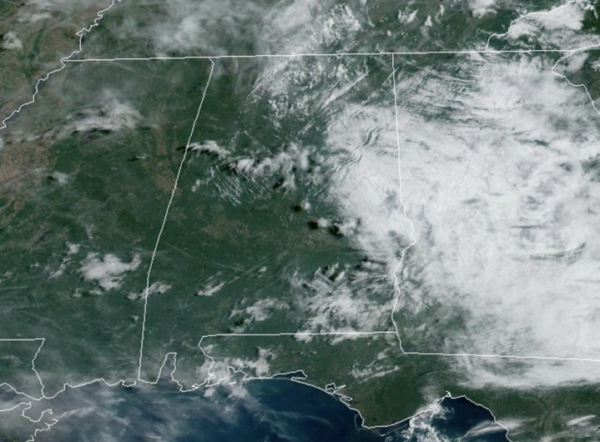
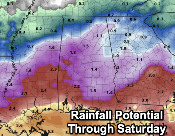
FIRST WEEK OF SEPTEMBER: It is a cooler day across Alabama as afternoon temperatures are in the upper 80s to lower 90s. Moisture levels rise today, and we will bring in the chance of scattered showers and thunderstorms, mostly during the afternoon and evening hours. A few showers or storms are possible tomorrow, with high in the mid 80s, but rain coverage should be much higher Thursday and Friday. Periods of rain are likely on both days with temperatures only in the mid 70s over the northern half of the state. Rain amounts tomorrow through Friday will be in the 1-2 inch range for much of Alabama, with potential for 2-4 inches closer to the Gulf Coast, where a trough of low pressure will set up.
BIRMINGHAM ALMANAC: For September 3rd, the average high for Birmingham is 89° and the average low is 69°. The record high is 102° set in 1925, while the record low is 52° set in 1952. We average 0.14” of precipitation on this date, and the record value is 3.29” set in 2001.
ACROSS THE USA: Thunderstorms will continue to produce locally heavy rainfall that may lead to some scattered flash flooding in central Texas and a part of the Texas Gulf Coast today where a Slight Risk of Excessive Rainfall is in effect. Excessive heat is forecast to impact the Southwest U.S. and parts of California Wednesday to Friday. Excessive Heat Watches and Warnings and Heat Advisories have been issue.
WEEKEND WEATHER: A much drier airmass will push into the state with a front on Saturday, setting the state for a very pleasant second half to the weekend across the Deep South. Mostly sunny warm days and fair cool nights; highs will be in the 80s. Temperatures drop into the 50s over North Alabama early Sunday morning.
INTO NEXT WEEK: For now most of the week looks rain-free with highs in the 80s and lows in the upper 50s and 60s. Very seasonal for early September
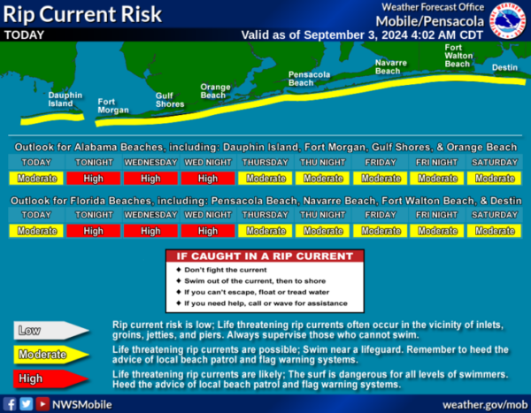
AT THE BEACH: Routine late summer weather for the Alabama and Northwest Florida Gulf Coast. Daily showers and storms and highs in the 90s today, falling into the 80s the rest of this week. Rip current threats are moderate to high the rest of this week. Please pay attention to the Rip Current Flag Warning System at each beach as conditions can change through out the day.
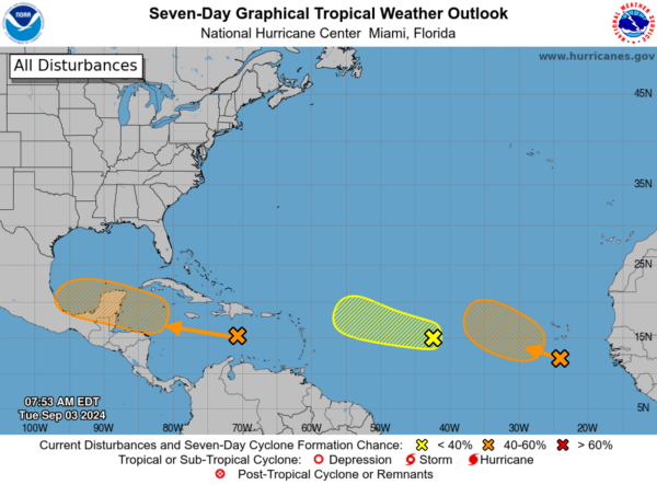
IN THE TROPICS: Three areas the NHC continues to monitor:
In the Caribbean Sea, a tropical wave is producing disorganized showers and thunderstorms over Hispaniola and portions of the central Caribbean Sea. This system is expected to move westward, and a tropical depression could form when it reaches the western Caribbean Sea and the southwestern Gulf of Mexico late this week or over the weekend. Formation chance through 7 days…medium…40 percent.
Next, in the eastern Tropical Atlantic Ocean, a tropical wave over the far eastern Atlantic is producing disorganized showers and thunderstorms. Environmental conditions are forecast to become a little more conducive for development, and a tropical depression could form later this week while the disturbance moves slowly west-northwestward or northwestward over the eastern tropical Atlantic Ocean. This system could produce locally heavy rains and gusty winds across portions of the Cabo Verde Islands in a day or two. Formation chance through 7 days…medium…40 percent.
Finally, in the central Tropical Atlantic Ocean, another tropical wave located about midway between the west coast of Africa and the Lesser Antilles is producing disorganized showers and thunderstorms. Some slow development is possible during the next couple of days while the system moves west-northwestward. By the end of the week, however, environmental conditions are expected to become unfavorable for additional development. Formation chance through 7 days…low…10 percent.
Next names up are Francine, Gordon, and Helen.
WORLD TEMPERATURE EXTREMES: Over the last 24 hours, the highest observation outside the U.S. was 117.0F at Omidieh, Iran. The lowest observation was -76.7F at Dome C, Antarctica.
CONTIGUOUS TEMPERATURE EXTREMES: Over the last 24 hours, the highest observation was 117F at Death Valley, CA. The lowest observation was 29F at Mount Washington, NH.
Category: Alabama's Weather, ALL POSTS


