Tropical Update On This Labor Day & a Look at the Rain Heading Our Way!
Hope everyone is having a wonderful Labor Day! It has been very quiet so far across the state of Alabama! Get out there and enjoy!
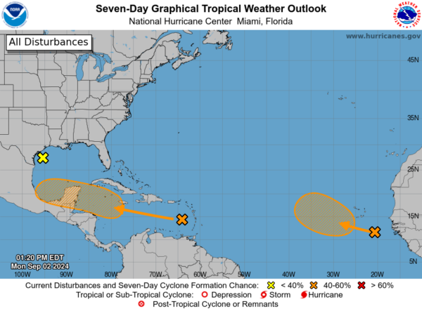
There are still a few features being monitored in the tropics. The NHC in their 1pm CDT outlook still gives a 40% chance for development over days to a wave near the Lesser Antilles and Caribbean Sea and another over the Eastern Tropical Atlantic Ocean. The showers and thunderstorm activity around these waves remain disorganized.
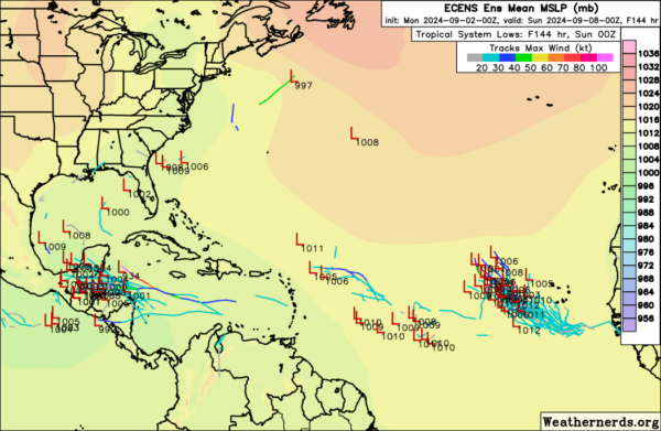
For the Lesser Antilles system, there is still a chance this could hold on and move into a more conducive environment for development. Here is a look at the possible position of the low from the European ensemble as of Sunday. A movement into central America could happen. After that, it is unclear. Perhaps a pull into the southern Gulf? A lot of uncertainties but we need to watch regardless.
What about that Gulf low? This system has helped to promote a good deal of rain across parts of Texas. Flash flood warnings were up for parts of the Galveston area early today. Some areas picking up over 6-7″ of rain!
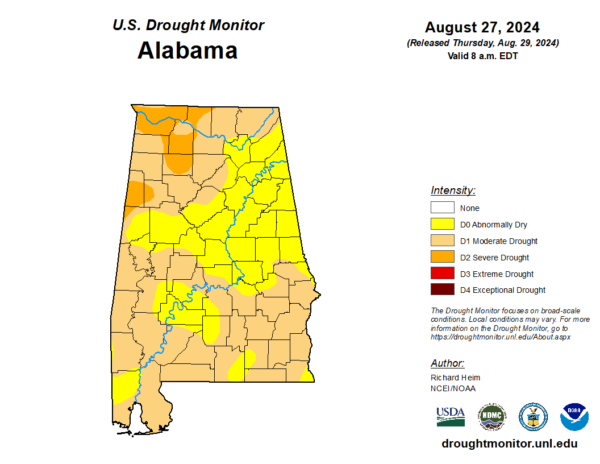
This low is not expected now to develop. It will be moving inland early Tuesday pulling in a lot of tropical moisture across the south. This feature will combine with another upper low and a front and all head east into Alabama. We will have easterly flow settling into the state and cloudy, cool and rainy weather is expected to set up across the state. Highs in the 70s for the Birmingham Metro Thursday and Friday! This will be welcome rain! Below is the latest drought monitor and we are in need of a big drink of water!
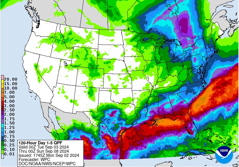
Here is the latest project rain amounts from the WPC. This takes us through late Saturday. Good 1-2 inches of rain possible across parts of northern and central Alabama with locally more especially further south.
Category: Alabama's Weather, ALL POSTS, Social Media, Tropical


