
Outflow Boundary Enhancing Storms Across Central Alabama
Temperatures soared higher than expected today across Central Alabama and that allowed thunderstorms to form further south than expected this afternoon.
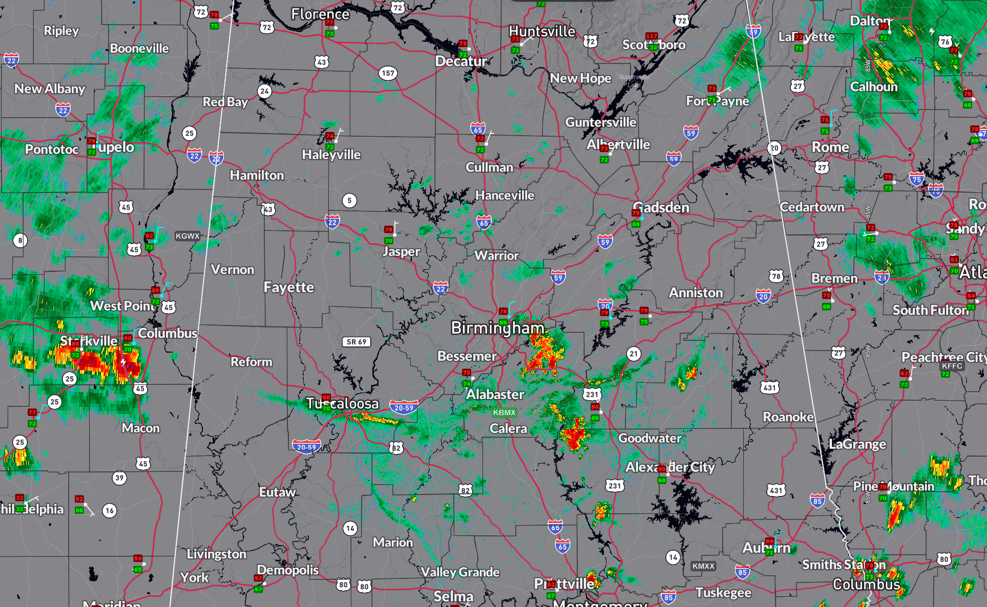
The thunderstorms over north Alabama weekend as expected and put down a large outflow boundary that has been moving southward for the past couple of hours.
It is now across southern part of the Birmingham metro area and will fire up thunderstorms located over Shelby county.
Already storms to the east and south east of Birmingham have intensified as a result of the outflow boundary. Those storms now are south of Leeds and Chelsea. They’re pushing to the east south east and will move in the general vicinity of Harpersville and Chelsea over the next 30 minutes.
Temperatures have dropped nicely across the area. The temperature at this hour in Birmingham is 78. It is 75 at Bessemer, and 79 at Pell City.
Meanwhile to the south, it is extremely hot in the US-80 Corridor with 91F at Demopolis, 93 at Selma, 95 at Prattville, and 96 at Montgomery, as well as 95 at Auburn.
Category: Alabama's Weather, ALL POSTS, Severe Weather, Social Media
About the Author (Author Profile)
Bill Murray is the President of The Weather Factory. He is the site's official weather historian and a weekend forecaster. He also anchors the site's severe weather coverage. Bill Murray is the proud holder of National Weather Association Digital Seal #0001 @wxhistorianSubscribe
If you enjoyed this article, subscribe to receive more just like it.


