A Few Morning Notes at 10 am
It is a fairly calm morning across Alabama with filtered sunshine through high clouds in some areas, some beautiful altocumulus clouds in spots, and some low stratus in others.
A few showers are showing up over Marshall and Etowah counties in Northeast Alabama.
Temperatures are approaching 80F in many areas. Dewpoints are where we would expect them, in the lower to middle 70s, making it feel muggy.
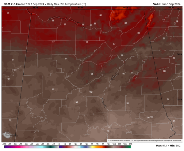
Highs will look like this today:
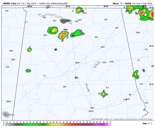
Temperatures are a tad hotter than we expected since there will be fewer storms than yesterday. Here is the HRRR simulated radar at about 5 pm today at the peak of convection:
Tomorrow’s forecast for the showers and storms being south of I-20 is on track with the front settling into Central Alabama during the day.
The 18z and 0z runs of the GFS were very concerning developing the tropical cyclone now east of the islands when it eventually gets over the western Caribbean and pulling it into the Gulf via a trough. The overnight (06z) never fully develops the system as it moves into the Gulf before splitting the energy and pulling a disorganized system toward the northeastern Gulf while leaving the main cyclone to develop over the southwestern Gulf where it moves toward South Texas or Mexico.
This is why we look with a jaded eye at all long range model output. We look for trends as possibilities and wait for the event to get closer.
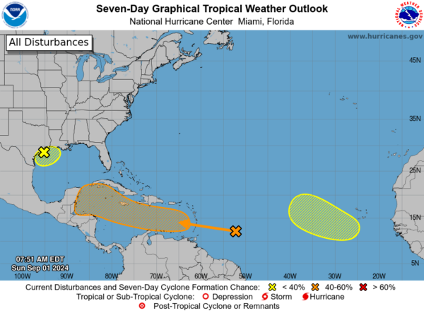
The NHC has a 40 percent chance of development for the system over the next 7 days.
The system off the Texas coast south of Houston has a well defined center this morning but hardly any convection around it. Still, its feeder bands are bringing very heavy rain into the Houston area. The deeper convection is to the east, especially over southeastern Louisiana and into the North Central Gulf south of the Alabama and Northwest Florida coasts.
The NHC has this disturbance at a low 10% chance for development in the short term and 20% in the longer term.
Category: Alabama's Weather, ALL POSTS, Tropical


